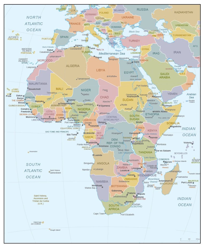
Map of Africa
Africa map online
Quite often, people are interested in countries not only for the purpose of news about any incidents, but also to expand their horizons, and knowledge of the geographical location, water resources. Therefore, in the article you can get interesting information about Africa, its location on the world map, and also find out what kind of map of Africa?
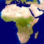
- Detailed satellite image of Africa
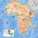
- Physical map of Africa with relief and hill names
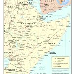
- Horn of Africa on a map of Africa
General description of Africa
Africa is the only continent in the world that is located on 4 hemispheres at the same time, has lush tropical vegetation and endless desert. The peculiarity is that it crosses the equator line and is symmetrical about it. It is Africa on the climate map that is located in 7 climatic zones, has 4 time zones and is separated from other continents by the endless waters of the oceans, and it is separated from Eurasia by the narrow part of the Suez Canal. On the world map, Africa looks rather small, but in fact it is larger in area than Russia and North America, and at the same time comparable in area to India and China. Today, the area of Africa is 30.3 million km2, including the islands.
The longest river in the world, the Nile , flows through the territory, as well as Niger , Congo , Zambezi , Limpopo and Orange . The highest point of the mainland is Mount Kilimanjaro (5895 m), and the lowest is Lake Assal in Djibouti (below 157 m of sea level).
Climate of Africa
The climate is simultaneously subtropical (summers are dry and hot, winters are comfortable and warm, but there is precipitation), tropical (the hottest zone, with daytime temperatures up to + 58С, and at night up to +10), equatorial (it rains constantly and it is very hot – +20 -30 degrees), subequatorial (it is hot in summer, and the rainy season begins in February).
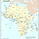
Political map of Africa with state borders and their names
The largest countries and cities on the map of Africa
There are 53 states in Africa, and the population of the entire continent is more than 700 million people, this is a mix of nationalities, tribes that inhabit absolutely the entire territory. It is worth highlighting the largest cities in terms of population:
- Nigeria, Lagos city – 11,500 million;
- DR Congo, Kinshasa – 10 million people;
- Egypt, Cairo – 9,800 million;
- Sudan, Khartoum – 5 million;
- Egypt, Alexandria – 4,500 million;
- Nigeria, Kano – 3,800 million ;
Geographical characteristics of Africa
In fact, Africa belongs to the group of southern continents, and the equator divides it into two equal parts. Also, the mainland is divided by the Atlantic, Indian Ocean, it is separated from Eurasia by the Red Sea, the Mediterranean Sea and the Suez Canal.
On the world map, Africa is represented by the African Platform, on the southern part of the mainland there are the Drakensberg and Cape Mountains. In Africa, strong earthquakes are widespread, as well as volcanic eruptions, as a result of which irreversible processes of relief change are triggered, which may lead to the disappearance of the Mediterranean Sea in the future.
Water resources of Africa
Looking at the map of Africa, you can see that most of it is washed by the Atlantic and Indian Oceans, but since most of it is occupied by the Sahara desert, water resources are not enough for life. Three large freshwater rivers flow throughout Africa – the Nile, the Congo and the Niger. Also among the water resources are deep lakes: Taganika, Victoria, Nyasa.
African nature
Most of the mainland is occupied by the Sahara desert and the vegetation is quite poor, mainly shrubs and date palms in oases. At the same time, part of the territory is savannas and tropical rain forests with large-leaved, evergreen hardwood trees, as well as palm trees. It is worth mentioning that it is Africa that is the birthplace of the coffee tree (Ethiopia), as well as ebony and mahogany, which have valuable wood.
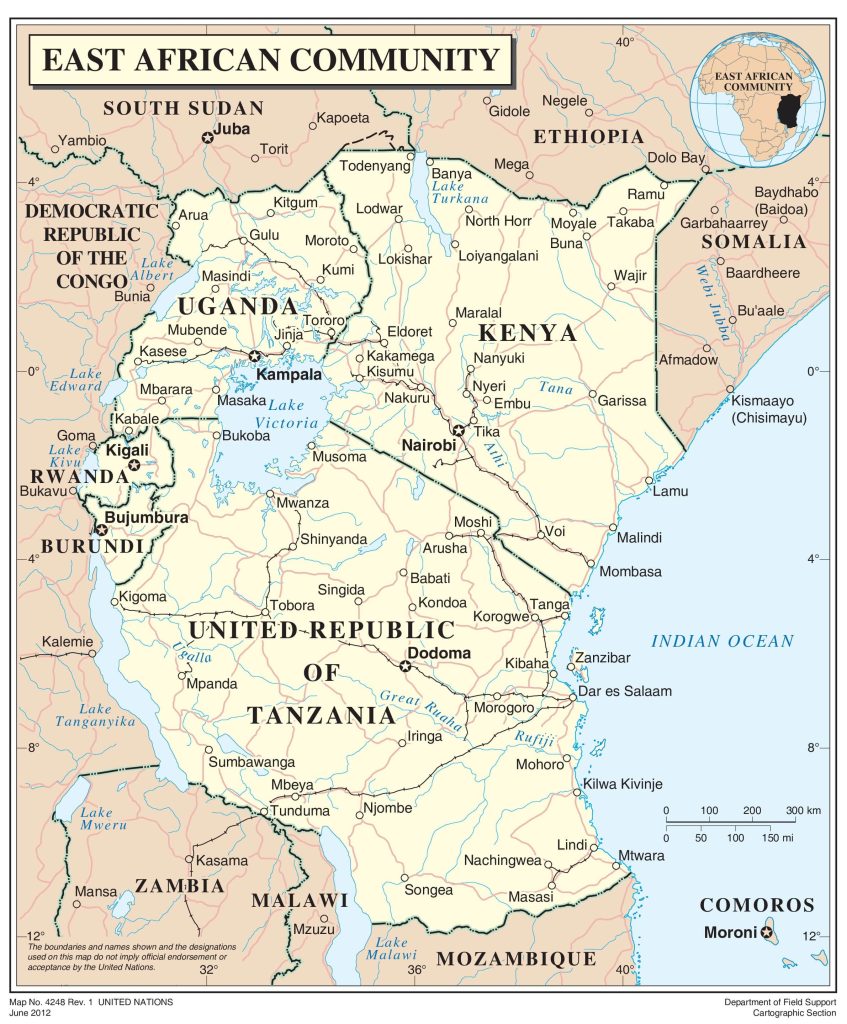
East African Community countries
Regions of Africa
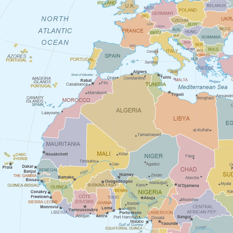 North Africa – here is the largest desert – the Sahara. It includes the following countries: Egypt, Tunisia, Algeria, Morocco. The countries are quite acceptable in terms of climate for living, have deposits of oil and gas, and also develop tourism infrastructure thanks to world-famous attractions.
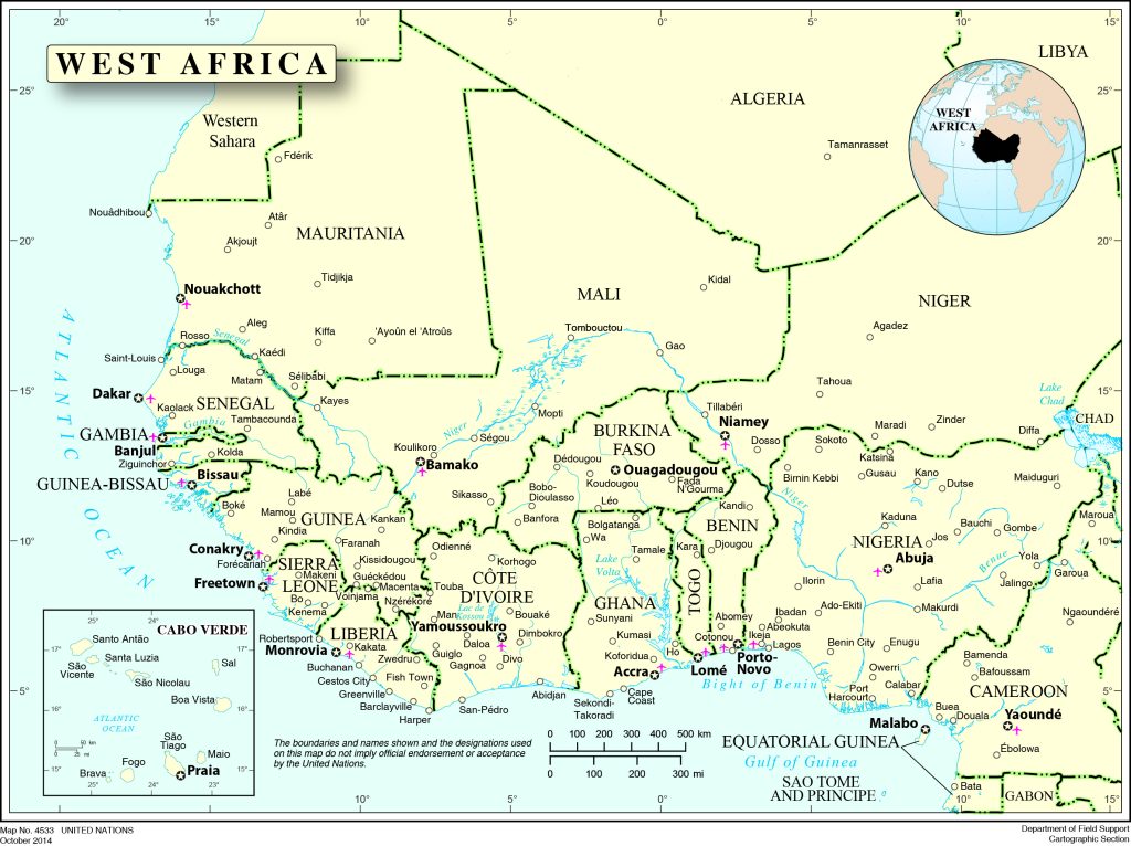 West Africa – part of the continent is washed by the Atlantic Ocean, it includes 16 countries, and is one of the largest subregions. South Africa is the most developed country in West Africa.
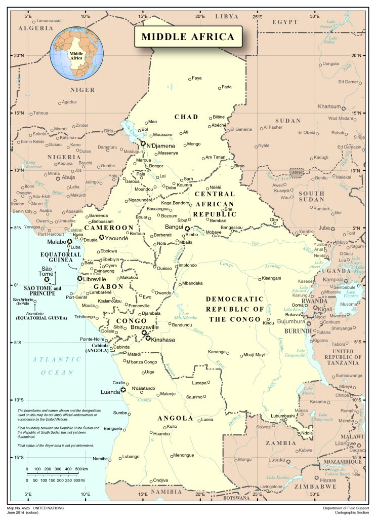 Central Africa – the least developed part of the continent includes the countries: Chad, Gabon, Cameroon, Congo, CAR (possesses oil, gold, ore). This part of Africa is the most abundant in water and rich in river network.
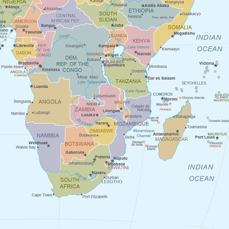 South Africa is the southernmost part, includes South Africa, Swaziland, Lesotho, Namibia, is washed by the waters of the Indian Ocean, occupies a leading place in the world in gold mining, as well as diamonds.
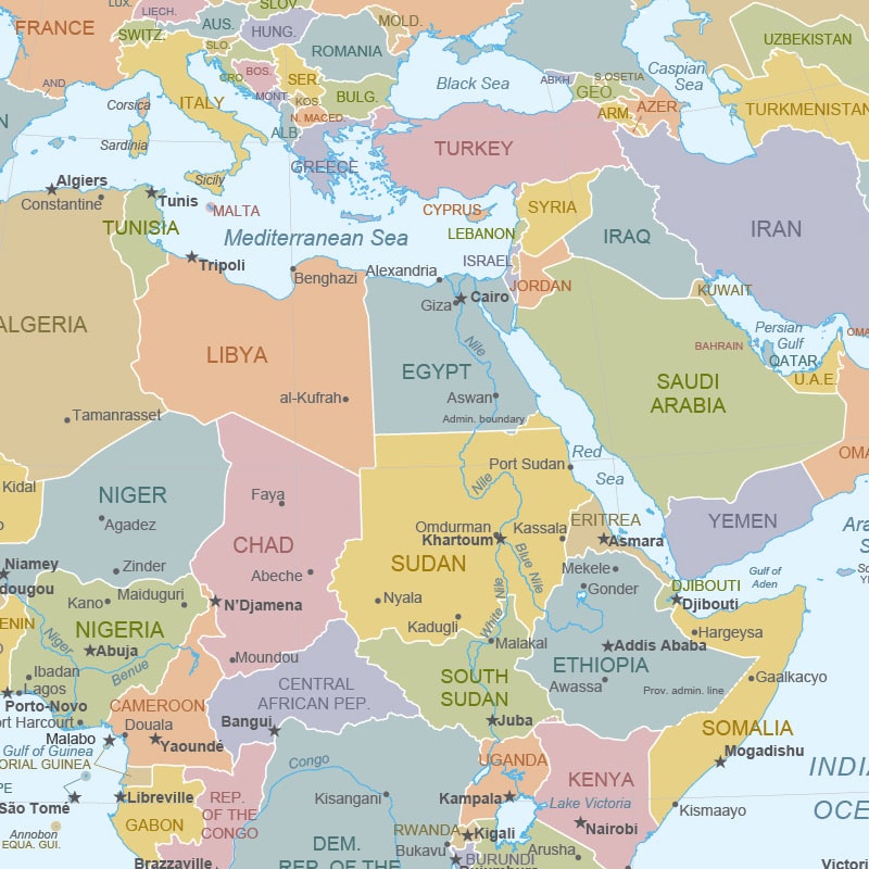 East Africa – Sudan, Ethiopia, Somalia, Kenya, Tanzania – countries included in the eastern part, not including Egypt. The region is located along the Indian Ocean, is a rich region in minerals, as well as a major global supplier of coffee.
The largest countries on the map of Africa
- Nigeria is the most populated country in Africa, occupies a leading position in oil production, is rich in cultural attractions, and has access to the Atlantic Ocean.
- Ethiopia is the oldest state in Africa, has no access to water, the population is mainly employed in agriculture, as well as in the extraction of gold, rare ore elements.
- Egypt is a country that is washed by the Mediterranean, the Red Sea, and its two parts are connected by the Suez Canal. A well-known tourist region thanks to the coral reefs and the pyramids of the pharaohs.
- The Democratic Republic of the Congo , a former colony of France, has significant deposits of coal, diamonds, oil, zinc, and malachite. One of the shortest coastlines in the world.
- South Africa is famous for its developed tourist infrastructure, with large hotels, safari loggias. Leads in gold mining, as well as 40 other types of minerals.
 The Guide Maps
