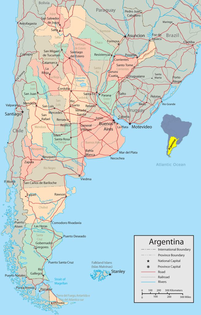
Map of Argentina
Argentine Republic map online
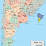
- Road map of Argentina
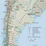
- Physical map of Argentina
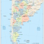
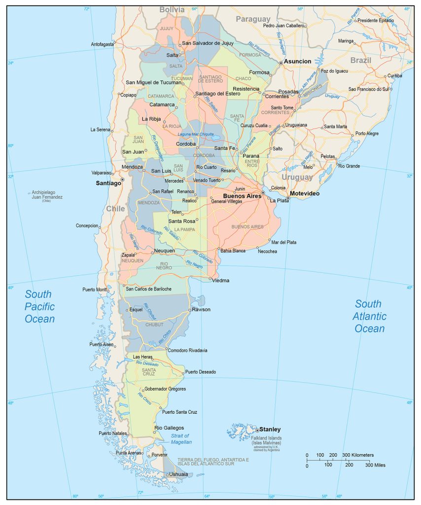
- Political map of Argentina
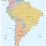
- Argentina on the map of South America
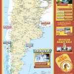
- Tourist map of Argentina with landmarks
General description of the Argentine Republic
The country is located below the equator, occupies the eastern and southern parts of South America. Argentina on the map has a vertically elongated shape, the total area of the territory is 2,780,400 km2 , which is three times smaller than the size of Brazil, but about twice the size of Peru. According to this indicator, Argentina ranks second on its mainland and eighth in the world.
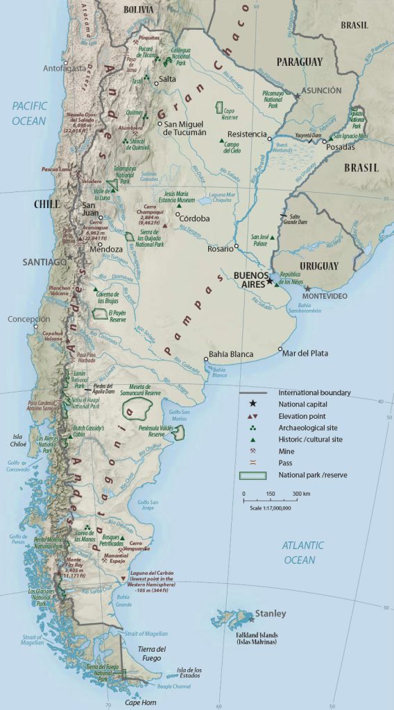
The longest and deepest river in the country is Parana, the second largest is Paraguay. The highest point in the relief is Mount Aconcagua, 6 960,8 м. The climate is varied. In the south it is moderate, with cold winters and cool summers, with temperatures around + 15 °C. The center of the country is located in the tropical climate zone, and the north is subtropical, with hot, humid summers and mild winters.
The capital, Buenos Aires, is located, as the map of Argentina shows, in the east-central part of the country. Other major cities:
- Cordoba (1.59 million people);
- Rosario (1.56 million);
- Mendoza (1.2 million);
- San Miguel de Tucuman (1 million);
- La Plata (899.2 thousand);
- Salta (702.7 thousand);
- Mar del Plata (675.7 thousand)
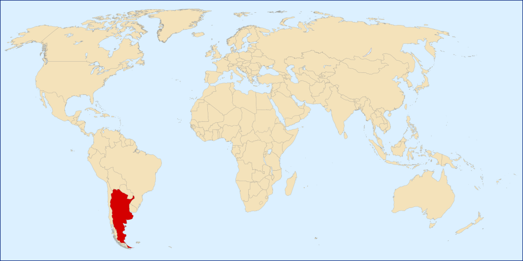
Location of Argentina on the world map
Argentina is located in the southern part of the planet, below the equatorial line. The country is located in the southeastern part of South America, and also occupies several enclave islands and the eastern half of Tierra del Fuego. In the east, a large area is washed by the Atlantic Ocean, the south is separated from Antarctica by the Drake Passage. The Andes mountain range stretches almost throughout the western part of the country.
Argentina on the world map has a border with five states:
- The longest one is in the west and south from Chile, along the Andes and on the islands of Tierra del Fuego. Overall length 5 308 км, there is a problem with the unfinished demarcation of the South Patagonian Icefield line and other territorial disputes.
- In the east of the northern part of Argentina has a border with Brazil. Almost all of it runs along river lines and the Iguazu Falls . The length is 1 224 км.
- In the east-central zone there is a dividing strip with Uruguay, along the course of the river of the same name. Border length – 579 км.
- In the north and northeast, the state border with Paraguay stretches, length 1 689 км. The border is natural and is defined by large rivers.
- The territory of the country adjoins Bolivia in the north from the Altiplano plateau to the Gran Chaco plain . Line length – 942 км.
Part of the territory of Argentina is represented by island enclaves, which are partially surrounded by other states. These units include:
- The four islands of Apipe (Isla Apipe, Isla los Patos, Isla Apipe Chico and Isla San Martin), separated by r. Parana and swamp. The total area is about 315 km 2 . The surrounding country is Paraguay.
- Martin Garcia is an island reserve with an area of 1.84 km 2 , surrounded by Uruguayan territorial waters.
- Entre Rios, a small island, 36 km2 , in the Paraguayan waters of the river. Parana.
Relief
The relief of the country is diverse. Argentina is home to the longest and one of the highest mountain ranges in the world, the Andes. In the north, from the Puna plateau, they are wider, narrowing towards the south, forming the Western and Eastern Cordillera.
The mountains in Argentina are characterized by different levels of altitude, sharp and more rocky-looking reliefs without vegetation. There are glaciers. The average height is 4 000 м. The main peaks located in the country:
- Aconcagua – 6 960,8 м;
- Monte Pissis – 6 792 м;
- Mercedario – 6 770 м;
- Cerro Bonete – 6 759 м;
- Walter Penk – 6 658 м;
- Tupungato – 6 550 м.
In the northeastern part, the mountain range flows into the Gran Chaco plain. It extends from the border with Paraguay and is a zone of lava plateau in the north, swampy and clayey lowlands in the center and sandy hills in the south. In the central-eastern part of the Andes, they pass into the plains of the Pampas with moist and loose soil. This area has only a few mountain ranges, such as the Sierras de Córdoba. Below is Patagonia , from the Andes mountains turning into a plateau and a flat region as you move east.
Water resources: seas, rivers and lakes
Water resources are represented mainly by rivers and lakes. The largest number of rivers is located in the northeastern part of Argentina. The most full-flowing, wide and longest of them is Parana, Uruguay and Paraguay are inferior to it. Most of the rivers drain into the Atlantic Ocean.
The lakes are mainly located at the foot of the Andes and in Patagonia , they are of glacial origin. The largest of them: Buenos Aires, Mar Chiquita, Argentino, Viedma, San Martin. In the north of the country you can observe lakes with salt water. Also in this part of the country, closer to Brazil, is the Iguazu Falls complex .
The largest cities on the map of Argentina
- Buenos Aires . It is located almost in the center of the eastern part of the country, on the one hand – the bay of La Plata Bay, on the other – the river. Riachuelo. It has a flat relief, characteristic of the Pampas. The largest city in the country in terms of population and area, one of the largest on the mainland, is a cultural, economic and educational center.
- Cordova . Located above and west of Buenos Aires , near the Sierras ridge Cordobesas and r. Sikuya. Also applies to the lowland Pampas. An important industrial center of the country, it is also famous for the sights that arose due to the fusion of several cultures.
- Rosario . It is located, as the map shows, approximately between Buenos Aires and Cordoba, surrounded on several sides by rivers, the main one being Parana. It is the center of the meat, footwear, flour-grinding industries, as well as the birthplace of famous athletes, coaches and Che Guevara.
- Mar del Plata . Located on the map a little south of Buenos Aires , on the ocean coast. A city of resort importance, with excellent tourist infrastructure and sports facilities. As well as one of the largest ports, a center for fishing and processing.
 The Guide Maps
