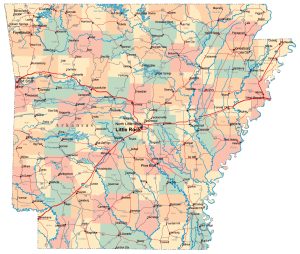
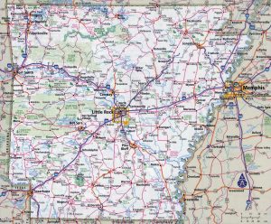
Arkansas map, USA
General map of Arkansas live
This state, located in the southeastern United States, can be called a typical middle peasant among the 50 regions of the country. With an area of 137,000 square kilometers, it ranks 29th between North Carolina and Alabama. In terms of population, Arkansas is on the 34th line with 3 million inhabitants. The state capital and its largest city, Little Rock, is located on the map of Arkansas in the center of the region.
- large administrative map of arkansas state with roads highways and cities
- Large Detailed Map of Arkansas With Cities And Towns
Location of Arkansas in the United States
The northern and southern borders of the state of Arkansas on the map are defined by geographic parallels. From the south at a latitude of 34 o , the state borders on Louisiana, in the north along a parallel of 36.5 o – with the state of Missouri. The eastern border with the states of Tennessee and Mississippi runs along the largest river in North America – the Mississippi. Arkansas borders Missouri to the west and shares a small area of common border with Texas to the southwest.
The small territory of the state is represented mainly by flat landscapes. Only the northwest of the state is a wooded mountain plateau, separated by deep valleys. In one of the valleys flows the largest river in the state, the left tributary of the Mississippi – the Arkansas River. Among the mountain plateaus of the region is the highest point in the state – Mount Signal Hill, 839 meters above sea level. The central and western part of the state is characterized by a flat landscape, cut almost equally by the low Crowley Range near the capital of Arkansas.
The geographical position of the state determines the climate as humid subtropical. Only in the mountains in the northeast are the climate characteristics closer to temperate. In summer, the state is humid, and maximum temperatures reach +34 o C. In winter, precipitation is much less, there is no snow cover in the lowlands. The average minimum of January temperatures is +11 o C. Arkansas is located approximately in the middle between the Gulf of Mexico and the Appalachians, which causes the appearance of adverse natural phenomena such as hail, thunderstorms and tornadoes.
Major cities of Arkansas on the map
On the map of Arkansas, among all the settlements, the four largest stand out.
- Little Rock . The administrative center of the state is geographically located almost in the center of Arkansas on the river of the same name. The city with a population of almost 700 thousand people is located in the zone of oceanic subtropical climate.
- Fort Smith. The second largest city of Arkansas with a population of 89 thousand people is 257 km from the capital along the federal highway No. 40. The city is located in the valley of the Arkansas River among the mountain plateau of the Ozarks on the border with Oklahoma. The mountains protect Fort Smith from adverse events, so the climate here is mild, with moderate humidity and temperature.
- Fayetteville . The city is 300 km northwest of Little Rock and is located on the Ozark plateau among picturesque lakes. The population of the city is about 73 thousand inhabitants. The climate in the city is humid, the amount of precipitation in the spring months can reach 140 mm per month. At the same time, temperatures rarely drop below zero.
- Springdale . This city of 66,000 people is located 305 km from the state capital on the Ozark plateau near the border with Missouri. Together with the neighboring city of Fayetteville and several other satellites, it forms an agglomeration with a population of more than 270 thousand people. Springdale is located near the large artificial lake, Beaver Lake , formed by a dam on the White River.
| № | Locality | State | Coordinates | Stations |
|---|---|---|---|---|
| 1 | West Memphis | Arkansas | - | 0 |
| 2 | Siloam Springs | Arkansas | - | 0 |
| 3 | Pocahontas | Arkansas | - | 0 |
| 4 | Pankey | Arkansas | - | 0 |
| 5 | North Little Rock | Arkansas | - | 0 |
| 6 | Little Rock Air Force Base | Arkansas | - | 0 |
| 7 | Jonesboro | Arkansas | - | 0 |
| 8 | Hope | Arkansas | - | 0 |
| 9 | Greers Ferry | Arkansas | - | 0 |
| 10 | Fort Chaffee | Arkansas | - | 0 |
| 11 | Fordyce | Arkansas | - | 0 |
| 12 | Conway | Arkansas | - | 0 |
| 13 | Clayton Spur (historical) | Arkansas | - | 0 |
| 14 | Cabot | Arkansas | - | 0 |
| 15 | Blytheville | Arkansas | - | 0 |
| 16 | Blowing Cave (historical) | Arkansas | - | 0 |
| 17 | Batesville | Arkansas | - | 0 |
| 18 | Little Rock | Arkansas | - | 0 |
 The Guide Maps

