Map of Asia
Asia map online
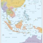
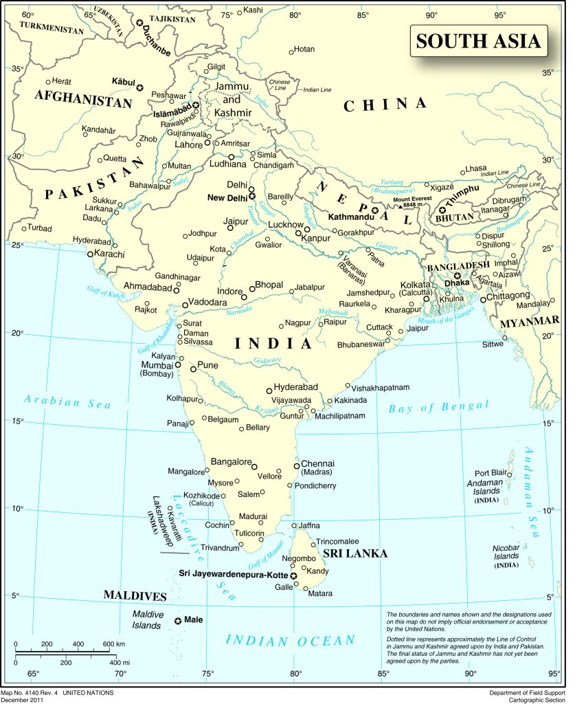
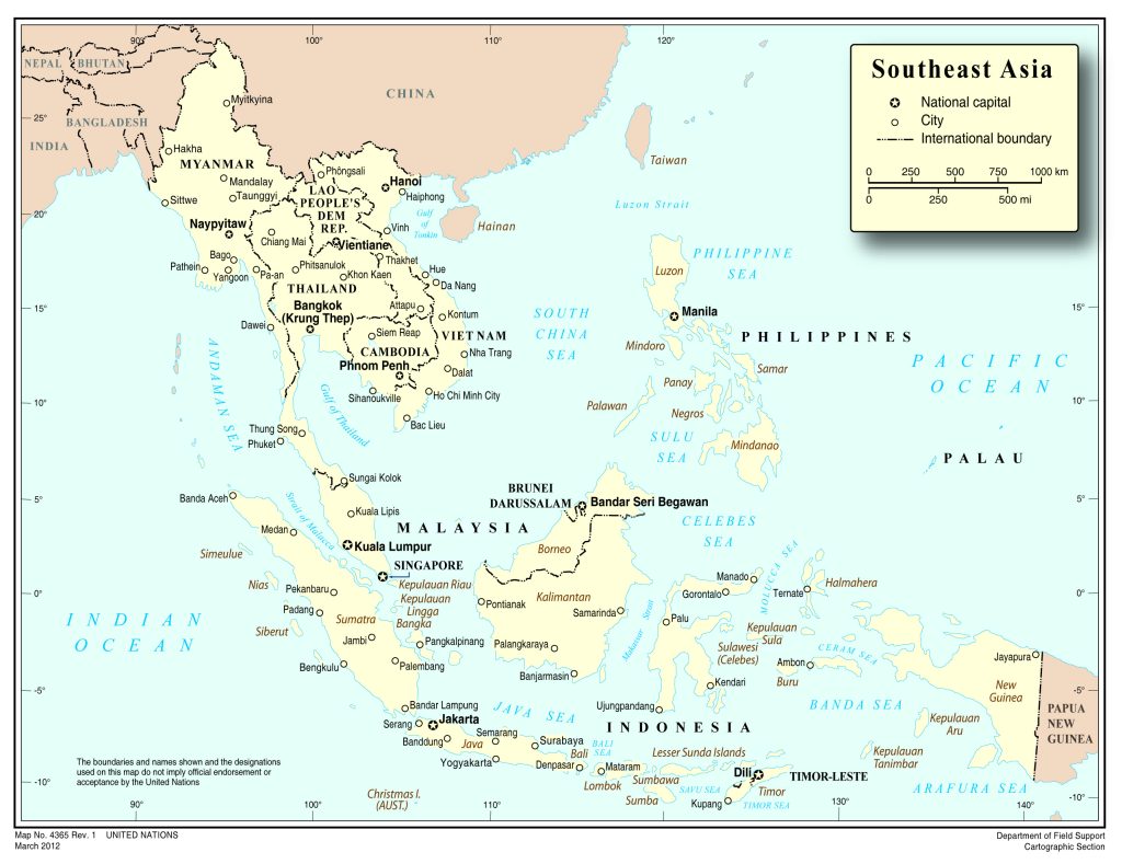
- Political map of Southeast Asia with country borders and capitals
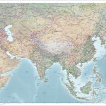
- Political map of Asia with the largest cities by population
General description of Asia
Asia on the map is part of Eurasia. It owns 34% of all land on our planet. The area of Asia is 43.45 million square meters. km. This is almost 2 times the area of North America and more than 5 times the area of Australia.
The physical map of Asia shows the highest point not only on the continent, but also on the Earth. This is the famous highest peak in the world Chomolungma (Everest) with a height of 8848 m. A little lower than it – Chogori (K2) with a height of 8611 m and Kanchenjunga – 8600 m. All these peaks are located in the Himalayas. The lowest point in Asia and the whole world is the Mariana Trench . It is located at 11022 m below sea level.
Asia is located in several climatic zones. Cold arctic deserts in the north are replaced by a temperate zone. In the south of the continent there are hot subtropics and equatorial forests.
The largest cities in Asia are:
- Shanghai in China – with 23416 million inhabitants;
- Beijing in China – from 21,009 million;
- Karachi in Pakistan – from 13,205 million;
- Mumbai (Bombay) in India – from 12,478 million;
- Delhi in India – from 11078 million;
- Dhaka in the Republic of Bangladesh – from 9724 million;
- Tehran in Iran – from 8778 million;
- Tokyo in Japan – from 8967.6 million;
- Baghdad in Iraq – from 6625 million.
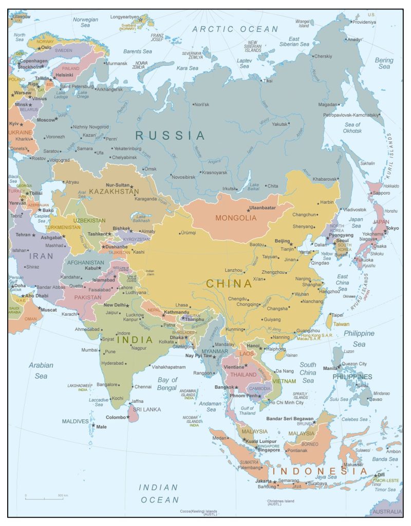
Political map of Asia with state borders and their names
Geographic location of Asia
Asia’s borders are marked on the map. It is separated from Europe between Asia by the Ural Mountains, the Emba, Kuma, Manych, Caspian, Azov, Black, Marble, Bosphorus and Dardanelles rivers. Asia also borders the African and Australian continents.
Relief
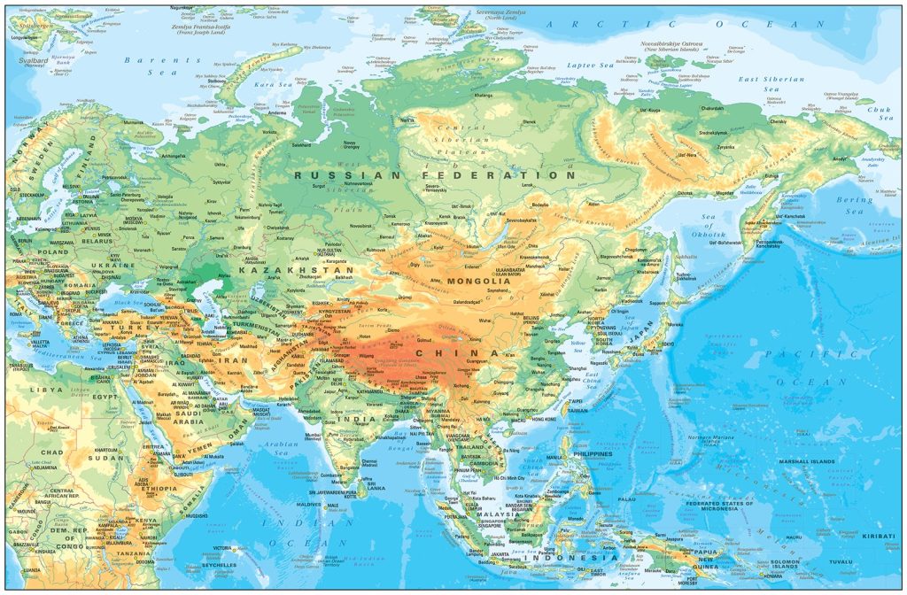 The Asian continent is dominated by mountains and plateaus. In Central and Central Asia, climbers are attracted by the highest peaks. Scientists-geographers distinguish 2 belts of mountain uplifts. The first includes the highlands of Western Asia, Pamir , Karakoram , Himalayan mountain systems. The Arakan Mountains stretch in the southern and southeastern parts . The second belt extends to the northeast of the continent. It includes the Tien Shan, the Altai Mountains, the Sayans, the highlands of Chukotka, Kolyma, Anadyr.
On ¼ of the territory of Asia are lowlands. The largest of them are West Siberian and Turan .
Water resources
The territory of Asia is washed by the waters of 3 oceans: the Arctic, Indian and Pacific.
The Bay of Bengal, the largest on the planet, has a huge area – almost 2.2 million square meters. km. The Ganges, Brahmaputra and other rivers flow into it.
On the physical map of Asia, the largest rivers of the continent are indicated:
- Ob with an area of 2.99 million square meters. km;
- Yenisei – 2.58 million square meters km;
- Lena – 2.49 million square meters km;
- Amur – 1.86 million square meters km;
- Yangtze – 1.8 million square meters km.
In the south of Siberia, there is the deepest lake on Earth with fresh water – Baikal. Its depth reaches 1620 m, the area is 31,722 sq. km. It contains 20% of our planet’s non-freezing fresh water . The reservoir is more than 25 million years old.
Another large lake – Balkhash is located in the Karaganda region of Kazakhstan, covers an area of 22 thousand square meters. km. On the western side of the lake, the water is fresh. From the east – salty.
Natural areas of Asia
On the islands of the Arctic and the coast of the Arctic Ocean, there are arctic deserts, tundra, giving way to forest tundra. Most of Siberia is occupied by taiga forests. Steppes begin in the south.
In the east of the continent lies a huge desert – the Gobi. Its area is 1.3 million square meters. km. It occupies the north and northeast of China and the southern part of Mongolia. In the west of Asia – a zone of subtropics. In the east of the continent there are humid tropics, on the Malay Peninsula and islands lying near the equator equatorial forests grow.
Regions of Asia on the map
Western Asia
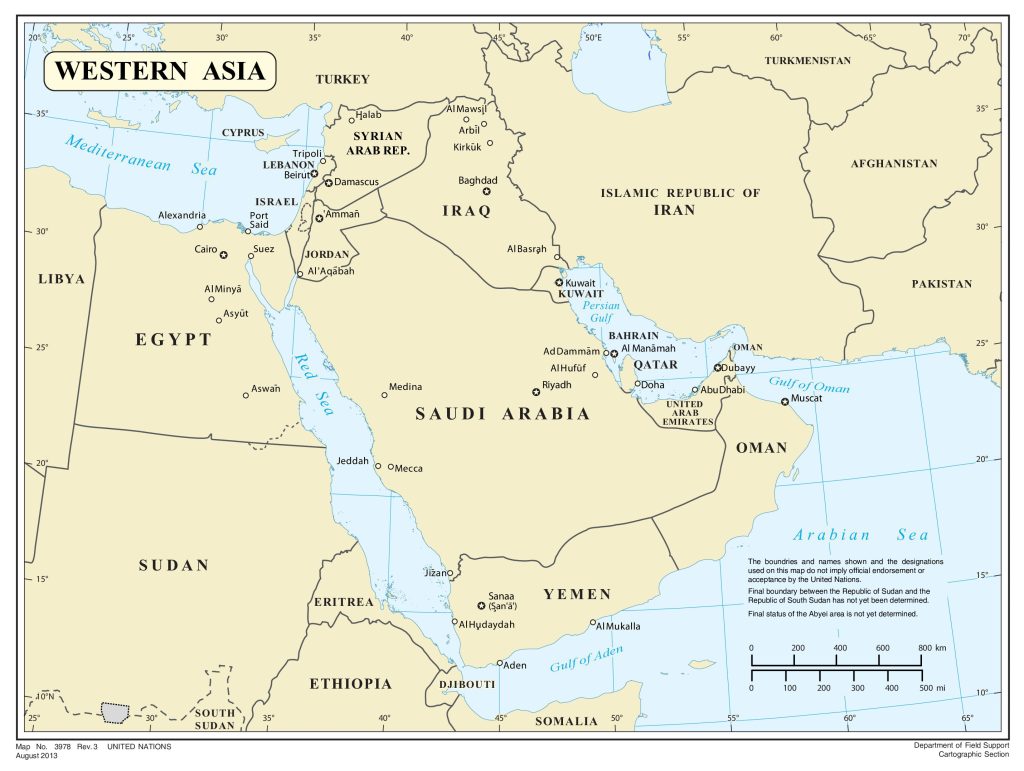 If you look at the map of Western Asia, you can see that it includes:
- Asia Minor highlands;
- Arabian and Sinai Peninsulas;
- the island of Cyprus;
- Mesopotamian lowland;
- Armenian and Iranian highlands;
It is separated from Africa by the Isthmus of Suez, from Europe by the straits of Turkey and the watershed of the Greater Caucasus.
The region is dominated by deserts, semi-deserts, dry steppes. Here is the fifth largest Arabian Desert in the world. It covers an area of 233 thousand square meters. km.
south of the Caspian Seas, southwest of the Arabian Peninsula and highlands are less arid .
Central Asia
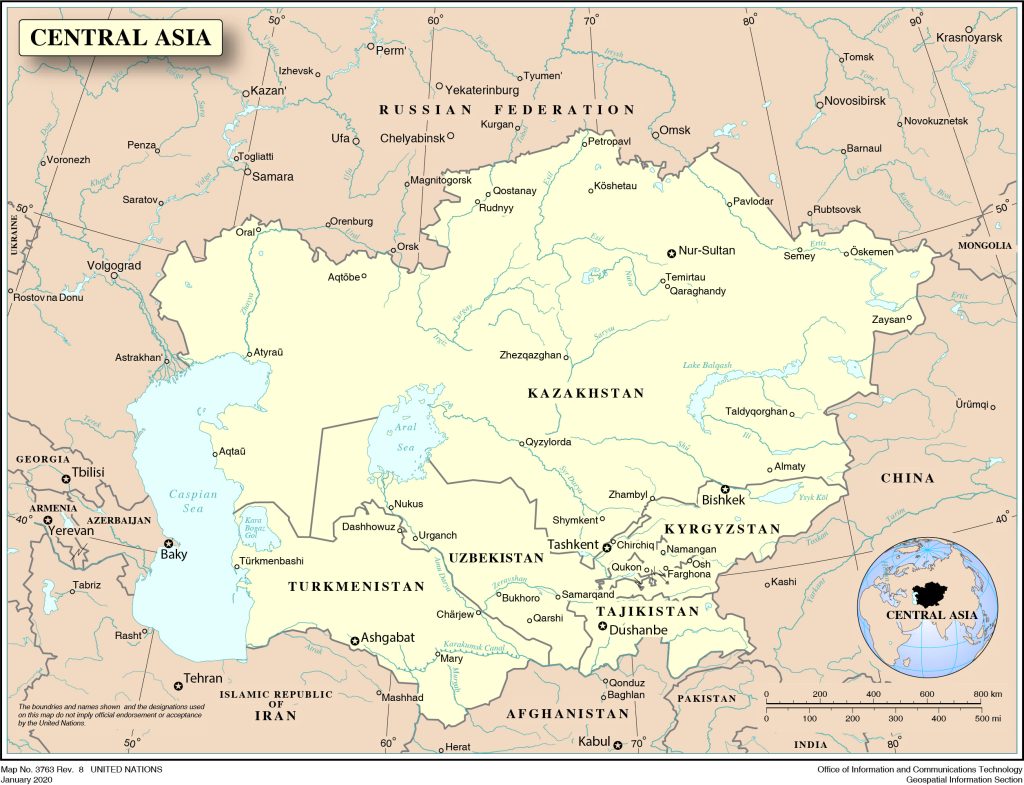
Central Asia is a fairly large territory with an area of more than 5 million square meters. km. She has no access to the ocean. On the UNESCO map, the region includes:
- Mongolia;
- northwestern China;
- some regions of the Russian Federation;
- northern Pakistan;
- northeast of Iran.
compilers of the Britannica also included Central Asia in the region.
In the west it is washed by the Caspian Sea, in the south it borders on Iran and Afghanistan, in the east – on China.
The climate in the region is dry continental. There are highlands and plateaus, in the flat part – deserts and semi-deserts.
South Asia
- peninsula Hindustan;
- the island of Sri Lanka and smaller islands.
On the physical map compiled by geographers from the USA, it also includes:
- the Malay Peninsula;
- Indochina with the islands located near it.
It borders with other regions of Asia.
On the Hindustan Peninsula there are the Himalayas with famous eight-thousander peaks and the Deccan Plateau. The region lies in the subequatorial climatic zone.
South East Asia
Southeast Asia is inferior in area to Central Asia. It consists of:
- peninsula of Hindustan,
- Malay Archipelago and other island territories between Japan, China, India and Australia.
It borders East and South Asia .
It belongs to the equatorial and subequatorial climatic zones; monsoon winds often blow on the islands.
East Asia
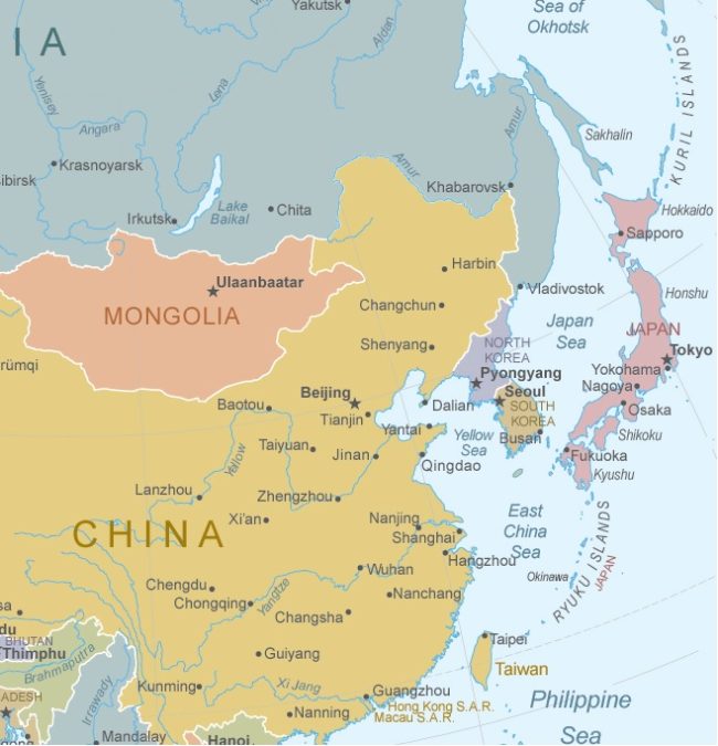 East Asia stretches from the Far East regions to South China. It also includes:
- Sakhalin;
- Kuriles;
- Japanese islands;
- Taiwan;
- Hainan.
In the north it borders on Siberia and the Far East, in the west – on Central Asia, in the east it is washed by the Pacific Ocean.
Relief features are marked on the physical map: mountains are combined with plains. The climate is subtropical, in the south – tropical, with frequent monsoon winds.
 The Guide Maps
