Connecticut map, USA
General map of Connecticut live
Connecticut is a state located in the northeastern United States. Its area is 14400 km2 . The state has a population of 3,600,000 people. The administrative center is Hartford .
History of Connecticut
Of the Europeans, the Dutch were the first to visit the places where the state of Connecticut is located. They established a settlement that eventually grew into the city of Hartford , the current state capital. From the second half of the 17th century, these lands were owned by the British. Connecticut is one of the 13 states that formed the United States after the end of the Revolutionary War. Received statehood on January 9, 1788. In 1875, Hartford became the permanent capital .
Location of the state of Connecticut on the US map
The name of the state comes from the word “Quononoquett” from the language of the local Mohican Pequot tribe. This word translates as “long tidal river.”
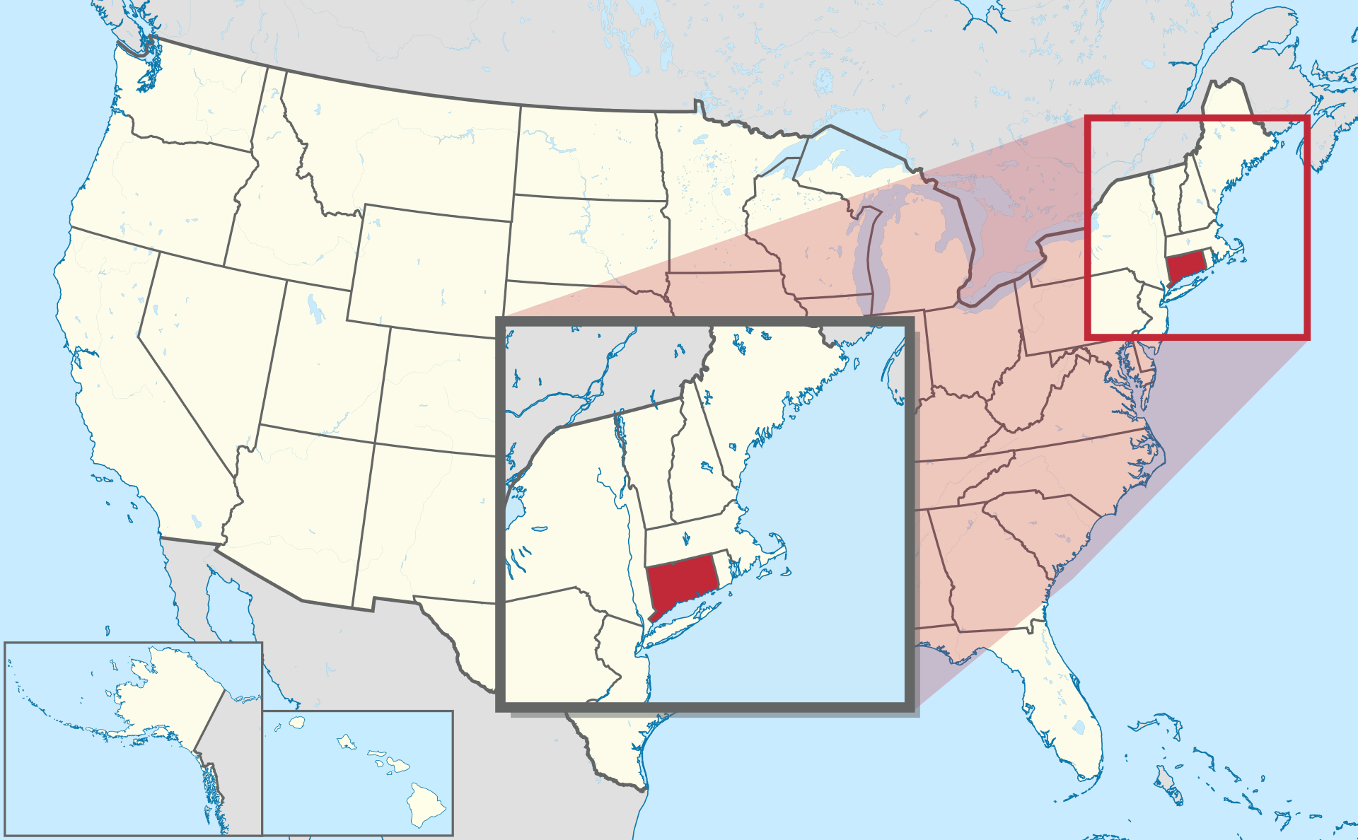
Location map of Connecticut in the US.
The state capital is Hartford . On the map Connecticut is located in the central part. Connecticut on the US map is located in the northeastern part. To the north of it is the state of Massachusetts, to the east – Rhode Island, to the west – New York. The southern border runs along the Long Island Sound.
Geographical characteristics
Much of Connecticut is forested. In the western part are the Taconic Mountains and the Berkshire Hills. In the south there are swamps. The highest point in the state is Mount Frissell (747 m). Connecticut is located on the territory of the Atlantic lowlands and the Appalachian mountain range.
The Connecticut River flows through the center of the state from north to south. Along the river is a valley also called Connecticut. Other major rivers: Housatonic and Thames . The Housatonic flows in the western part of the state, the Thames in the eastern. The largest lake in the state is Candlewood. There are sandy beaches along the coast of Long Island Sound.
Northern Connecticut has a humid continental climate, while southern Connecticut has a humid subtropical climate. In Hartford , the average temperature in January is from -7 ⁰C to 2 ⁰C, in July – from 17 ⁰C to 30 ⁰C. Storms hit the coast of Long Island.
Major cities of Connecticut on the map
- Bridgeport is the state’s largest city. Its area is 50 km 2 , the population is 148,700 people. In 1639, the village of Pequonnock was founded where the town is now . In 1800, a drawbridge across the Pequonnock River was built in this place and the settlement was named Bridgeport (“ bridge ” means “bridge” in English). It received city status in 1836. Located in the southwestern part of the state, on the coast of Long Island Sound. This location contains the mouth of the Pequonnock River. The distance to Hartford is 70 km.
- Hartford is the capital of the state of Connecticut. The area is 47 km 2 , the population is 124,800 inhabitants. Founded in 1635 by English settlers. The settlement was first called Newton. After 2 years it was named Hartford in honor of the English city of the same name. Located in the county of the same name on the banks of the Connecticut River.
- New Haven is the third most populous city in Connecticut. 135,000 people live in it. The area is 52 km 2 . In 1638, the English Puritans founded the New Haven Colony on this site (translated from English as “ new haven ” means “new paradise”). New Haven received city status in 1784. Located in the southern part of the state, on the coast of Long Island Sound. The Quinnipiac River flows through the city . Hartford is 40 km away .
- Stamford It is the second most populated city in Connecticut. Area – 135 km 2 (1st place in the state) population – 135,500 people. Founded in 1641. The first name is Rippovam. It was later renamed Stamford (after the English city of the same name). Located in southwestern Connecticut, on the coast of Long Island Sound. The city owns several islands in the strait. The River Rippowam flows through Stamford . The distance to Hartford is 100 km.
- The city of Waterbury is located in the western part of the state, on the banks of the Naugatuck River . The area is 75 km 2 , the population is 114,400 people. The first settlement in these places was founded in 1674. It was called Matetakoke. The name was then changed to Mattatuck . In 1686 the settlement received the status of a city. In the same year, the settlement received its current name. It is connected with a large number of streams that flow into the Naugatuck River in this place . The distance to Hartford is 53 km.
| № | Locality | State | Coordinates | Stations |
|---|---|---|---|---|
| 1 | West Haven | Connecticut | - | 0 |
| 2 | Waterbury | Connecticut | - | 0 |
| 3 | Stamford | Connecticut | - | 0 |
| 4 | South Windsor | Connecticut | - | 0 |
| 5 | Shelton | Connecticut | - | 0 |
| 6 | Saugatuck Shores | Connecticut | - | 0 |
| 7 | Old Greenwich | Connecticut | - | 0 |
| 8 | North Stonington | Connecticut | - | 0 |
| 9 | North Haven | Connecticut | - | 0 |
| 10 | New London | Connecticut | - | 0 |
| 11 | Naugatuck | Connecticut | - | 0 |
| 12 | Middletown | Connecticut | - | 0 |
| 13 | Hamden | Connecticut | - | 0 |
| 14 | Waterford | Connecticut | - | 0 |
| 15 | Torrington | Connecticut | - | 0 |
| 16 | North Haven | Connecticut | - | 0 |
| 17 | Naugatuck | Connecticut | - | 0 |
| 18 | Mystic Seaport | Connecticut | - | 0 |
| 19 | Deep River Center | Connecticut | - | 0 |
| 20 | Hamden | Connecticut | - | 0 |
| 21 | Enfield | Connecticut | - | 0 |
| 22 | East Haven | Connecticut | - | 0 |
| 23 | Derby | Connecticut | - | 0 |
| 24 | Danbury | Connecticut | - | 0 |
| 25 | Brookfield | Connecticut | - | 0 |
| 26 | Bridgeport | Connecticut | - | 0 |