Dallas map, Texas USA
Interactive Map of Dallas
Dallas map collection
- Road map of Dallas
- Landmarks of Dallas
- Dallas Public Transportation Routes
- Map of Dallas Airport
What can be found on the map of Dallas
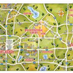
The political and physical map of Dallas, USA reveals a vibrant city with much to offer. Located in the U.S. state of Texas, the city is situated at the intersection of four major highways – Interstate 35, Interstate 30, Interstate 20 and US Route 67. This makes it easier for travelers to get around the city as well as explore its environs.
The Trinity River runs through much of Dallas’s west side and creates various lakes, wetlands and creeks which add to its natural beauty. The physical map also shows numerous parks around the city where people can relax and enjoy nature, including White Rock Lake Park, Bachman Lake Park and Fair Park. In addition to this, there are several public golf courses within Dallas that offer visitors an enjoyable outdoor experience on sunny days.
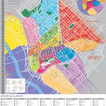
The political map also showcases various neighbourhoods within Dallas such as Deep Ellum and Oak Lawn; each with their own unique character and characteristics that make them stand out from one another. One can also spot iconic landmarks like Reunion Tower which offers fantastic views of the city skyline and Dealey Plaza – the site where President John F Kennedy was assassinated in 1963.
Furthermore, the physical map reveals Dallas’s robust transportation network which includes both rail (DART) and bus services that make commutes convenient for locals as well as visitors alike. Additionally, airports such as Love Field Airport (DAL) and Dallas-Fort Worth International Airport (DFW) provide easy access into or out of town for air travelers.
Overall, Dallas is a vibrant metropolitan area with plenty to see do while visiting the Lone Star State! Whether you’re looking for great shopping opportunities at the Galleria mall or enjoying a night out on Greenville Avenue – you’ll find something unique about this bustling Texan metropolis just waiting to be explored!
 The Guide Maps
