El Paso map, Texas USA
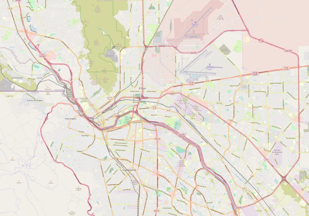
View this map of El Paso with roads, streets and houses. El Paso, Texas is a must-visit destination for travelers who are looking for an authentic taste of the American Southwest. Nestled against the picturesque Franklin Mountains, this city offers breathtaking views and a rich cultural heritage that is unrivaled in the region.
Interactive Map of El Paso
El Paso map collection
- El Paso road map
- El Paso reference map
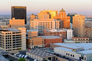 Take a look at the map of El Paso, and you’ll quickly see that the city is located in the far western part of Texas and is bordered by the Rio Grande River to the south. This mighty river not only forms the boundary between the United States and Mexico, but it also flows through a series of beautiful reservoirs, including the Elephant Butte Reservoir. Whether you’re looking to take a refreshing dip or just enjoy the scenery, this reservoir is a perfect place to spend a relaxing day.
About El Paso
Located in the far western corner of Texas in the United States, El Paso is a thriving city full of culture and excitement. This guide will provide all the information travelers need to know about this vibrant destination. From its physical and political maps to its airports, railroads, highways, and attractions, El Paso has something for everyone. Read on to learn more! The El Paso map is a great tool to avoid getting lost in an unfamiliar city.
Where is El Paso located?
El Paso is located in the far western corner of Texas. It rests on the banks of the Rio Grande River at an elevation of 3,800 feet above sea level. The city borders Mexico to the south and New Mexico to the west. El Paso’s population was estimated to be 683,577 in 2019; it is one of the fastest growing cities in America due to its strong economy and low cost of living.
Physical & Political Maps
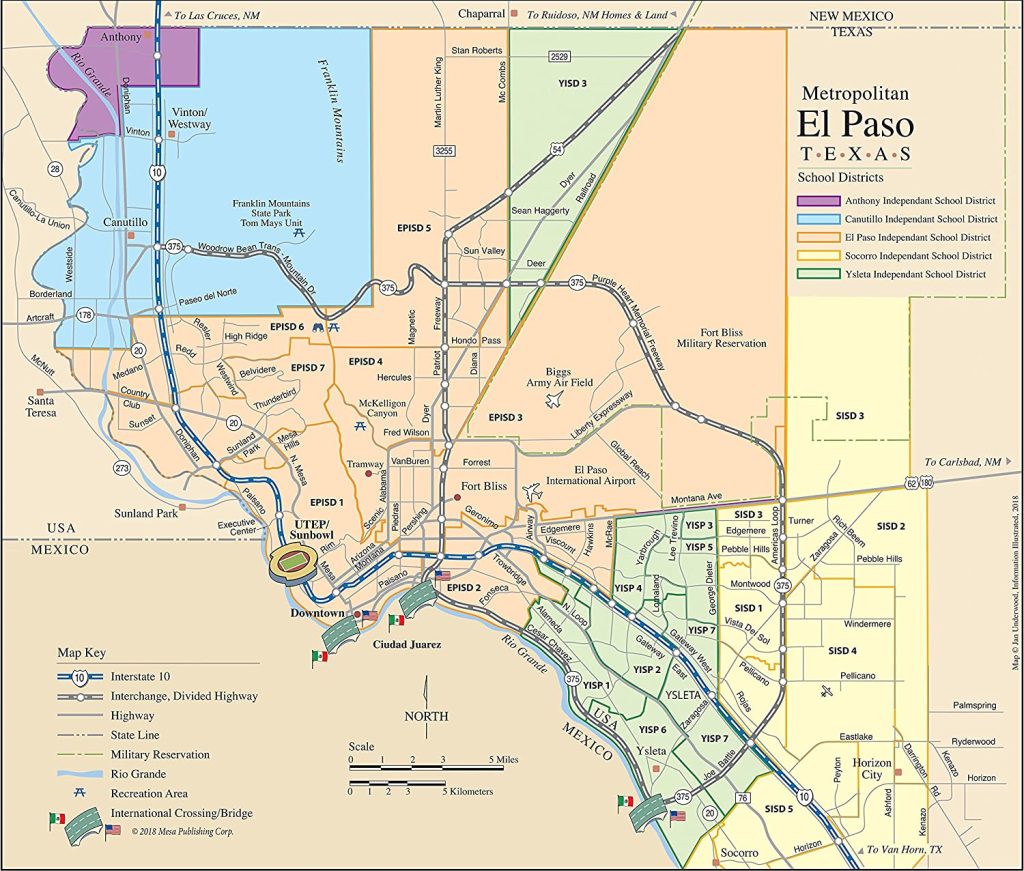
The physical map of El Paso displays its many rivers and mountains as well as its various parks and wildlife refuges like Franklin Mountains State Park and Hueco Tanks State Historic Site. Additionally, it reveals numerous trails for hiking and biking that can be accessed from throughout town. The political map illustrates El Paso’s numerous neighborhoods from Downtown to Mission Valley along with important landmarks such as Concordia Cemetery or San Jacinto Plaza. The reference map of El Paso serves as a starting point in the world of traveling around the city.
Things to do In El Paso
El Paso offers plenty of activities for travelers looking for adventure or relaxation alike. There are several museums such as the El Paso Museum of Art or Insights Science Center where visitors can explore art collections or scientific exhibits respectively. Other popular attractions include Splash Water World which features over twenty water slides; Horseshoe Park which boasts lush golf courses; or an array of Mexican restaurants serving up delicious traditional dishes like burritos, nachos, or tamales just across the border in Juarez City. The map of El Paso perfectly shows the shape of the city and its location.
Transportation options & nearby airports
Travelers have multiple transportation options when visiting El Paso including Greyhound buses which transport passengers around town; Amtrak trains which pass through from Chicago; LAX Airport Los Angeles International Airport located approximately 632 miles away; DFW Airport Dallas Fort Worth International Airport located about 718 miles away; Phoenix Sky Harbor International Airport located about 455 miles away; plus nearby highways US 54/62/180/85 connecting drivers throughout town plus beyond into New Mexico or Mexico itself.
How far Is the Mexican border from El Paso?
The Mexican border is only minutes away from downtown El Paso via I-10 West Freeway but visitors should note that passports are required when crossing into Mexico so proper identification documents should be carried at all times when traveling abroad.
Is El Paso a beautiful place to live?
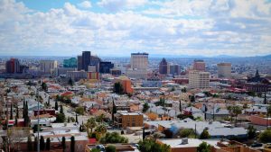 Yes – life in sunny El Paso offers plenty of beautiful scenery and experiences every day! Residents enjoy bright blue skies year-round with mild winters perfect for outdoor activities like golfing or hiking in Franklin Mountain State Park while summer months bring temperatures ideal for swimming at local pools or rafting down Rio Grande River rapids. Additionally, there are numerous festivals held annually offering live music concerts and food tastings plus cultural experiences ranging from art galleries to historical tours so no matter what your interest may be there’s something special happening each day here in El Paso!
El Paso is a unique city in many ways, and one of the most remarkable things about it is its close proximity to Mexico. The city is connected to its sister city of Ciudad Juarez by several international bridges, which have helped to create a thriving cross-border culture. You’ll find that residents of both cities move freely between them for work, shopping, and other daily activities, giving the area a truly cosmopolitan feel.
Finally, it’s worth mentioning that El Paso is also home to several military installations, including the historic Fort Bliss. This military presence has helped to shape the city into a hub of defense and security-related industries, making it a truly fascinating place to visit for travelers who are interested in American history and military culture.
In conclusion, El Paso is a city that offers something for everyone. From its stunning natural beauty to its rich cultural heritage, it is a must-visit destination for travelers who are looking for an authentic taste of the American Southwest.
 The Guide Maps
