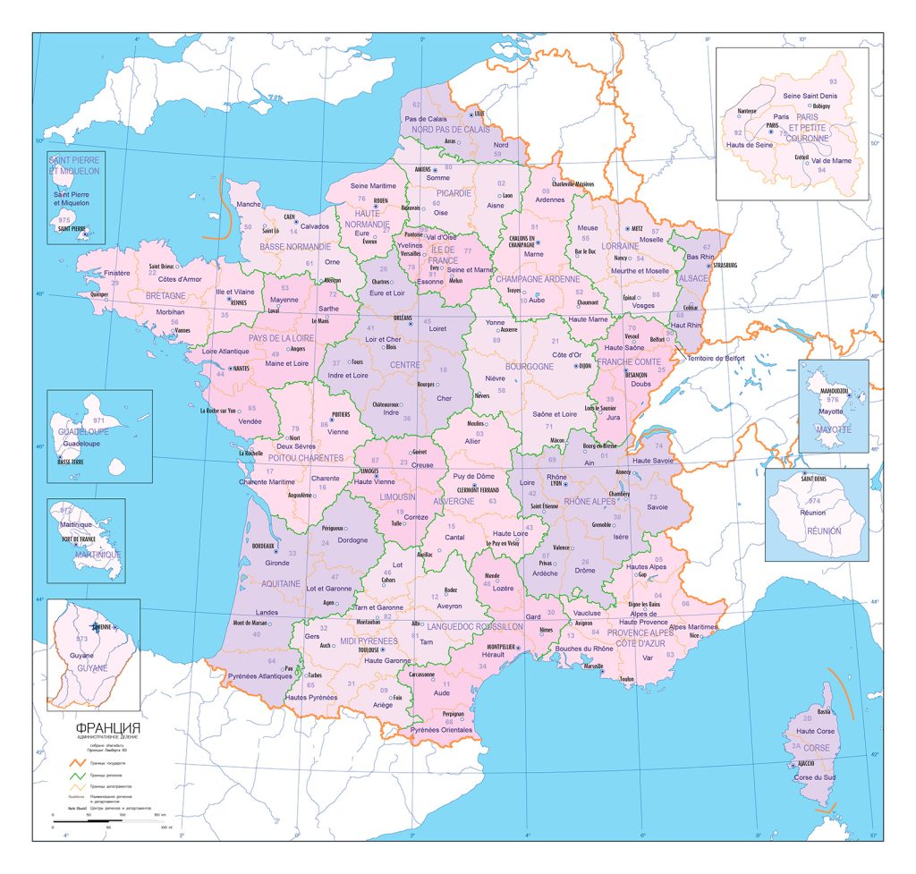
Map of France
French Republic map online
France is a developed country located in the west of Europe. The economic and geographical position of the country is characterized by two main features: firstly, France directly borders with the countries of the European Union, and secondly, it has long maritime borders, which allows it to use cheap sea transport to communicate with other countries.
General description of the French Republic
France is one of the largest states in modern Europe. Its territory is 552 thousand km2. The territory of modern France was formed in its main features at the end of the XV century as a result of the unification of numerous feudal possessions under the auspices of the French kings and the liquidation of English possessions after the Hundred Years’ War (1337-1453), as well as as a result of the conclusion of various treaties, trade deals.
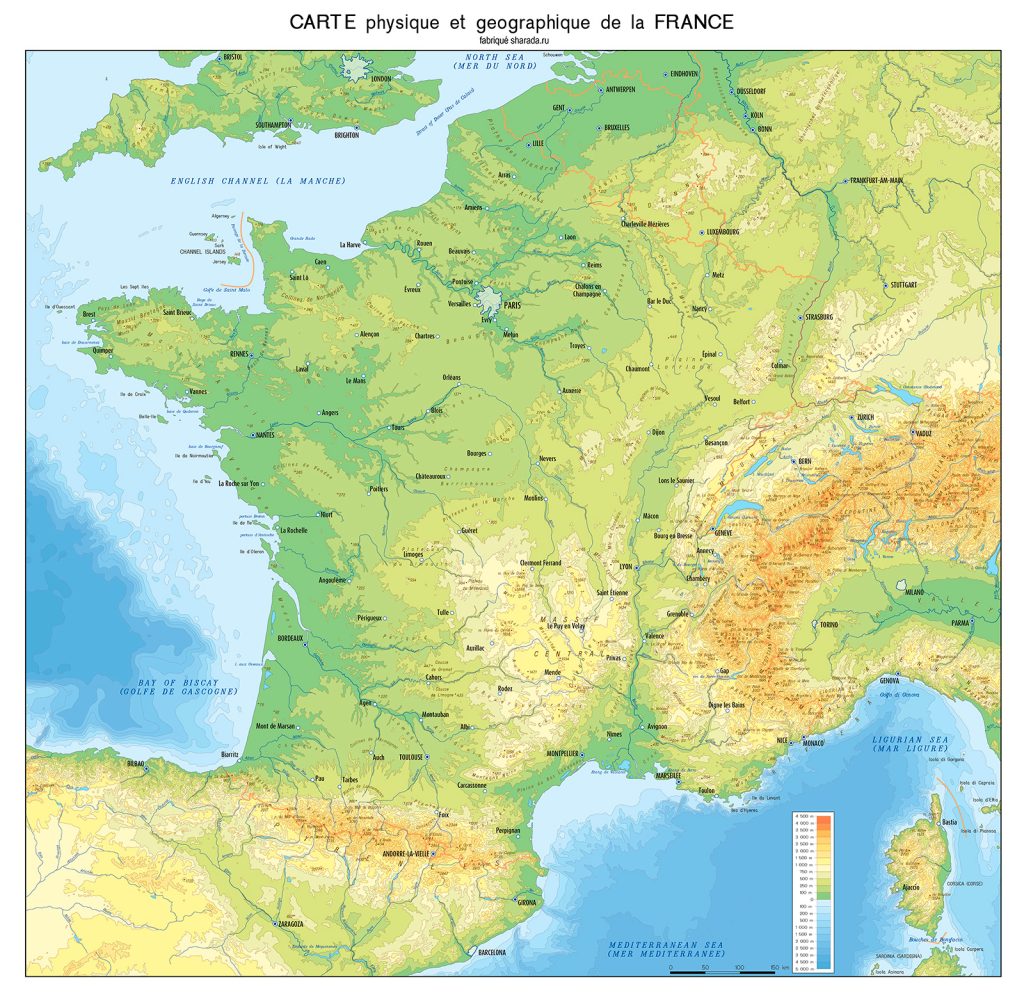
The two largest rivers of the country are: Loire – 1012 km. and the Seine – 776 km.
The highest point is Mont Blanc in the massif of the same name. Its height reaches 4810 m above sea level.
France has a favorable climate. This is the only country on the map of Europe, which is located in four climatic zones: Atlantic (in the west), continental (in the east and in the center), Alpine and Mediterranean (in the south). Due to sea winds, winters are warm, and summers are moderately hot with a lot of rain.
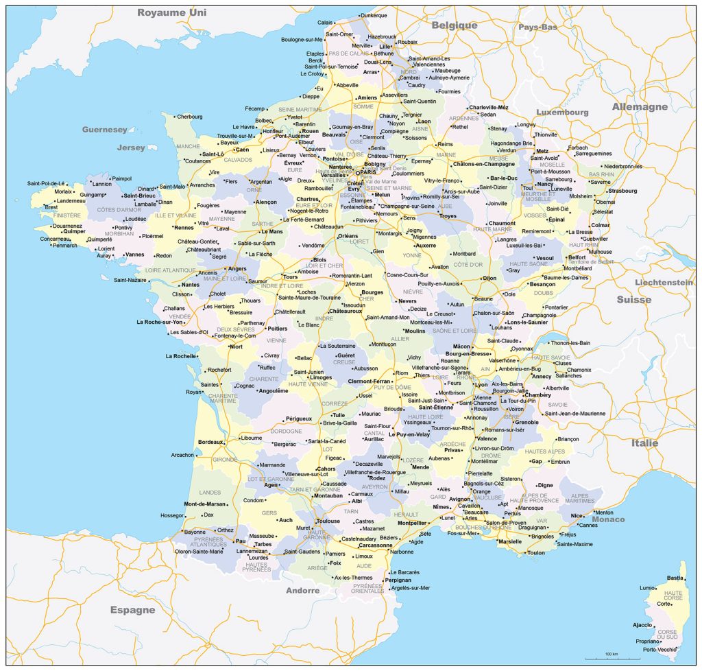
In the northern part of the state, on the Seine River, is the capital of France – Paris .
The largest cities (data excluding agglomerations):
- Paris – 2,250,000;
- Marseille – 870,000;
- Nice – 533,560;
- Lyon – 506 620;
- Toulouse – 475 450;
- Nantes – 291,600;
- Montpellier – 275,320;
- Strasbourg – 272,500;
- Bordeaux – 256,050.
Location of France on the world map
The main part of France is located in Western Europe. The republic also has overseas regions and territories. It ranks third in Europe in terms of size. It has a favorable economic and geographical position, as it borders with developed countries: in the south – with Spain, with Belgium and Luxembourg – in the northeast, and in the east – with Germany, Italy and Switzerland. From the north it is washed by the English Channel, and from the west by the Bay of Biscay. And it has access to the Atlantic Ocean. France on the world map is in the top ten.
Relief
The relief in this country is diverse: plains and low massifs on the outskirts contribute to the development of trade. Thus, the plains and lowlands of the western and northern regions gradually rise and turn into mountain ranges. The highest of them are the Alps. They stretch to the borders of Italy and Switzerland and have the highest point of the country – the top of Mont Blanc. The Alpine system of mountains includes the Pyrenees, the Alps and the Jura.
Water resources of the country
France is washed by the Atlantic Ocean in the west, the Mediterranean Sea in the south, the English Channel in the northwest, and the northern shores are washed by the North Sea.
The Seine, Garonne, Loire, Rhone are the largest rivers in France and the main source of fresh water. They are of great importance in the development of the country’s economy and serve as channels for the delivery of goods. Shipping is one of the cheapest modes of transport in France.
Also on the map you can see that there are many lakes: Allos, Capitello, Geneva, Annecy, Aiguebelette, Mont Cenis, Lac du Bourget, Sainte-Croix and Serre-Poncon. The lakes of France are famous for their purest water, fish and picturesque places for recreation. Most of the lakes are of glacial origin. According to their origin, they are divided into 3 groups:
- lakes with glacial feeding – mountain;
- with rain – flat;
- estuaries and coastal lakes with mixed nutrition.
The largest cities on the map of France
Paris
The capital of France. It is located in the Ile-de-France region in the northern part of the country, on both sides of the Seine River. The city is considered the center of world culture, fashion and art. The Eiffel Tower with panoramic views is the most popular attraction not only in Paris, but throughout Europe. It was she who became the symbol of the city. No less famous sights: the Louvre, the Cathedral of Notre Dame de Paris, the Arc de Triomphe and others.
Marseilles
The second largest and oldest city in France. It is located in the southeastern part of the country on the Mediterranean coast. It stands on the shores of the Gulf of Lion, near the mouth of the Rhone River. This is a port city with narrow streets, yachts in the Old Port, ancient fortresses and azure bays. The old port is the heart of Marseille, and the local fish market has become famous throughout Europe.
Lyon
The third largest city in France, located in the east. It is famous for ancient ruins, charming medieval streets and atmospheric quarters along the rivers Rhone and Saone. The production of world-famous textiles and silk is established here. Also, this city is recognized as the culinary capital of France and is included in the list of UNESCO World Heritage Sites.
Nice – the pearl of France
Located in the southeast between the sea and the mountains in the Bay of Angels. This is a famous resort place with azure shores. This city joined France in 1860, before that it was associated with Italy. Therefore, Nice can be called a real find for lovers of French and Italian culture.
Toulouse
It is located in the southwest of the country near the Pyrenees, between the Atlantic Ocean and the Mediterranean Sea. The fifth city in terms of population and size. It is considered a modern center for aviation and space research. In the old part of the city, many buildings were built of terracotta bricks. Therefore, it is also called the “Pink City”.
 The Guide Maps
