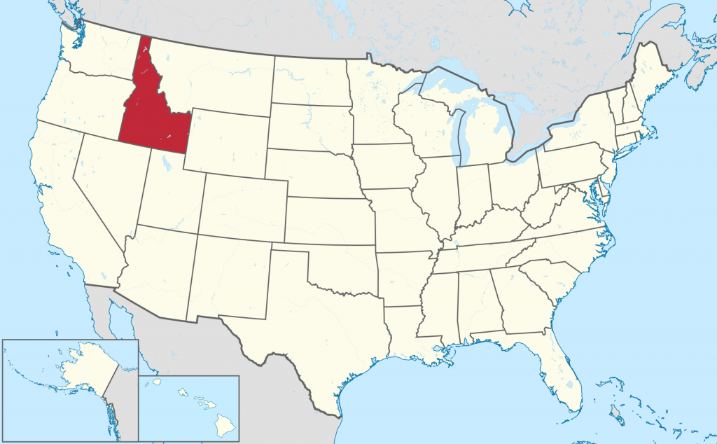
Idaho map, USA
General map of Idaho live
Location of Idaho in the United States
According to one version, the word “Idaho” in the language of the Shoshone Indian tribe means “mountain gem”, according to another – “the sun rises”. According to the third version, in the language of the Athabaskan tribe, this word means “enemy.” Boise is the capital city of Idaho.
The state of Idaho on the US map is located in the northwestern part. It borders the states of Washington, Oregon (to the west), Nevada, Utah (to the south), Wyoming and Montana (to the east and northeast), as well as Canada to the north.
About 25% of the territory of the state is occupied by the Snake River Valley . The largest lake in Idaho is Pand Ouray . Its area is 466 km 2 . The highest point in the state is Mount Bora Peak (height – 3859 m).
Most of the map of Idaho is occupied by mountains: Bitterroot, Lemhi, Lost River, Clearwater, Salmon River, Southout and White Cloud. Hells Canyon – The canyon, located in Idaho, is the deepest canyon in the continental United States. The first national park on the planet, Yellowstone, is located on the territory of the state.
Major cities of Idaho on the map
- Idaho’s capital, Boise, is the state’s most populous city. It has a population of 227,000 people. The area is 165.8 km 2 . The city is located in the southwestern part of the state, on the banks of the river of the same name. Founded in 1863. A year later received the status of the city. The name is related to the French word ” Lesbois ” (trees). The distance from Boise to Oregon is 66 km, to Nevada is 177 km. Most of the city is located on a plateau. The local climate is characterized by hot and dry summers, cold winters, and short springs and autumns.
- The second largest city in Idaho is Nampa . Its area is 76.4 km 2. 87900 people live here. Founded in 1886. City status received after 4 years. The name is related to the Native American word ” namb “, which means “moccasins” or “footprints”. Formerly called New Jerusalem . The city is located in southwestern Idaho, on a hill. Boise is 30 km away. Lowell Lake is located southwest of Nampa .
- The second most populous city in Idaho is Meridan. 117,600 people live here. In terms of population growth, Meridan occupies one of the leading positions. The area is 30.5 km 2 . Founded in 1891. It received city status in 1902. The first name is Hunter. The current name comes from the name of the lodge, which was located on the same meridian as the state capital. Located in southwestern Idaho, in Treasure Valley. Several irrigation canals run through the city.
- Idaho Falls is the largest city in the eastern part of the state. The population is 62900 people. The area is 58 km 2 . Founded in 1864. City status received after 7 years. The first name is Eagle Rock. Translated from English “falls” ( falls ) is translated as “waterfalls”. Located in eastern Idaho on the banks of the Snake River . The city is an important transportation hub between eastern Idaho and western Wyoming.
- Pocatello is one of the oldest cities in Idaho. Founded in 1834. It received city status in 1889. Named after the chief of the Shoshone tribe. 54,300 people live in Pocatello . The area of the city is 83.9 km 2 . Located in the southeast of the state. Pocatello is the highest city in Idaho. It is located at an altitude of 1356 m. The river Portneuf flows through the city .
| № | Locality | State | Coordinates | Stations |
|---|---|---|---|---|
| 1 | Sun Valley | Idaho | - | 0 |
| 2 | Mountain Home (historical) | Idaho | - | 0 |
| 3 | Mountain Home Air Force Base | Idaho | - | 0 |
| 4 | Lewiston | Idaho | - | 0 |
| 5 | Kellogg | Idaho | - | 0 |
| 6 | Fruitland | Idaho | - | 0 |
| 7 | Coeur d'Alene | Idaho | - | 0 |
| 8 | Boise | Idaho | - | 0 |
 The Guide Maps

