Joliet map, Illinois USA
Located in northern Illinois, Joliet is a city that’s rich in history and culture. From the Will County Courthouse to the Joliet Prison, it’s a place that has so many stories waiting to be heard and explored. From its lakes to its educational centers, it's a place that’s definitely worth visiting. Here's what you need to know about this picturesque place. The Joliet City Map is the best tool for travelers.
Interactive Map of Joliet
Joliet map collection
- Schematic map of Joliet with streets and roads
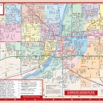
- Joliet map with schools and streets
Where is Joliet, Illinois?
 Joliet is located about 40 miles southwest of downtown Chicago and is part of the greater metropolitan area that makes up the entire Chicagoland region. It lies within Will County just south of Interstate 80 along the Des Plaines River, making it easily accessible from all parts of the state as well as surrounding states like Wisconsin and Iowa.
Political map of Joliet, Illinois
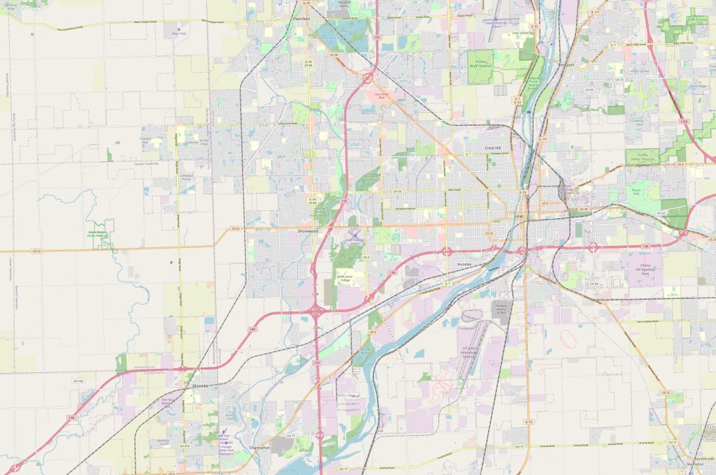
The political map of Joliet shows various neighborhoods throughout the city such as Black Road/Rockdale Drive/Caton Farm Road on the west side or Hillcrest Avenue/Deneen Street/Laraway Road on the north side. There are also numerous parks scattered throughout including Hickory Creek Preserve, Pilcher Park and Rock Run Preservation Area which make for excellent places to explore nature and wildlife during your visit to Joliet! Additionally, you can also find some notable attractions such as Hollywood Casino Amphitheatre and Route 66 Raceway on this map which are both popular destinations for locals and tourists alike! With the Map of Joliet, you will definitely not get lost.
Physical map of Joliet USA
 The physical map of Joliet shows several rivers including Des Plaines River and DuPage River as well as multiple lakes such as made in National Tallgrass Prairie Lake, Dandelion Lake and Hidden Lake Park which provide plenty of opportunity for fishing and other recreational activities like kayaking or canoeing in addition to bird-watching! Additionally, there are also two airports in close proximity: Lewis University Airport (8 miles away) and Chicago Executive Airport (15 miles away). There are also railways that run through town such as Union Pacific Railroad with their main station being located at 6th Ave & E Jefferson St intersection! Lastly you can even see some highways like I-80 running right through downtown area connecting different parts of state together! The map of Joliet shows the border of the city.
By what landmarks can I find the city on the physical map?
On a physical map you can find various landmarks around town such as Rialto Square Theatre which is an iconic landmark built in 1926 off Collins Street or St Mary Nativity Church along Jefferson Street near downtown area where you can attend mass every Sunday! Other recognizable landmarks include Silver Cross Field which is home of local baseball team known as “the Slammers” or Louis Brier Home & Hospital for those who need nursing care services during their stay in town!
Things to do in Joliet USA?
Joliet offers plenty to do for people who love outdoor activities like biking/hiking trails at nearby parks or boating tours down Des Plaines River but if you prefer something more indoors then there’s always shopping malls with indoor amusement park rides plus lots restaurants serving delicious cuisine from all over world ranging from Italian pizzerias like Giordano’s Pizza House down Broadway Street all way Mexican street tacos found El Sol Restaurant right next door! For those who want bit culture during their trip then try out historical sites spread across town such Rialto Square Theatre showcasing art film screenings live music performances every weekend making perfect way spend lazy Saturday afternoon after exploring rest city sights during day time hours! The Joliet, road map is a great helper when traveling by car.
Nearest cities to Joliet USA
If you’re looking for cities around without leaving Will County then here they are: Lockport (8 miles away), Romeoville (10 miles away), Platteville (14 miles away), New Lenox (15 miles away), Bolingbrook (17 miles away) Aurora (19 miles away)! Plus, if you want venture little further then try out cities outside county borders such Oak Lawn (30 miles away) Tinley Park (32 Miles Away) Naperville (35 Miles Away) Orland Park (42 Miles Away).
Nearest Airport, Railway Station Highways
If you’re looking fly into nearest airport then there’s Lewis University Airport located 8 Miles Away With, Flight Services Majorly Catered Towards General Aviation only plus nearby Chicago Executive Airport Offers Scheduled Commercial Flights Major Airlines As, Well Although it is a bit further, about 30 miles away. Both of these airports offer convenient transportation options to get to your destination, such as rental cars, taxi services, and shuttle buses. If you prefer a more scenic route, you can also consider taking a train or bus into the city, as there are several stations and stops located within close proximity to the airports.
 The Guide Maps

