Map of Thailand
Kingdom of Thailand map online
The Kingdom of Thailand is located in southeast Asia and occupies the southwestern part of the Indochina peninsula and the northern region of the Malay Peninsula.
Until 1939, the state was known in the world under the name of Siam. On June 24, 1939, the government issues a series of state decrees, according to which the country should be called Thailand , and the population – Thais. However, in September 1945, a new leadership comes to power, which returns the state to its former name. The country bears the name Siam for about four more years, until in May 1949 it is again changed to Thailand . Since then, the name has not changed.
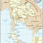
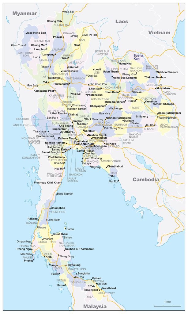
- Geopolitical map of Thailand with borders and neighboring states
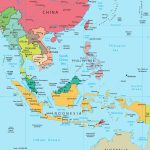
- Location of Thailand in Southeast Asia
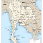
- Thailand map with roads, railroads, major cities, airports
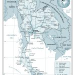
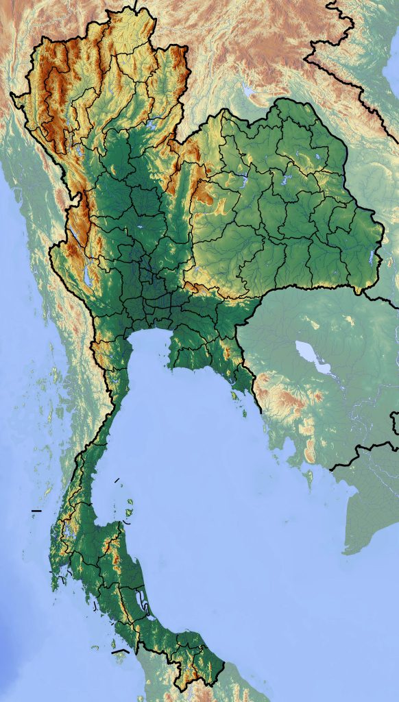
- elevation map of thailand with other marks
General description of the Kingdom of Thailand
The kingdom is washed by the Andaman Sea on the western side, and the Gulf of Thailand from the east.
Thailand on the world map is located between Myanmar, Cambodia, Laos and Malaysia.
The country is characterized by a variety of climatic conditions, due to which crops are harvested in Thailand many times a year, and tourists come to the country all twelve months.
Almost half of the country’s territory is occupied by forests. Tropical evergreen trees grow in the south, tropical ones in the north.
The ethnographic map of Thailand is represented mainly by Thais and Laotians. A small part of the population are Chinese, Malays, Hmong , Khmer and Vietnamese. The Kingdom is home to 68,098,000 people. A huge agglomeration of 15,000,000 people gathered around Bangkok. The rest of Thailand is fairly evenly populated.
The main religion of the country is Buddhism. About 5% of local residents are Muslims and about 1.7% are Christians.
The largest cities in Thailand :
- Khon Kaen – one of the largest cities in the northeast of Thailand. Khon Kaen has a population of 121,000. The city has its own airport, railway and is connected by bus to all major settlements of the Kingdom.
- Lampang – located in the valley of the Vang River , which flows through the entire city. It is the third largest settlement in northern Thailand . About 61,000 inhabitants live here.
- Nakhon Pathom – the city is located 50 kilometers from the capital of the Kingdom. About 85,000 inhabitants live here.
- Nakhon Ratchasima (Korat) – is located in the northeast of Thailand on the Korat plateau. The population is about 146,000 inhabitants. There are four universities and silk factories in the city.
- Nakhon Sawan is a settlement located in the central part of the state. The city has about 93,000 inhabitants.
- Nakhon Si Thammarat – the city is located in the south of Thailand . About 106,000 inhabitants live in the village
- Ayutthaya is located 70 kilometers north of Bangkok. Until 1767 it was the capital of the kingdom of Ayutthaya . The village is home to 55,000 people.
The climate of Thailand
Thailand ‘s weather is represented by three seasons:
- On the fifteenth of May, the rainy season begins and lasts almost until the end of October. In August and September, heavy rains can lead to floods.
- In late October – early November, the second season begins. By this time, the rains stop, and the cold period begins, which lasts until mid-February.
- The third season begins at the end of February and is characterized by intense heat and ever-increasing humidity.
The air temperature in mountainous areas during the cool period can drop to zero at night, while during the day it reaches +25 °C. In the warm season, the temperature reaches +40 °C.
Location of Thailand on the world map
Thailand is the 50th largest country in the world, with an area of 514,000 square kilometers.
The length of the coast is about 3200 kilometers. Most of the coast is located in the lowlands, there are swampy areas.
On the map of Thailand, hundreds of islands are marked within the coastal zone of the country. The largest is Phuket , its area is 543 kilometers.
The state has borders with four countries. In the east and northeast, the country borders on Laos, from which it is separated by the Mekong River. In the south, 506 kilometers is Malaysia, in the west, the country is separated from Myanmar by 1,800 kilometers. Mountain peaks located in the southeast fence off Thailand from Cambodia.
The total length of the borders of Thailand on the world map is 4863 kilometers.
Relief
The hypsometric map of Thailand reflects the diversity of the country’s topography. The northern regions of the country are characterized by mountainous terrain. Here is the highest peak of the country – Mount Doi Inthanon whose height is 2559 meters.
The eastern part of the country is represented by the elevated plain Korat, the height of which rises from the border with Cambodia from 150 to 500 meters.
Water resources: seas, rivers and lakes
In Thailand, there are large reservoirs and full-flowing rivers belonging to the basins of the South China and Andaman seas. The largest and most significant river is Chao phraya (formerly Menam). Its length is 372 kilometers, and the total basin area is 158,000 kilometers. The Chao Phraya flows into the Gulf of Thailand. The river plays a big role in the life of Thailand: its water is used for irrigation, timber is transported along it and ships, including large-tonnage sea transport, go through it.
In the east of the country, among the Korat plain , there is another large river basin formed by the Mekong River. The Mun River, which is the largest tributary of the Mekong, also flows there. Several small rivers pass through the Malay Peninsula.
There are few large lakes in the country. The largest – Lake Thaleluang is located on the Malay Peninsula. Its area is 1000 kilometers.
In Thailand, there are many reservoirs artificially created on the dams of large rivers.
The largest dam, Bhumbiol, has been created on the Ping River . The reservoir was formed for power generation, fish farming and flood control. The volume of water held by the dam is 13,462,000,000 cubic meters.
The second largest reservoir is Sirikit . The dam was built on the Nan River in 1972 to generate electricity and meet agricultural needs. The dam holds a 9,510,000,000 cubic meter reservoir.
The Khaulem and Srinakarinda reservoirs are located in the south of the country.
The largest cities on the map of Thailand
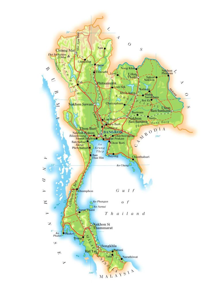 Thailand is divided into large and small towns and villages.
Bangkok
Bangkok is the capital of Thailand , located on the banks of the Chao Phray River. It is the largest city in the Kingdom: it covers an area of more than 1.5 thousand kilometers and has 5.6 million inhabitants.
On the map of Bangkok’s transport networks, it can be seen that the city has established connections with all the settlements of the country.
The historical center of Bangkok is the island of Rattanakosin located on the Chao Phray River. The island is surrounded by fortresses and ditches created to protect the capital.
On the island is the palace of the former royal residence, on the territory of which the Temple of the Emerald Buddha is located.
In the same part of Bangkok is the Temple of the Reclining Buddha Wat Pho . This is the largest statue of Buddha in the prone position, the sculpture is 46 meters long and 15 meters high.
The Temple of Dawn, Wat Arun , is on the opposite side of the Chao Phraya River .
Nonthaburi
Nonthaburi – the city is located on the Chao Phraya River , 20 kilometers from the capital. About 267,000 people live in the settlement.
The city has preserved transport channels of the 19th century, thanks to which you can get an idea of the life of the city at that time.
A well-known tourist attraction is the Old Town Hall, built in European style during the reign of King Rama VII. The building is decorated with teak carvings.
Pak Kret
Pak Kret – located in the center of Thailand and is part of Greater Bangkok. About 167,000 people live in the city. Pak Kret consists of twelve districts, which include 85 townships.
The main attractions of the city are:
- Koh Kret Island , located on the Chao Phraya River . The local inhabitants of the island are the Mon tribes , who have been engaged in pottery since ancient times.
- Muang Thong Thani Stadium , built for the 13th Asian Games in 1998. Currently wearing ” Impact “.
Hat Yai
Hat Yai is a city in the south of the country, located 50 kilometers from the Malaysian border. About 157,000 inhabitants live in the city.
City attractions:
- Hat Yai Temple – the main temple of the city is famous for the statue of a thirty-five-meter reclining Buddha
- City amusement park Hat Yai Park .
- Waterfall Ton Nga Chang Waterfall – a waterfall consisting of seven levels is located 30 kilometers from the city.
Pattaya
Pattaya is a resort town located on the shores of the Gulf of Thailand. The population exceeds 500,000 inhabitants.
There are no significant historical or architectural monuments in the city, however, Pattaya attracts millions of tourists from all over the world every year.
The city has a park of copies of world attractions Mini Siam. In the suburbs of Pattaya , zoos, crocodile and elephant farms and an aquarium are open for visiting. You can also visit Buddhist temples and the Ban Sukhawadee palace complex .
 The Guide Maps
