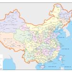
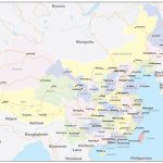
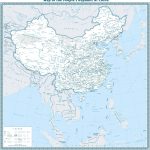
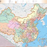
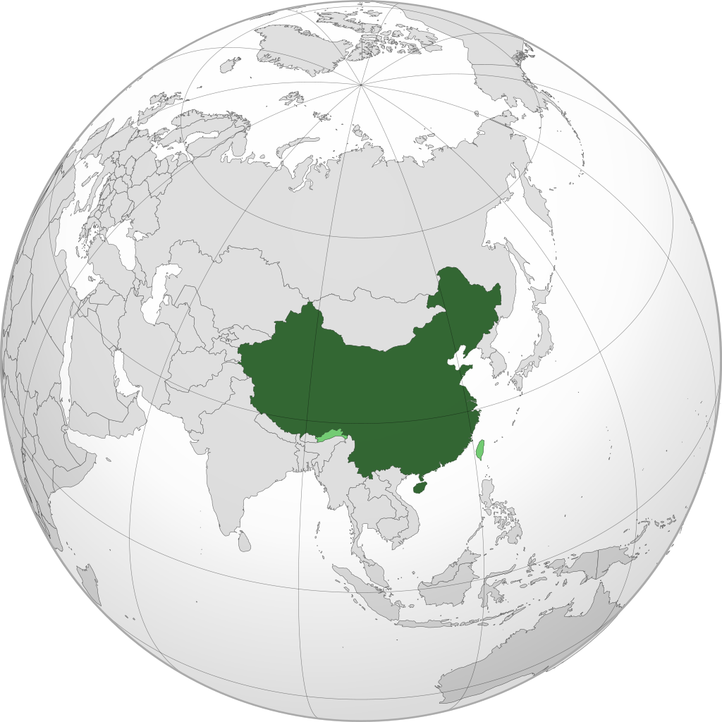
Map of People's Republic of China
China map online
- Large map of China with administrative borders and city names
- Political map of the People’s Republic of China with borders of neighboring states
- Road map in Chinese
General description of the People’s Republic of China
China – the official name of the People’s Republic of China – is a state in East Asia. One of the largest countries
- in terms of population, it ranks first in the world with 1.415 million people;
- in terms of territory, it is in third place in the world – 9599 thousand km 2 .
The People’s Republic of China (PRC) is a socialist state. According to IMF estimates, China’s GDP in 2022 should be $18,321 million. According to this indicator, China, producing about 18% of the total product of the world economy, is second only to the United States.
As can be seen from the numbers and the place China occupies on the world map , the state is a world superpower. China is a permanent member of the UN Security Council, which determines the fate of the countries of the world. China has the largest army in the world, possesses nuclear weapons, and is one of the leading space powers.
The map of China was formed several thousand years ago. This is a unique state in which many imperial dynasties have changed, but the country has remained unchanged. For most of history they were empires, now it’s a republic.
The Celestial Empire, as China is often called, has risen and fallen, but has always risen from the ruins. History, traditions, philosophy, culture of China for 5 millennia have become a reliable support that helps the country find its place in the world. Many inventions appeared in China that had a significant impact on world civilization.
The most famous:
- paper;
- typography;
- powder;
- compass;
- silk production;
- porcelain;
The traditions and qualities of the people contribute to the fact that for several decades the PRC has been the most stable and dynamically developing economy in the world. This allowed the country to quickly regain lost positions, turning into a world leader.
In China, after the victory of the revolution in 1949, a one-party system. The ruling party is the Chinese Communist Party (CCP).
This name was also used in Europe, after it was brought there by Marco Polo. Distributed in many countries , China appeared from the ancient Qin empire that existed on the territory of ancient China.
Location of China on the world map
China on the world map is located in the east of Asia. On the eastern side, its borders are washed by the waters of the Pacific Ocean. These are the East China, Yellow, South China Seas and the Gulf of Korea. Land border neighbors are:
- in the northeast, North Korea and Russia;
- in the north – Mongolia;
- in the northwest – Russia and Kazakhstan;
- in the west – Kyrgyzstan, Tajikistan and Afghanistan;
- in the southwest – Pakistan, India, Nepal and Bhutan;
- in the south of Myanmar, Laos, Vietnam.
The length of the sea coast on the map of China from North Korea to Vietnam is 14.5 thousand km. Off the east coast of China is the island of Taiwan, which became an independent Republic of China, which is not recognized by mainland China – it considers the island of Taiwan to be part of a single Chinese territory. The country stretches from west to east for 4.5 thousand km, and from north to south – for 4.1 thousand km.
Relief
The physical map of China is dominated by brown. This means that most of its territory is mountainous. The highest mountain range of Tibet is in the southwest of the country. Its average height is more than 2000 m above sea level . The predominance of mountains is also observed in the northern part of the state, but their height is lower – 200-2000 m. The central part of China and Sichuan province are located in the mountains, which are lower than Tibet and have an average population density.
In Eastern China, the Great Chinese Plain is located, which forms the most favorable places for life with the lower reaches of the main rivers.
Rivers and seas
Three major rivers flow through China: the Yellow River, the Yangtze River and the Pearl River.
The rivers of China have been important trade routes between the western and eastern parts of the country for many centuries. The Great Canal of China, which connected them, made waterways the main highways before the advent of railways and roads. The waters of the rivers helped in the cultivation of the surrounding lands, giving them the necessary moisture. Rivers are used as sources of drinking water and for the needs of industry.
With the development of shipping , the long sea coast became an important factor for the industrial development of the country. China on the world map has moved from its ports to the most important regions with harbors, such as Europe and America.
Vegetation of China
China is one of the world’s leading biodiversity countries. Wildlife is protected in 2,349 nature reserves covering 15% of China’s area. map . About 32 thousand species of higher vascular plants grow in a country with diverse natural zones. Here you can find completely different forests.
Coniferous trees predominate in the north. Bamboo groves are widespread. In the mountains there are many yews and junipers with rhododendrons as undergrowth. In the center and south of China, subtropical forests dominate, characterized by a large number of endemics. A quarter of plant species are found in the rainforests of Hainan Island and Yunnan Province .
The largest cities on the map of China
Shanghai
On the map, Shanghai is located at the confluence of the Yangtze River into the ocean. The population of the city is about 25 million people. It is the world’s largest port, financial, industrial and commercial center of China. The city has the longest metro line in the world – 831 km.
The city is located in a zone of subtropical climate favorable for life. The combination of futuristic modern architecture and historical monuments has made Shanghai a popular tourist destination.
Beijing
The capital and largest cultural and educational center of China on the map is located in the northeastern part of the country. The population is about 22 million people. Geographically, the location of the city is the northern peak of the Great Plain of China. Plains located in the south and east are protected from cold air by mountains in the west and north. The climate is temperate, monsoonal.
Beijing is the northern end of the Great Canal of China. The Great Wall of China passes near the city.
Guangzhou
Capital of Guangdong on the map is located in the south of China. The most important city in South China with a population of 14 million people. is an industrial, foreign trade and cultural center of the most developed industrial region of the country. Located near the Pearl River Delta on the coast of the South China Sea, next to Hong Kong and Macau. The climate is humid subtropical.
Shenzhen
Located 100 km southeast of Guangzhou on the map of China , Shenzhen City is a shining example of China’s economic miracle. Since 1979, it has grown from a small town to one of China’s largest metropolitan areas with a population of 17.5 million. The city borders Hong Kong and became the first special economic zone to start transformations in the country.
At present, it is the most important high-tech innovation center, called China’s Silicon Valley. Located south of the Pearl River Delta in the humid tropics.
Chengdu
Chengdu is located on the map of China in the southwestern part of it. This is the valley of the Minjiang River in the west of the Sichuan Basin. The capital of the well-known Sichuan province is informally the center of economic development in Western China. The city is the investment center of the region. It is located in a zone of humid subtropical climate comfortable for agriculture and life.
Main directions of tourism
It is interesting. Travel and tourism in China in 2022 became the second industry in terms of contribution to the country’s GDP.
Note to the tourist. In China, tourist sites are assigned ratings. To choose a travel route, it is useful to familiarize yourself with the objects that have been assigned the highest rating of tourist attraction 5A. It is listed on Wikipedia.
Northeast China
On the map of China , the northeast consists of 3 provinces:
- Heilongjiang;
- Liaoning;
- Jilin.
This is a region once inhabited by Mongolian tribes, with a harsh climate. Most of the attractions are natural. China is actively developing tourism infrastructure here to attract Russian tourists who live across the Amur River. The flow of Russians turned out to be not as significant as the inhabitants of the warm regions of China attracted by the service and exotic nature. In 2009, 100 million Chinese tourists visited Heilongjiang Province.
Northern China
The map of Northern China consists of the provinces of Hebei and Shanxi , the Autonomous Region of Inner Mongolia, the cities of Beijing and Tianjin .
The region is very diverse. The climate of Inner Mongolia is sharply continental. The rest of the region is in the temperate monsoon climate zone.
Most of the attractions are concentrated in the major cities of Beijing and Tianjin , which are major centers of tourism. In inner Mongolia, there are objects associated with both China and Mongolia – the most famous is the tomb of Genghis Khan.
Northwest China
In Northwest China, territories are allocated that occupy a significant area on the map of China . These are the provinces:
- Gansu;
- Shaanxi;
- Qinghai.
And autonomous regions:
- Xinjiang Uyghur;
- Ningxia Hui.
The region is not rich in tourist sites, but there are a number of places worth visiting. Among them is the unique Terracotta Army near Xi’an ; geopark Danxia , Mogao Caves and Mati Temple in Gansu .
Southwest China
main part of the country along the southern borders is assigned to the southwestern part on the map of China . The region included: Tibet Autonomous Region, Chongqing Central Subordination City, Yunnan Province , Sichuan, Guizhou .
This is the most diverse region for tourists. Here is the mysterious Tibet, the highest peaks in the world, the famous cuisine of Sichuan province, the main habitats of pandas, amazingly beautiful places created by nature and areas inhabited by small peoples with their own national flavor.
South central China
This region on the map includes 3 provinces of China: Henan , Hubei , Hunan . One of the most interesting tourist areas to which you can dedicate a separate trip:
- Henan is 4 ancient capitals and the Shaolin Monastery ;
- Hunan nature reserves with beautiful nature, mountains ” Avatar “;
- Hubei – Three Gorges on the Yangtze, a complex of dao temples in the Wudangshan mountains .
South China
Includes the provinces of Guangdong and Hainan , Guangxi Zhuang Autonomous Region, Hong Kong, Macau. One of the most popular areas of China among tourists is the most diverse in terms of its attractions.
The climate is dominated by tropical. Of interest are Hong Kong and Macau, which until recently developed separately from China. Guangdong has a combination of antiquity and the most developed modern megacities. In autonomy – the culture of other peoples and the incomparable beauty of the cruise on the Lijiang River . On the map Hainan is outside the mainland. The tropical island will provide a beach holiday and spa treatment.
Eastern China
The east of China is occupied by densely populated, industrialized provinces of China, saturated with many interesting places to visit. The following provinces are included in this tourist region:
- Anhui;
- Jiangxi;
- Fujian;
- Jiangsu;
- Shndong;
- Zhejiang
and the central government city of Shanghai.
The names of the cities of this part on the map of China alone arouse interest and desire to see them. Here, many historical and cultural monuments of the Celestial Empire are complemented by areas reminiscent of Europe – from here cooperation with overseas states began and colonial buildings were preserved. The most modern districts with the highest skyscrapers in China have become a great addition to the historical quarters.
 The Guide Maps
