Map of Kenya
Republic of Kenya map online

General description of the Republic of Kenya

Political map of Kenya with borders of regions and capital
Kenya on the map is located on the continent of Africa. The area of the state is about 583 thousand km 2 . This is larger than the territory of Spain or Thailand, but somewhat smaller than Turkey. It is the 48th country in terms of area, and its territory can completely accommodate two Great Britain.
A map of Kenya indicates the largest and most important objects of the territory.
Major rivers:
- Tana is the longest river in Kenya, with a length of 800 km.
- Galana – length 375 km.
The highest point in the country is the city of Kenya , height 5199 m.
The climate varies depending on the region of the country. On the coast of the ocean, the climate is tropical, inland it becomes temperate. In the north and northeast of Kenya, arid and semi-arid areas are located. The rainy season starts in March-April and lasts until May or June. The hottest months are February and March, the coldest is July.
The capital of the state is the city of Nairobi , located in the southwestern part of the country.
Largest cities in Kenya:
- Nairobi – 4,400,000 people
- Mombasa – 1,200,000 people
- Nakuru – 571,000 people.
- Kisumu – 400,000 people
Location of Kenya on the world map
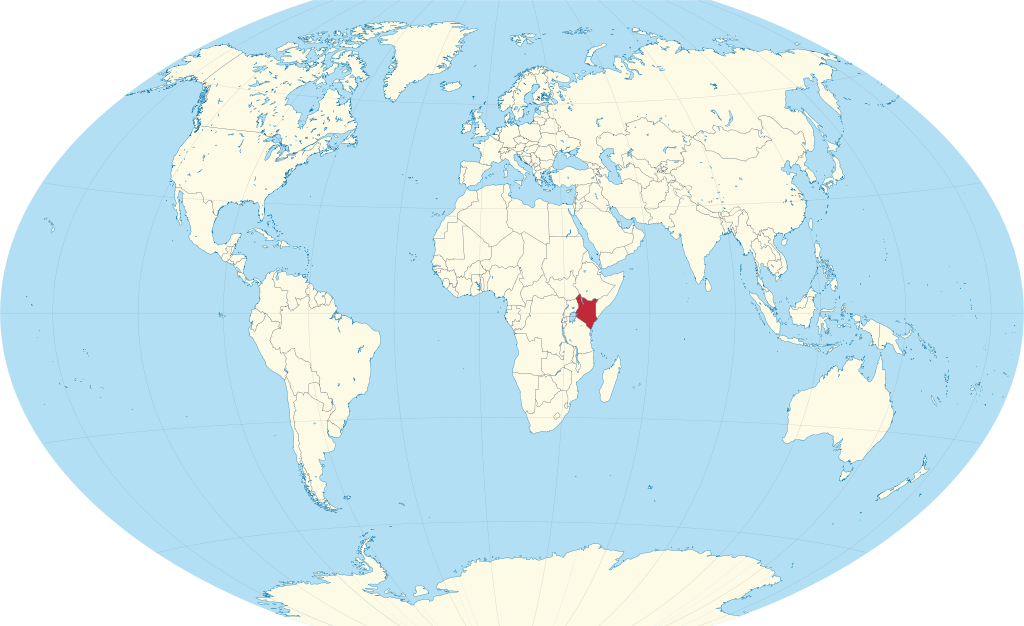
Kenya location on world map
Kenya on the world map is located in the central part of East Africa. The equator line crosses the country almost exactly in the middle.
From the southeast side, the coast of Kenya is washed by the waters of the Indian Ocean. In the southwest, the country borders on Tanzania. Part of the western border runs along the shores of Lake Victoria. North of the lake, the western border separates Kenya and Uganda. South Sudan borders Kenya to the northwest, and further north is the border with Ethiopia. Somalia separates Kenya from the Indian Ocean to the east.
Relief
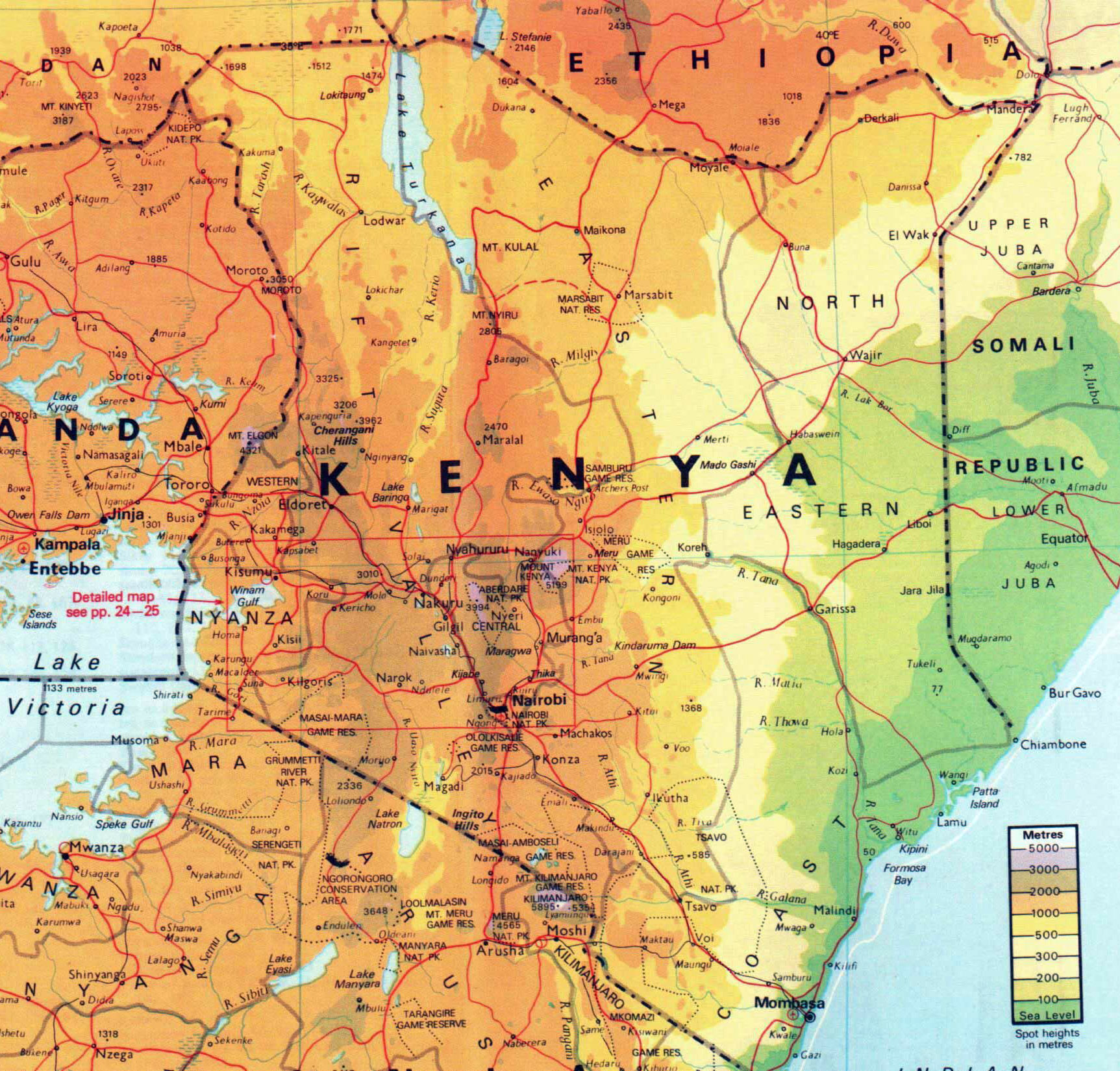
Large physical map of Kenya with relief and rivers
Plains stretch along the coast of the Indian Ocean. Closer to the center, they pass into the Eastern Plateau. Here begins the most fertile region of Kenya. Even further away, the highlands begin, which are bisected by the Great Rift Valley – an internal system of ridges. In the highlands is the highest point in the country – Mount Kenya, 5192 m.
Water resources
In the west of Kenya is the largest lake in Africa – Victoria. The Kenyan border affects only part of the coast.
In the north of the country there is the fourth largest African lake – Lake Rudolf ( Turkana ) with an area of about 8.5 thousand km 2 .
To the south of the city of Nakuru is a lake of the same name with salt water.
Mount Kenya is the source of Kenya ‘s largest river, the Tana. Making a big bend in a northerly direction, it flows into the Indian Ocean. Reservoirs, dams and a hydroelectric power station have been built on the river.
The second important river in Kenya is the Galana . It originates near the Great Rift Valley and flows until it flows into the Indian Ocean.
The largest cities on the map of Kenya
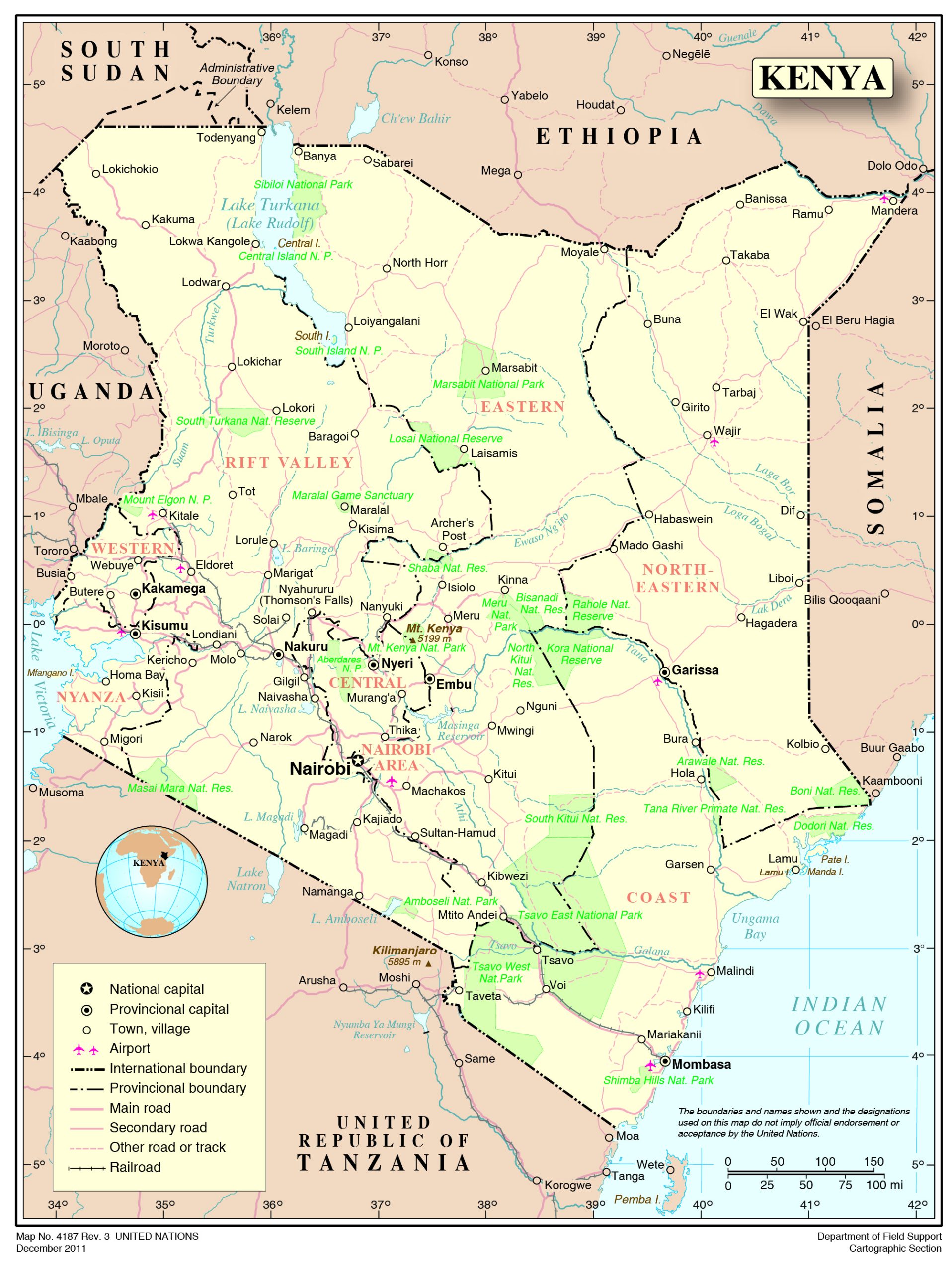
Map of Kenya with names of cities
The map of the Republic of Kenya indicates the 3 largest cities.
Nairobi
The largest city is located in the central part of the country, a little closer to the south. The equator line passes near the city. Mount Kenya rises to the north of Nairobi, and on a clear day, Mount Kilimanjaro in Tanzania is visible to the southeast.
Mombasa
The city is located in the southeastern part of the country, on the coast of the Indian Ocean. It is the oldest city in Kenya, founded around 900 AD. e. Throughout Kenyan history, the city has been a trading port. Mombasa is located on the coral island of the same name and is connected to the mainland by a bridge and dams. Areas that belong to the city are built on the continent, so Mombasa occupies the island and the coast on the map.
Nakuru
Nakuru is located in the southwestern part of Kenya. In its vicinity is the lake of the same name, which is part of the national park, as well as the Hyrax Hill Archaeological Museum .