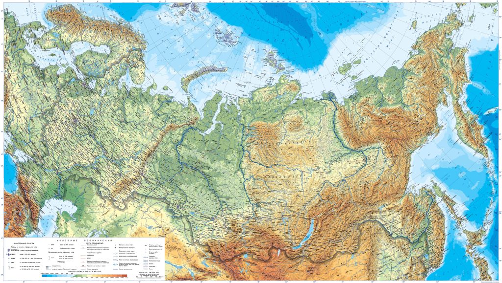
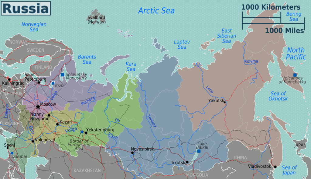
Map of Russia
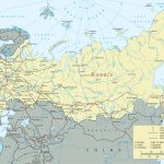
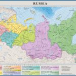
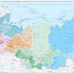
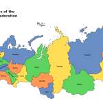
Russian Federation map online
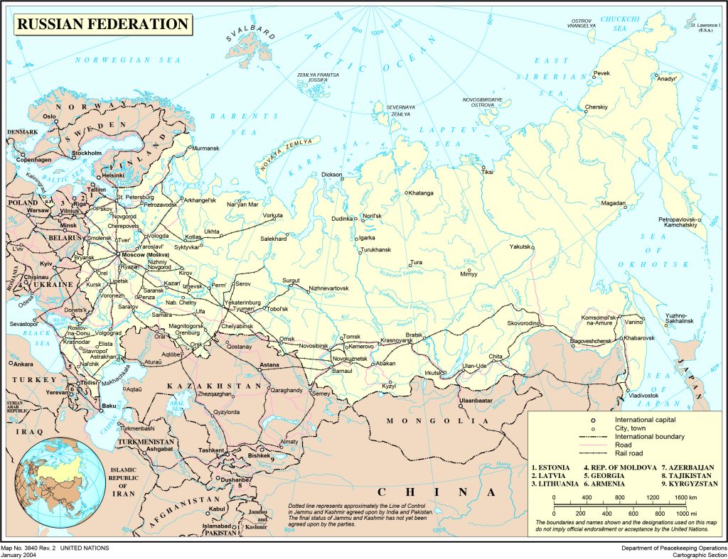
- Political map of Russia with borders and neighboring states
- New maMap with Russia regionsp of the Russian Federation with borders after referendums in 2022 in Russian www.sharada.ru
*The page shows a map of Russia until 2022, before the Referendum
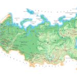
Huge Russia on the map of the planet. Variegated relief colors from greenish lowlands and plains to all shades of reddish-brown tones of mountains and uplands. With drops of blue-blue reservoirs of various calibers. With large and small black dots of megacities and very tiny villages. Immense , not amenable to a brief description, complex, different. It is almost an impossible task to systematize all the wealth of the state, which is boundless in terms of area. It is flexible, able to change its boundaries and capabilities. The map of Russia is changeable, but it is still worth trying to draw a general portrait of its power.
General description of the Federative Russian Federation
The state feels great in a transcontinental format, occupying territories on 2 continents at once: Northern Asia, Eastern Europe. It has the status of the largest country of all existing on Earth. The total area of the giant is over 17 million sq. km. It occupies one eighth of the inhabited land on the planet. In the piggy bank of the state:
- 89 regions from picturesque Kamchatka to Kaliningrad, surprising with its contrasts;
- 11 time zones with different climates;
- border zones on land, shared with 16 powers and small republics, are second only to China in their number;
- maritime borders involve the Caspian, Black, Baltic Seas, as well as a whole collection of seas included in the waters of the Pacific and Arctic Oceans;
- the largest population on the European continent;
- has one official and several unspoken capitals: Moscow – by jurisdiction, St. Petersburg – by culture; Kazan – in sports, Rostov-on- Don – in the southern regions and regions;
- on the map of Russia , but the country has no analogues in terms of natural and resource wealth, all world powers are inferior to it in this.
Russia (Rus) acquired its name in consonance with one of the ancient peoples from among the Eastern Slavic tribes. They mastered these territories and were called “Rus, grew”. This was documented for the first time in 839. It is believed that this nation was a kind of social elite of the Old Russian state. Later, hundreds of other nationalities joined her on these lands. Over the past centuries, the features of everyday life, traditions, and living conditions have intertwined, but at the same time, authentic features that are important for a single community have been preserved.
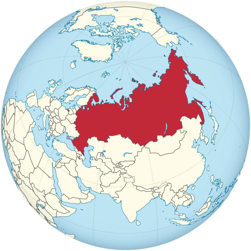
Location of Russia on the world map
Impossible to get confused and not find Russia on the world map. It is unlikely that there will still be a state on the globe that is larger than such continents as Antarctica and Australia. Its territory is comparable only with the possessions of the continent of South America.
For those who get acquainted with the map of Russia for the first time, the reference point should be kept on the mainland of Eurasia. The vector is northeast. At the same time, approximately 30% of the land is in Europe, and 70% in Asia.
The state borders of the Russian Federation have a total length of 60,392 km. At the same time, the mainland is 22,125 km, including 7,616 km for such water bodies as rivers and lakes. The sea distances related to the dividing lines are 38,807 km long. There is no distinction between the republics, territories, regions that are part of Russia. Tourists are absolutely not required to issue permits to go from Buryatia to Dagestan, or from the Krasnodar Territory to the Novosibirsk Region. All subjects of the Russian Federation are equal and friendly among themselves without civil strife.
Analyzing Russia on the world map, it is easy to see that it has border zones and crossing points (crossing points) with the following states:
- former republics of the USSR: Ukraine, Belarus, Georgia, Azerbaijan, Kazakhstan;
- Baltic countries: Latvia, Lithuania, Estonia;
- Asian neighbors: China, North Korea, Mongolia;
- representatives of old Europe: Poland, Finland, Norway;
- USA and Japan on the seas and oceans;
- republics not recognized by all states: Abkhazia, South Ossetia.
After the final resolution of the issue with the territories of the Ukrainian republics of the DPR, LPR, Kherson and Zaporozhye regions, Crimea, newly joined to Russia, the data on the length of state borders will be revised.
Relief features
The characteristics of the earth’s surface, which has become the involuntary base for such a huge state, are best arranged in the form of a list. Otherwise, with such a variety, it does not immediately become clear what and how. Details of geographical reality:
- 60% of the lands on the map of Russia are flat, they were occupied by plains, all the most significant on the planet gathered here: East European or as it is also called Russian, West Siberian .
- On a flat surface, there are surprises, on the plains there are often massive hills up to 285-480 m high and at the same time lowlands, sometimes falling 100 m below sea level.
- Green “spots” of the plains on the geographical map of Russia are found mostly in the west and in the central regions of the country.
- The mountain peaks got 40% of the territories , they chose the eastern and southern outskirts of Russian possessions.
- The highlands are also characterized by the presence of plateaus. Significant – Central Siberian, the rest of the relief does not “spoil” so noticeably.
- Significant, majestic mountain masses are the heights of the Greater Caucasus with the giant Elbrus (5642 m), the Crimean, Ural and Altai mountains, the stone masses of the Western and Eastern Sayan , the volcanoes of Kamchatka and the Kuril Islands are clearly inferior to this ridge.
- Notable are such peaks as Klyuchevskaya Sopka (4688 m), this peak of volcanic origin is located in Kamchatka, Mount Belukha 4506 m high (Gorny Altai), Chersky Ranges (3000 m), Suntar-Khayata (2960 m), Dzhugdzhur (1906 m)
The rest of the mountains, volcanoes, hills and hills only on a flat surface from a distance seem to be something impressive. Their height almost never exceeds several hundred meters. In rare cases, tends to mark 1 km.
Russia is incredibly rich in forests. Trees, shrubs, flower meadows adjacent to them occupy 33.5% of the territory of the state. In mileage, this figure is amazing – 11.5 million square kilometers. 35-50 million hectares of land remain for the share of steppe forbs. These were the natural steppe eco-zones , but now from 50 to 95% of them have gone to the agricultural needs of the country. Due to subjective reasons, the virgin steppes on the territory of Russia remained only in reserved places protected by law.
Water holdings
The water resources of Russia account for 1,454.3 million square meters. km of territory. The priority type of water bodies is rivers of different fullness and flow speed. Lakes do not lag behind in number, there are more than 2 million of them.
In order of importance, the top most significant water holdings are as follows:
- The Caspian Sea (lake) is the record holder in terms of area, we can say the world champion in this indicator;
- Lake Baikal is an incomparable leader in beauty, the largest freshwater reservoir on the mainland, a favorite of the tourist public.
- Ladoga and Onega lakes are the pride of the northwestern regions of Russia, natural curiosities of the Leningrad region and Karelia.
- Multinsky lakes are the decoration of Altai, ready to compete with Swiss delights in picturesqueness.
- Lake Khanka , simultaneously belonging to the Primorsky Territory of the Russian Federation and neighboring China.
- The Black, Azov, Baltic Seas, inviting travelers to take part in a beach holiday, guaranteeing high catches of fish and seafood of commercial species.
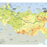
- The largest water rivers-arteries suitable for navigation: the Volga, Yenisei, Angara, Irtysh, Amur, Lena, Ob, Oka, Ural, Dnieper, Don, Kama, Pechora, Belaya, Anadyr, Western Dvina (Daugava).
The length of all these rivers is at least more than 1000 km. Suitable and widely used for economic purposes, as well as interesting in terms of tourist attractiveness for the prospect of the sea: Barents, Japanese, Okhotsk, White, Laptev Sea, Chukotka, East Siberian, Kara, Bering. Their further development is the future.
The strange world of Russian flora
The range of representatives of the plant world, freely growing in the vast expanses of Russia, is unlimited. Types and types entirely depend on climatic zones, and they are apparently invisible in the country:
- The harsh Arctic does not offer suitable conditions for the normal growth and development of plants, but a few mosses and lichens still manage to gain a foothold here.
- More gentle tundra. It occupies expanses on the coast of the Arctic Ocean, a little south of the snow-white Arctic. The zone is not suitable for forests, only dwarf trees such as pines, miniature birches survive. Lichen, northern cranberries and blueberries, velvet moss, and undersized shrubs feel excellent here. The only persistent flowers are forget-me-nots.
- 60% of the territory of the state was conquered by the taiga. It extends from the western latitudes to the shores of the Pacific Ocean. It is rich in coniferous and mixed forest lands. The range of tree species is wide. Gives generous harvests of pine nuts, mushrooms, wild fruits of apples and pears, berries.
- Forest-steppe and steppe are located on 7% of the territories. They have long been a cereal and oil granary for Russia. Gardens, garden plantations, vineyards are fertile here. Does not disappoint with the results of planting gourds.
- The semi-deserts and deserts of the Caspian Sea in the east of Ciscaucasia hardly allow grasses to grow on pastures.
- The subtropical paradise of the south in the Far East, the coastal areas of the Black Sea contribute to the growth of exotic flora. Decoration and “lungs” of these regions: citrus trees, powerful oaks and eucalyptus trees, enchanting magnolias and palm trees, fruit-bearing pomegranates, almonds, figs.
The flora of Russia is infinitely diverse, which does not stop breeders who love experiments. Innovative technologies have long ago mixed different types of green crops in areas that are unusual for them . But this only improves the appearance of an unusual country as a whole.
The largest cities on the map of Russia
Official statistics state that 1118 cities are registered in the Russian Federation. In the life of the country, each of them has a certain important role. The most significant are listed below.
Moscow
The capital of the Russian state. Location – East European Plain (platform). It is based immediately on 2 banks of the Moscow River . The terrain is changeable. The west of the city is on a hill. The eastern regions of the settlement are built on a plain. The southeast slopes into the Meshchera lowland. The climate is typically temperate, with all features of a standard continentality .
St. Petersburg
Cultural capital of the country. Stunningly majestic and beautiful city. Russian “Mecca” of tourism. Location – north-west of the Russian Federation. “Assigned” territorially to the Neva lowland. The owner of the constellation of reservoirs, occupying 7% of the area of the settlement. The climate is humid, unstable, often cool even in summer.
Novosibirsk
“Center of the Universe” of the Siberian Federal District. It occupies both banks of the Ob River. Built in the southeast of the West Siberian Plain. The length of the settlement varies from 25 to 43 km. The main part falls on the Priobskoye plateau. The climate is sharply continental.
Yekaterinburg
The heart of the Urals and the Sverdlovsk region. “Occupied” the eastern slope of the Ural Mountains. The key body of water that solves all economic problems in the city is the Iset River. Close to the border with Europe, although it belongs to the Asian part of the state’s territories. The relief is hilly, the climate is temperate continental.
Kazan
Sports capital of the country. The owner of the title – “The Third Capital of Russia”. Also the main city of the Republic of Tatarstan. Modern , picturesque, in many ways authentic. The owner of a mass of wonderful sights. Location – the left bank of the full-flowing Volga River at its confluence with another water “thread” Kazanka . The relief is half, the plain is adjacent to the hills.
Nizhny Novgorod
Head of the Volga Federal District and the Nizhny Novgorod Region. In the city, 2 large rivers Volga and Oka merge together. The relief is varied: uplands, plains, lowlands. 33 lakes and 12 rivers feel at ease on the territory of the settlement. There are many outlandish places in Nizhny Novgorod that are worth paying attention to inquisitive tourists. It is colder here in winter and hotter in summer than in Moscow, such are the surprises of the climate.
Chelyabinsk
Landmark – the border of the Urals and Siberia. Born and developed on both banks of the Miass River, a tributary of the Iset. It was the result of the development of part of the eastern slope of the Ural Mountains. The city is a millionaire , famous for its developed industry. It was originally a defensive citadel of the region. Geographically – the very center of the Eurasian continent. I have long been accustomed to the second name – “Gate of Siberia”. Climatically it is quite moderate , far from large reservoirs such as seas-oceans.
Samara
“Head” of the economy of the Volga region and the Samara region. The local natural attraction is the graceful bend of the Volga River, known as the Samarskaya Luka. It stands on the bank of the man-made Saratov reservoir. Very close are the mouths of such rivers as the Sok and Samara. It is famous for its irregular, rugged shape, many ravines. Winters here are quite frosty, and the summer months indulge in pleasant heat.
Main directions of tourism
Traveling in Russia is full of new discoveries. The country is able to give odds to overseas curiosities in the abundance of interesting places and entire regions. Choosing where to go is the business of tourists. Let short “notes” about different lands help them in this. Their identification was carried out according to geographical “signs”.
Central Russia
It is located entirely in Europe part of the world. By location, it is most directly related to the basin of the Volga River and its tributaries. 10 regions fall under the jurisdiction of the “center” of the country: Moscow, Ryazan, Smolensk, Ivanovo, Kostroma, Tula, Vladimir, Kaluga, Yaroslavl, Tver. It is here that the famous Russian “Golden Ring” with the constellation of ancient cities and the “Green Ring” with a collection of reserves pass.
Chernozem
O unites 7 regions. These are cities and their ward lands: Tambov, Kursk, Bryansk, Voronezh, Belgorod, Oryol, Lipetsk. It borders on Ukraine. It is located south of Central Russia. Here, on a vast territory, many legendary sights are based, from places of severe battles during the Great Patriotic War, to estates and reserves.
North-West of Russia
Natural fiefdom – mostly taiga. The climate is harsh, but nowhere else you will find so many masterpieces from the famous UNESCO list. Under the “wing” of the north-west of the Russian Federation there are 10 subjects. “Northern palmyra” or handsome Saint Petersburg together with the Leningrad region . Such snowy regions as Komi, the Nenets Autonomous Okrug, the Arkhangelsk and Murmansk regions. Incomprehensible in its exotic Karelia. Ancient wonders of Novgorod, Pskov and Vologda regions.
Kaliningrad region
It is forced to be considered an exclave of Russia – a region territorially isolated from the state by borders with foreign powers. It is famous all over the world for its “deposits” of amber. It directly borders on Lithuania and Poland due to the fact that it previously belonged to East Prussia. The owner of the picturesque Curonian Spit National Park.
South of Russia
Consists of 5 legally independent entities: Rostov Region, Stavropol and Krasnodar Territories, Kalmykia, North Caucasus. Adjacent to the Crimean peninsula, controlled by Russia. Deservedly recognized as the granary of the Russian state. It has direct access to the Black Sea, many mountain and sea resorts. The relief is varied, there are many mountain peaks . In the distance, along the plain, steppes with forbs and wild flowers diverge.
Volga region
Fully located in the European part of the country. Nearest neighbors: Urals, Southern Federal District, northwestern regions, Chernozem region, Central Russia. One of the borders is common with Kazakhstan. The territory falls on the lands along which the lower and middle channels of the Volga pass. Has 3 “fragments”: Upper, Middle and Lower Volga. Key cities: Nizhny Novgorod, Saratov, Ufa, Astrakhan, Cheboksary, Ulyanovsk, Volgograd, Kazan, Samara. Climatic conditions are close to typically continental .
The Ural region In
terms of relief, it combines the massive parts of the East European and West Siberian plains, as well as the Ural Mountains. There is a section bordering on Kazakhstan. It includes such territories as the South Urals, the Middle Urals, parts of the Urals and Trans-Urals. It has access to the Arctic Ocean and the Aral Sea. Owner of many rivers and lakes. Incredibly rich in minerals. It boasts snowy winters with frequent frosts.
Siberia
These lands occupy the largest area of the Russian state. Under the administration of 3 large regions: Central Siberia, Eastern and Western. There are many thematic and national resorts. The most iconic body of water in the territory is Lake Baikal. The most mysterious object is Olkhon Island, which was chosen for rituals by shamans from all over the world.
Far East
The location is consonant with the name – the eastern lands of the Russian Federation. There are many water bodies nearby. There are also hot geysers. The relief is mostly mountainous. This region accounts for 36% of the land holdings of the state. It borders on North Korea, China, shares a maritime border with Japan and the United States. Stunningly beautiful and at the same time harsh region. Climatic realities are strict, winters are long, snow is in bulk . But here the sun is the most active in the country, it shines, but it does not warm very much.
 The Guide Maps
