Map of South America
South America map online
South America on the world map is part of the land along with the islands in the form of a rough triangle . It is a continent and is part of the part of the world – America.
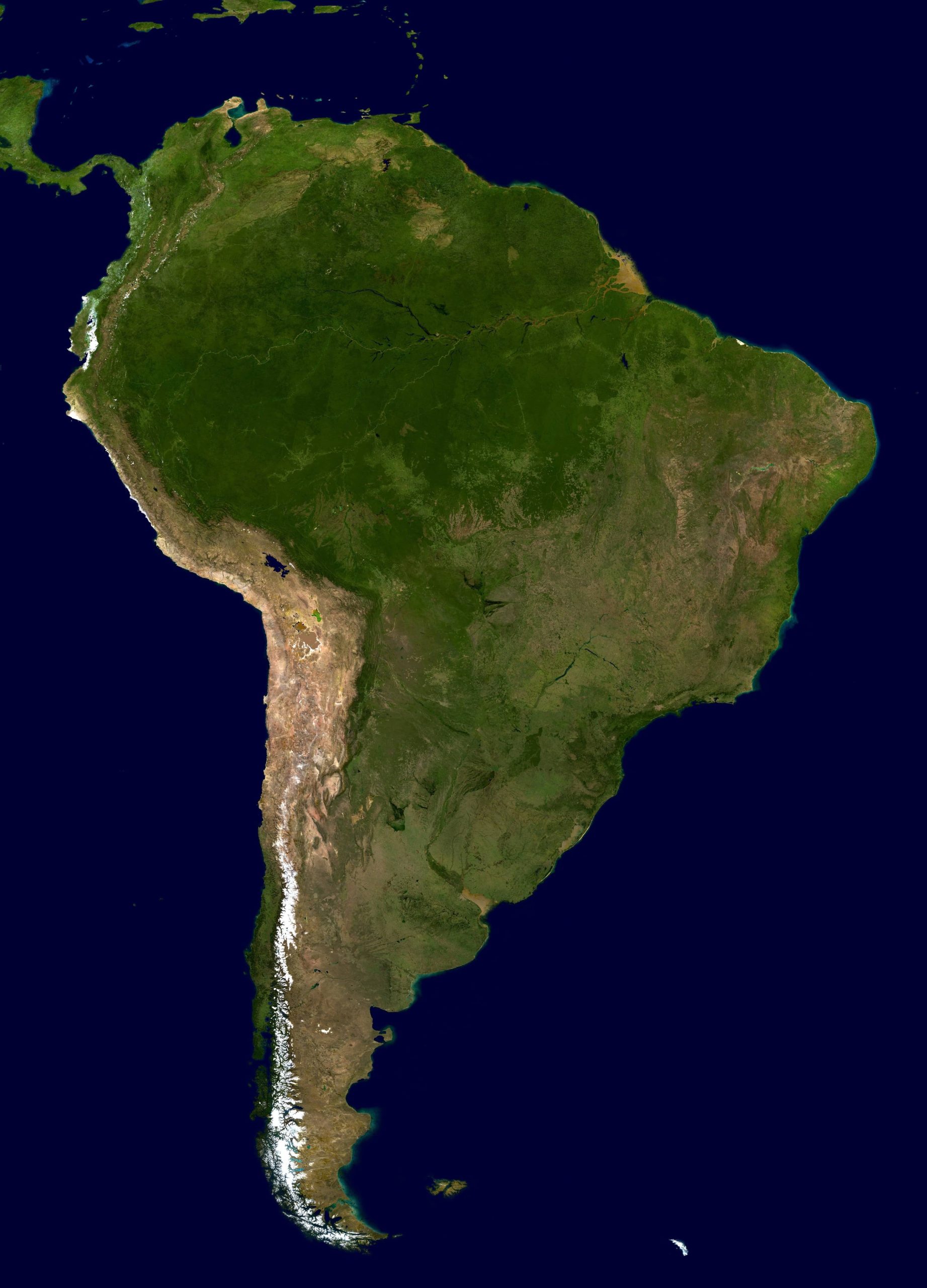
Detailed satellite image of South America
General description of South America
The area of South America is 17.84 million km 2 . Among the continents, it is in fourth place – more than Antarctica (14.1 million km 2 ) and less than North America (24.4 million km 2 ). Distance between extreme points: 7.35 thousand km (north – south), 5.18 thousand km (west – east).
Major rivers:
- Amazon – 4 thousand km;
- Parana – 4 thousand km;
- Orinoco – 7 thousand km.
Highest points:
- Mount Aconcagua – 6962 m;
- volcano Ojos del Salado – 6893 m;
- active volcano Llullaillaco – 6739 m.
Climate zones
The continent is stretched from north to south. It crosses 6 climatic zones of the Earth: from Subequatorial in the northern hemisphere to Moderate in the southern. Most of the territory is dominated by a warm tropical climate without sudden temperature changes, from +20 ° C to +28 ° C, with dry and wet seasons and a huge amount of precipitation.
In the south of the mainland, the weather is comfortable – about 0 ° C in winter , and up to +25 ° C in summer.
The west is characterized by strong regular winds of the fortieth latitudes.
In the Andes, climate change occurs with increasing altitude. For each kilometer of ascent, the temperature drops by 6 °C .
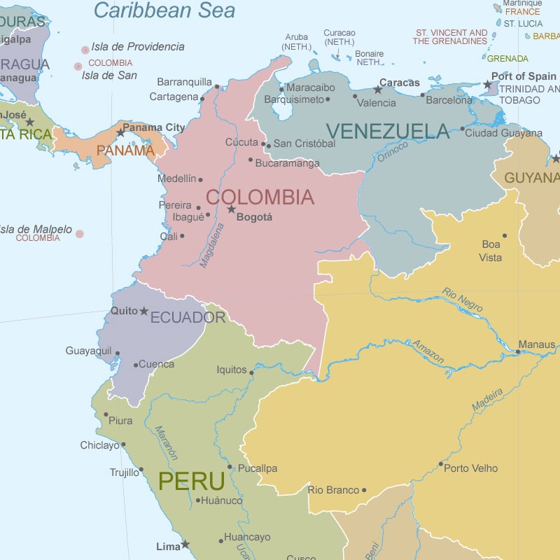
Major countries
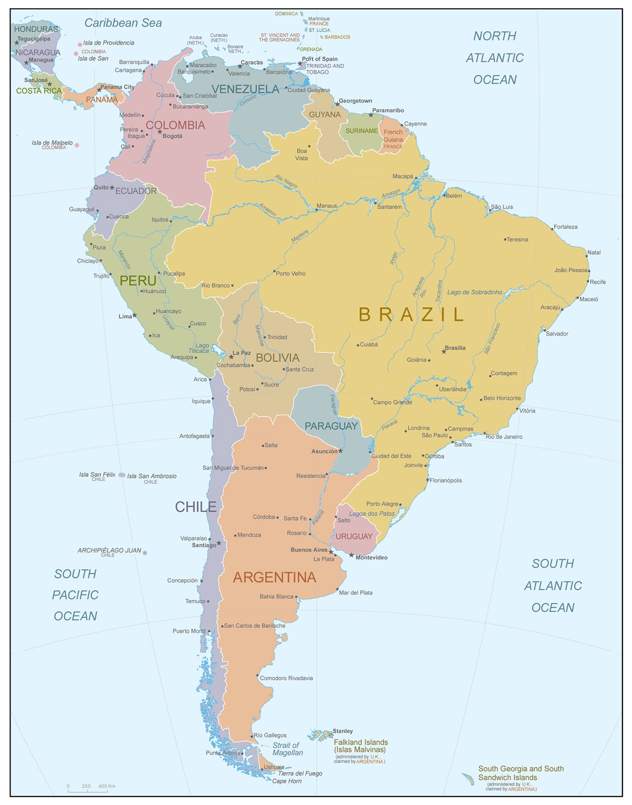
The political map of South America is divided into 12 independent states and 3 dependent territories. The largest countries by area are:
- Brazil 8.51 million km 2 ;
- Argentina 2.77 million km 2 ;
- Peru 1.29 million km 2 ;
- Colombia 1.13 million km 2 ;
- Bolivia 1.10 million km 2 ;
- Venezuela 912 thousand km 2 .
Political map of South America with state borders and their names
Geographic location of South America
South America lies entirely in the Western Hemisphere – the coordinates of any of its points have western longitude.
The equator runs through the mainland. Despite the fact that a small part is located in the northern hemisphere, South America is considered the continent of the southern hemisphere.
Extreme points are located on capes. Their coordinates:
- the north 12° 27ʹ N. 71° 39ʹ W – Gallinas in Colombia;
- in the south (mainland) 53° 54ʹ S . 71° 18ʹ W – Frouard on the coast of the Strait of Magellan, in Chile;
- in the south (island) 56° 30ʹ S 68° 43ʹ W — Diego Ramirez – a group of islands closest to Antarctica;
- in the west 4° 40ʹ S 81° 20ʹ W – Parinas in Peru;
- in the east 7° 10ʹ S 34° 47ʹ W – Cabo Branco in Brazil.
Relief of South America

Physical map of South America with relief
Two types are distinguished in the relief: the Andean west and the Plain-platform east.
In the west, a mountain system, the Andes, runs through the entire continent , with a length of 9 thousand km. Between the Pacific Ocean and the Andes lies the Atacama Desert.
To the east of the Andes are located, consisting of several plateaus, the Guiana Plateau and the Brazilian Highlands, and the almost flat Amazonian and La plata lowlands.
Water resources
The hydrography of the mainland is represented by rivers and lakes. Main rivers: Amazon, Parana, Orinoco, Paraguay and Uruguay. They flow in the eastern part of the mainland. They feed mainly on sediment. They belong to the Atlantic Ocean.
Lakes are few. Most are concentrated in the Andes. The largest:
- Maracaibo – a lake-lagoon in a depression between the Andes ranges, an area of 16.3 thousand km 2 ;
- Titicaca – of tectonic origin, located on the Andean Highlands, area 8.3 thousand km 2 , depth 304 m;
- Patus – on the east coast, the largest lagoon in the world, an area of 10.14 thousand km 2 .
Natural areas of South America
The nature of South America varies depending on the climate of the area:
- humid equatorial forests – most of the Amazonian lowland;
- temperate forests – foothills of the Andes;
- savannahs and woodlands – the Brazilian and Guiana highlands, the Orinoco lowland;
- subtropical steppes – La Plata lowland;
- deserts and semi-deserts – south of the mainland;
- altitudinal zonality – Andes.
Borders
South America is separated from North America by the Caribbean Sea and the Panama Canal. The border with other continents is the Pacific and Atlantic oceans. In the south, America and Antarctica are separated by the wide Drake Passage.
The largest countries on the map of South America
Brazil
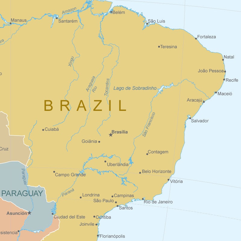 The republic occupies 47.3% of the mainland area . Located in the central part. A small area lies in the northern hemisphere. It borders with almost all states of the continent. In the east it is washed by the Atlantic Ocean. The capital city is Brasilia.
Argentina
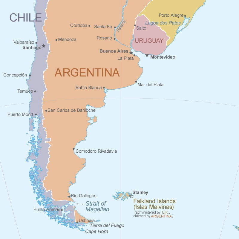 The Republic is located in the southeast of the mainland and occupies the eastern part of the Tierra del Fuego archipelago. It has a common border with the countries: Chile, Bolivia, Paraguay, Brazil and Uruguay. The east side faces the Atlantic Ocean. The capital city is Buenos Aires.
Peru
 Located on the west coast. Washed by the Pacific Ocean. It borders on land with Ecuador, Colombia, Brazil, Bolivia and Chile. The Andes mountain belt passes through the territory. The country is located in a seismic zone. The capital city is Lima.
Colombia
On the map , it occupies an area in the northwest of the mainland. The republic has access to both oceans. Land borders separate Colombia from five states: Brazil, Venezuela, Ecuador, Peru and Panama. The capital is the city of Bogoto.
Bolivia
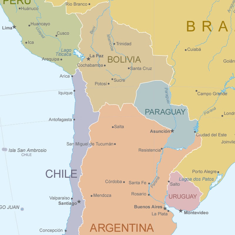 Inland state. Located in the center of the mainland. The western region lies in the Andes, and in the east – low plains. Neighbors with Brazil, Paraguay, Argentina, Chile and Peru. The capital is the city of La Paz.
Venezuela
Republic in northern South America . Its entire territory is located in the northern hemisphere. It borders on land with three countries: Guyana, Brazil and Colombia. It is washed by the waters of the Caribbean Sea and the Atlantic Ocean. The capital city is Caracas.