Bermuda topographic map
Elevation and landscape map of Bermuda
Bermuda topo map
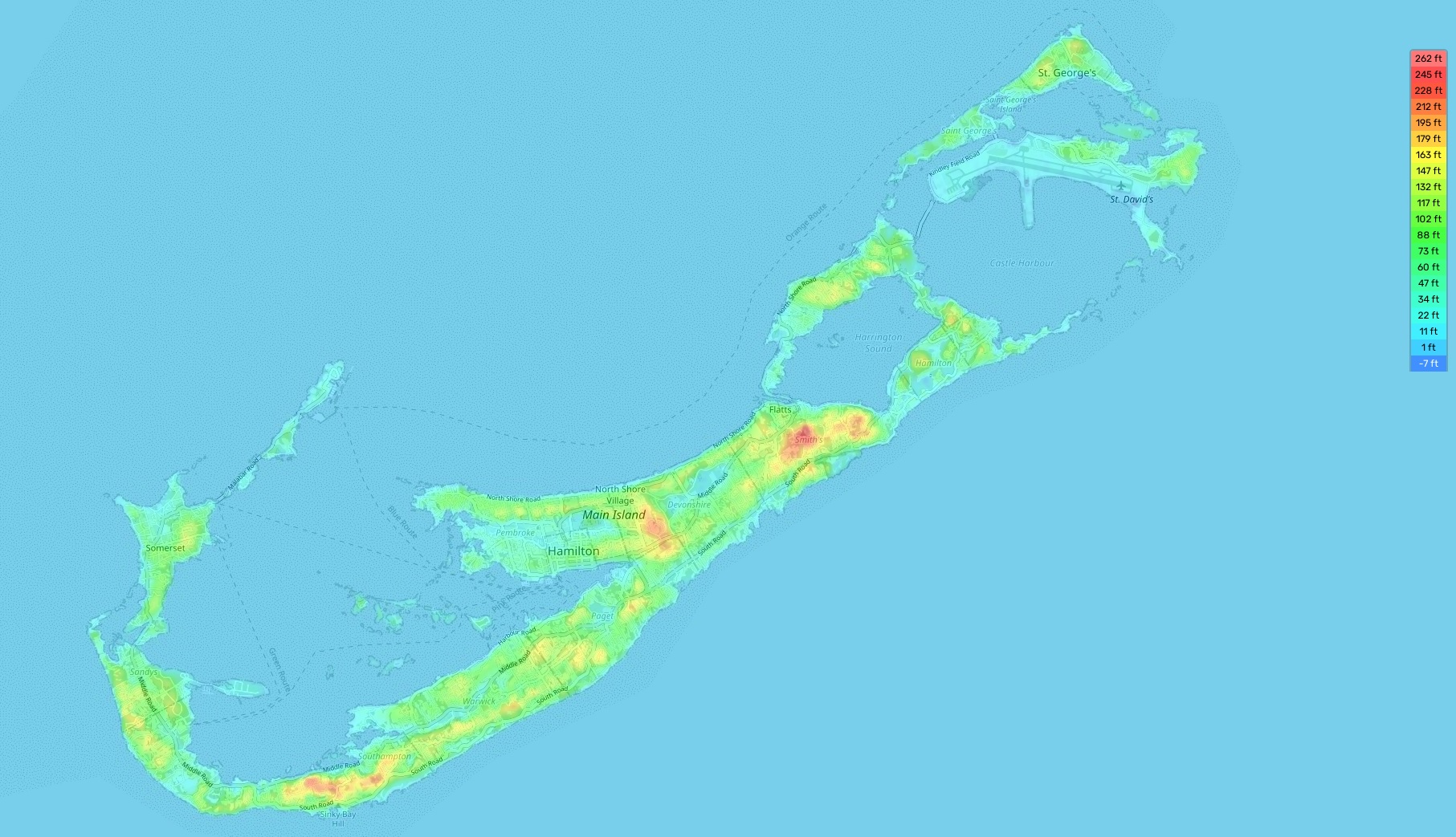
Bermuda is an archipelago located in the western Atlantic Ocean that includes some 181 islands. It boasts a rich topography, featuring a few distinct landforms, including beaches, coral reefs, rolling hills, and even the highest point in Bermuda – Town Hill (259 feet (79 meters) above sea level). The average elevation of Bermuda is 78 feet (24 m) above sea level and its minimum elevation is 3 m. Our site provides a topographic map online for free. On our map there are designations of heights and other important attributes. There are also many beautiful tidal lagoons around the island which offer breathtaking views and provide a wonderful habitat for a variety of wildlife and marine life. Bermuda has several distinctive features: it has an abundance of pink sand beaches, more than any other region in the Caribbean; one of the most famous shipwrecks in the world can be found here; Hamilton Harbor has been designated as “The Jewel of Bermuda” due to its picturesque scenery; and lastly, Bermuda has many crystal-clear coves with stunning underwater caves filled with colorful fish that make snorkeling and diving activities especially rewarding!