Brunei topographic map
Elevation and landscape map of Brunei
Brunei topographic map
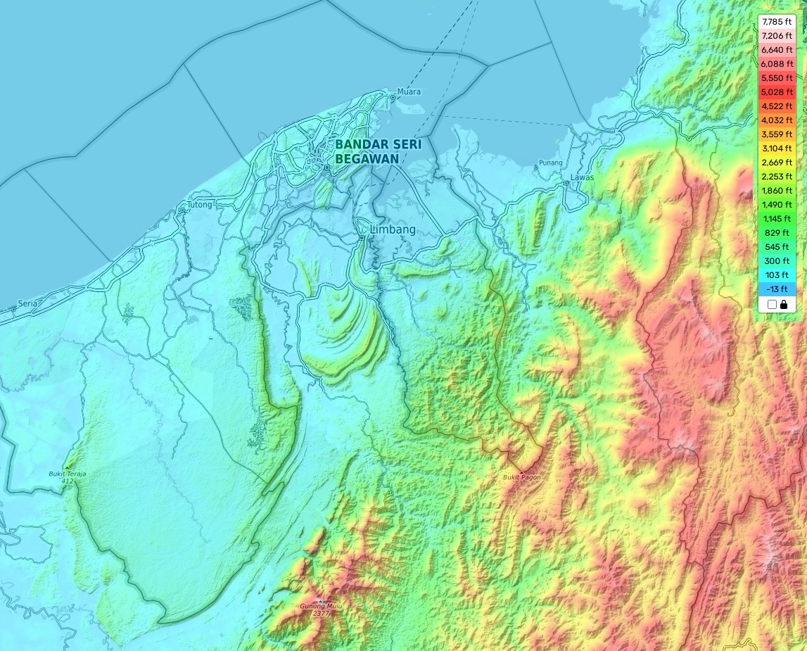
The topography of Brunei is characterized by its highest point, Bukit Pagon, which stands at an highest elevation of 6,070 feet (1,850 meters). This peak is situated in the southeastern part of the country, nestled within a mountainous region known as the Crocker Range. On average elevation, Brunei’s elevation hovers around 980 feet (300 meters), while some coastal areas near the sea level reach as low as 0 meters.
Our website provides a comprehensive topographic map that showcases the intricate details of Brunei’s landscape. It includes precise markings of heights, as well as notable features such as rivers, roads, and borders. Additionally, the map highlights the nation’s unique attributes, such as its lush tropical rainforests, expansive swamps, and thriving mangrove forests.
Brunei’s abundant vegetation contributes to its status as one of the most biodiverse countries in Southeast Asia. It serves as a habitat for numerous endangered species, including the proboscis monkey and the Sumatran rhinoceros. The vibrant ecosystem also attracts a variety of rare bird species that flourish amidst the plentiful resources available.