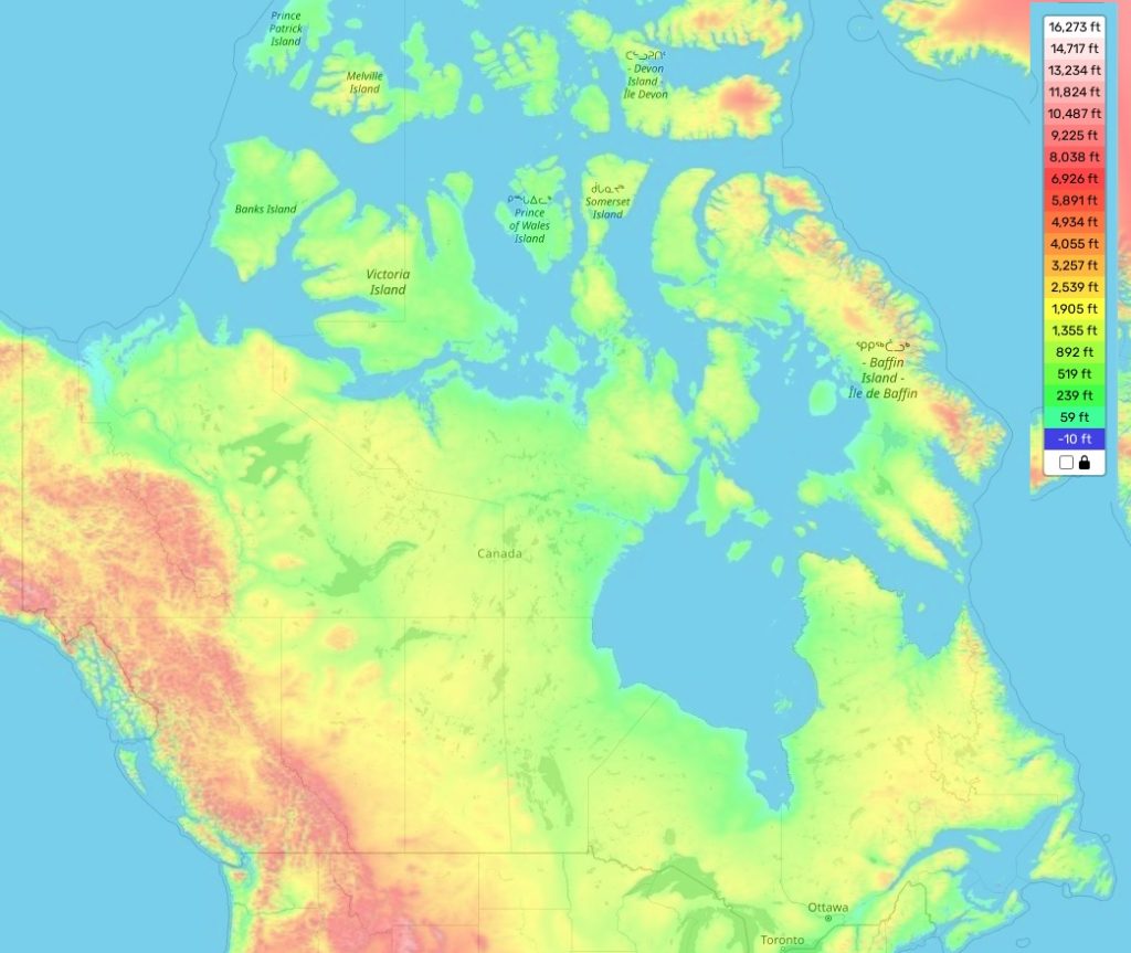
Canada topographic map
Elevation and landscape map of Canada
The topography of Canada is as diverse as its population, stretching from the snow-capped peaks of the Rocky Mountains to the rolling hills of the Canadian Shield and the flat landscape of the Great Plains. The country’s highest elevation point is Mount Logan in Yukon Territory, with an elevation of 5,959 meters (19,551 feet) above sea level. The average elevation across Canada ranges from 110 to 180 meters (360 to 600 feet) above sea level. Meanwhile, Ontario’s lowest point is Lake Erie at a minimum elevation of 72 meters (236 feet). Special attention should also be given to distinctive features such as the area around Cape Spear in Newfoundland and Labrador – the oldest lighthouse in North America.
Our site provides a topographic map online for free that outlines all these geographic details with ease and clarity. On our map you will find not only elevations but also rivers, mountains and other geographical characteristics that give Canada its unique character. Designations on our map are marked by symbols and colours to indicate different levels of land height and other important attributes like ocean depths or farmlands. With just one glance on our topographic map you can get a clear overview about Canada’s amazing geography!
 The Guide Maps
