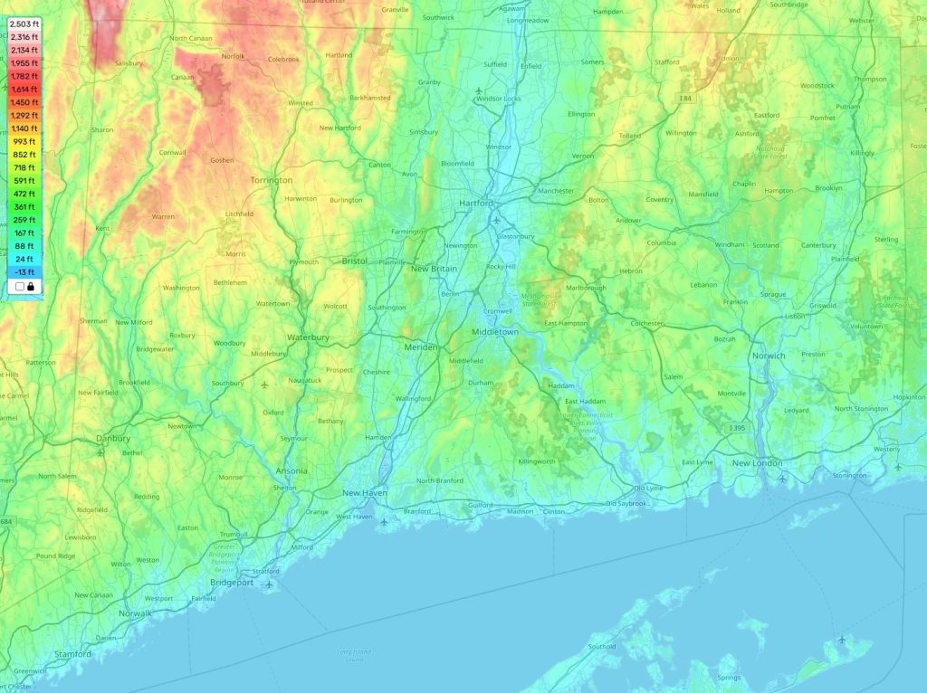
Connecticut topographic map
Terrain, elevation and landscape map
Connecticut is an interesting state with changing topography ranging from flat to hilly. The highest point of Connecticut is the summit of Mount Frissell in Salisbury, reaching 2,380 feet (725,3 m) above sea level. This point marks the tri-state boundary between Massachusetts and New York as well. The average elevation of the state is 564 feet (172 meters). The lowest point of the state is on Long Island Sound reaching 0 feet above sea level.
On our online topographic map, you can find a comprehensive data on the topography of Connecticut and other states for free! Our map provides designations of heights, county boundaries, highways and other important features that are essential for better understanding of the landforms in this region. Besides tracking heights, it also contains detailed information about rivers, lakes and streams that meander across the land making it even more interesting to explore. The distinctive feature of Connecticut’s topography is its rocky coastlines along Long Island Sound which offer spectacular views and great opportunities for outdoor activities such as fishing, sailing or swimming as well as sightseeing!
 The Guide Maps
