France topographic map
Elevation and landscape map of France
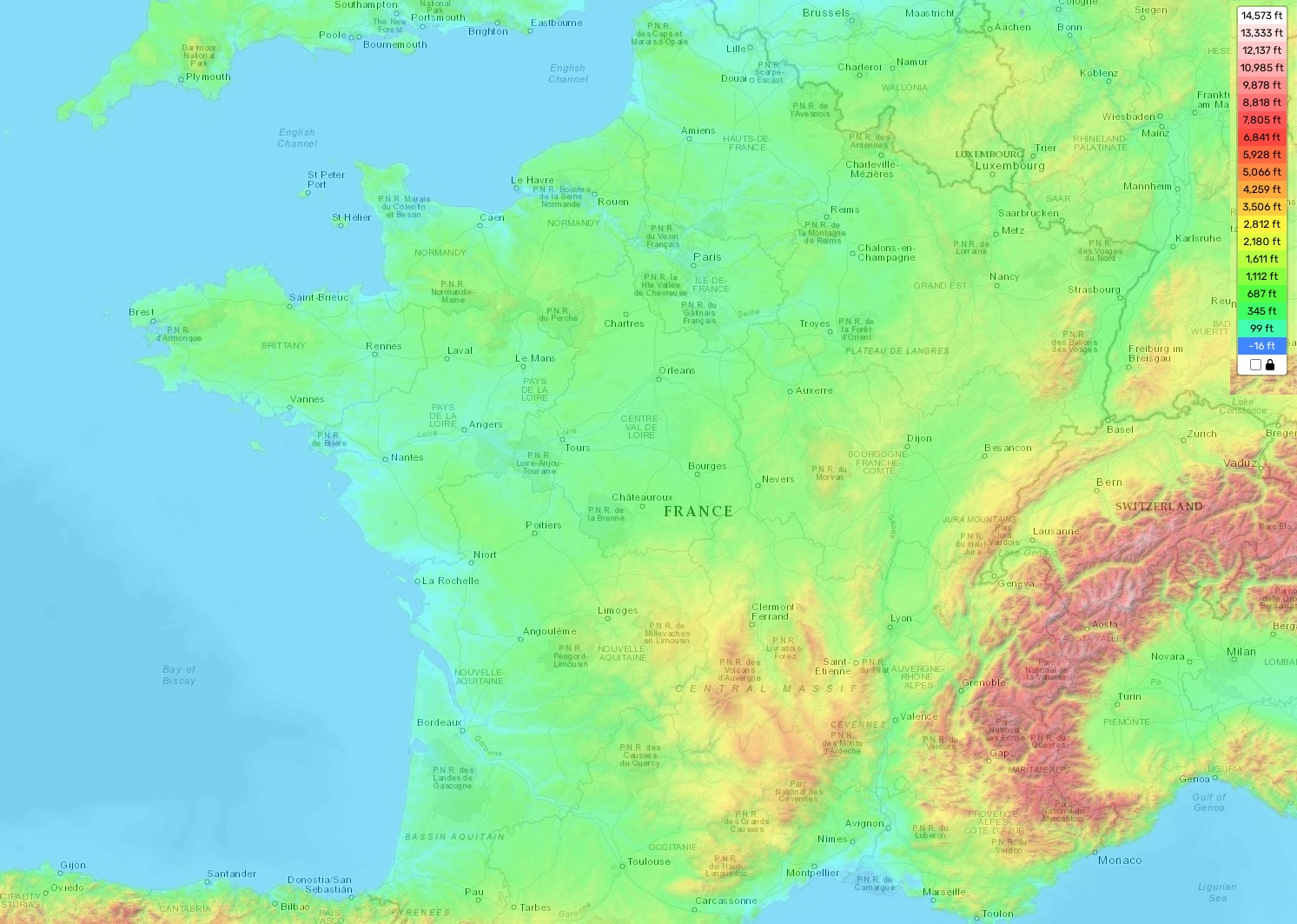
France topographic map
France is an enchanting country with a diverse topography. Located in Western Europe, France’s terrain is complex and varied, with an average elevation of 300 meters (984 feet) above sea level. The highest point in the country is Mont Blanc, located in the French Alps, which stands at 4,810 meters (15,781 feet). Meanwhile, at only 6.5 meters (21.3 feet) below sea level, the lowest point lies in Lac de Salagou near Lodève.
The French landscape is made up of three main topographic regions: mountains and highlands; rolling plains; and coastal lowlands and basins. In the north and east are several mountain ranges including the Massif Central, Vosges Mountains, Jura Mountains and Pyrenees Mountains that form part of the European Alps system. The central plain stretches from north to south along the length of France with gentle rolling hills. The southern coastlines feature beautiful bays and coves with sandy beaches as well as low-lying coastal plains that are punctuated by marshlands and lagoons such as Camargue Natural Regional Park near Arles.
On our site you can find a free topographic map of France to help explore this mesmerizing country! Our map includes designations of heights and other important attributes that make it easier to better understand the geography of this amazing nation. With its breathtaking scenery, rich cultural heritage and infinite surprises around every corner – there’s something for everyone in beautiful France!