Hawaii topographic map
Terrain, elevation and landscape map
Hawaii topographic map
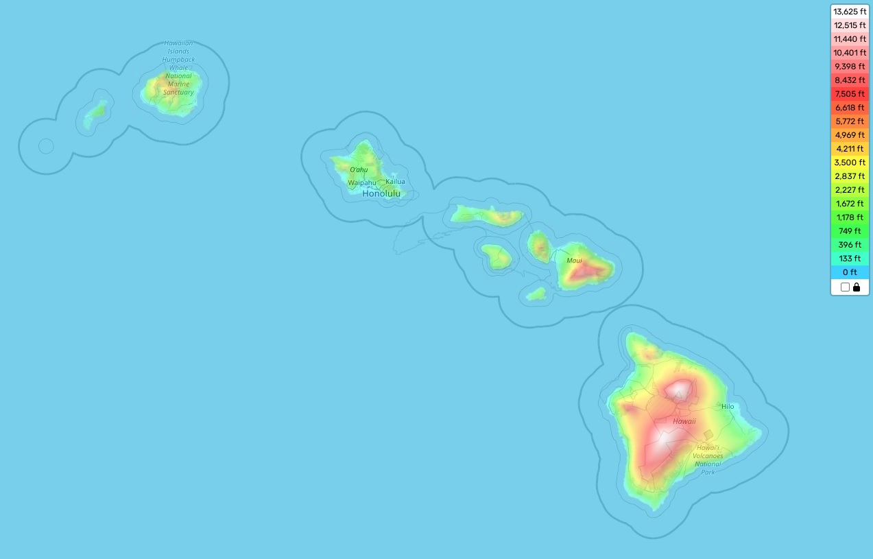
Hawaii is known for its unique landscape and diverse topography, which provides a lot of outdoor exploration opportunities. The highest elevation point in Hawaii is Mauna Kea at 13,796 feet above sea level. It’s located on the island of Hawaii and is part of the Mauna Loa volcano complex. The average elevation across all Hawaiian islands is about 3,030 feet above sea level. The lowest point in Hawaii is Kalaeloa at sea level.
On our site, you can find an interactive topographic map online for free that shows designations of heights and other important attributes. This will help you get an understanding of the different landforms throughout Hawaii – from mountains and volcanoes to beaches and coral reefs. Among these distinctive features are the Koolau Mountains on Oahu, Haleakala Crater on Maui, and Akaka Falls on the Big Island. Additionally, due to its tropical climate and close proximity to so many different ecosystems, Hawaii is home to a wide variety of unique flora and fauna that make it one of the most biodiverse places on Earth!