Hellenic Republic topographic map
Elevation and landscape map of Greece
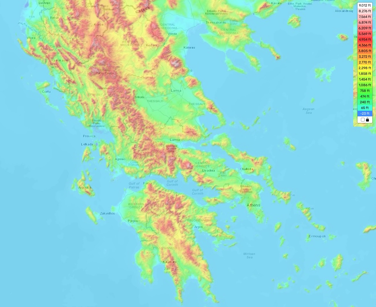
Greece topographic map
Greece is a country of stunning natural beauty and majestic landscapes. Its topography varies from sea level to the highest elevation of Mount Olympus at 2,918 meters above sea level. The average elevation in Greece is about 500 meters, with the minimum elevation being around -40 meters near Lake Koroneia in the north. This variety of terrain creates many different types of landscapes, from rugged mountain peaks to sandy beaches. Furthermore, some distinctive features of the Greek landscape include its numerous islands and its white-washed Cycladic houses which are scattered throughout the country.
Our site provides a topographic map online for free that displays designations of heights and other important attributes. This map allows you to get an accurate overview of the topography of Greece including landforms such as mountains, valleys, plains, rivers, lakes and coastal areas. Additionally, it can also show points of interest such as forests or towns as well as major roads and railways. With this resource you can explore all aspects of the Greek countryside right down to its smallest details!