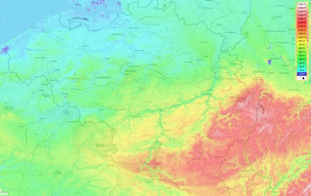
Belgium topographic map
Elevation and landscape map of Belgium
Belgium is a country of diverse terrain located in the northwest of Europe. Its topography includes flat coastal plains, rolling hills in the center and higher ranges of mountains towards its borders. The highest elevation point is Botrange Mountain at 2276 feet (694 meters) above sea level, located near the Belgium-Netherlands border. The average elevation for Belgium is 547 feet (167 m) above sea level, with a minimum elevation of -6 m at the Luxembourg-Belgium border. These elevations are clearly marked on our topographic map platform that provides detailed information about the area for free.
One distinctive feature of Belgium’s terrain is its abundance of rivers and canals that cross through many areas in the country. This makes it popular for water sports and recreational activities such as sailing, boating and fishing. In addition to this, its rolling hills provide breathtaking views and hiking trails surrounded by lush forests and meadows. As if all these weren’t enough, it also includes picturesque villages nestled in between valleys – making it an ideal destination for tourists looking to capture unique moments.
 The Guide Maps
