Louisville topographic map
Terrain, elevation and landscape map
Louisville topographic map
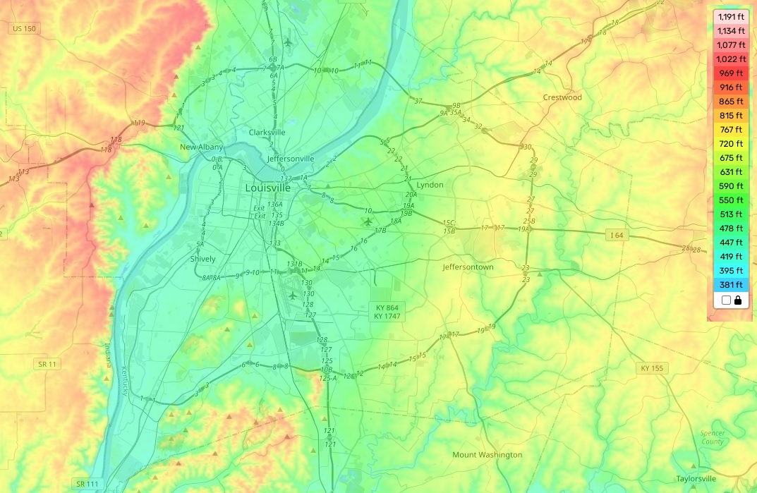
Louisville is situated in the central region of Kentucky and has a unique topography. The highest elevation in Louisville reaches 845 feet, while the average is around 583 feet. The minimum elevation here is 400 feet. On our site you can find a free online topographic map that shows designations of heights and other important features of the terrain. It’s worth noting that Louisville also has a distinctive feature – its lush green country sides with rolling hills and valleys. On the topographic map, you can see several creeks, gorges and forests as well as several reservoirs which serve multiple purposes such as providing drinking water for local communities, recreation activities and hydroelectric power generation. Our map allows for detailed exploration of rugged terrain in this part of the state and enables an understanding of some aspects related to Louisville’s local climate and ecosystems.