Minnesota topographic map
Terrain, elevation and landscape map
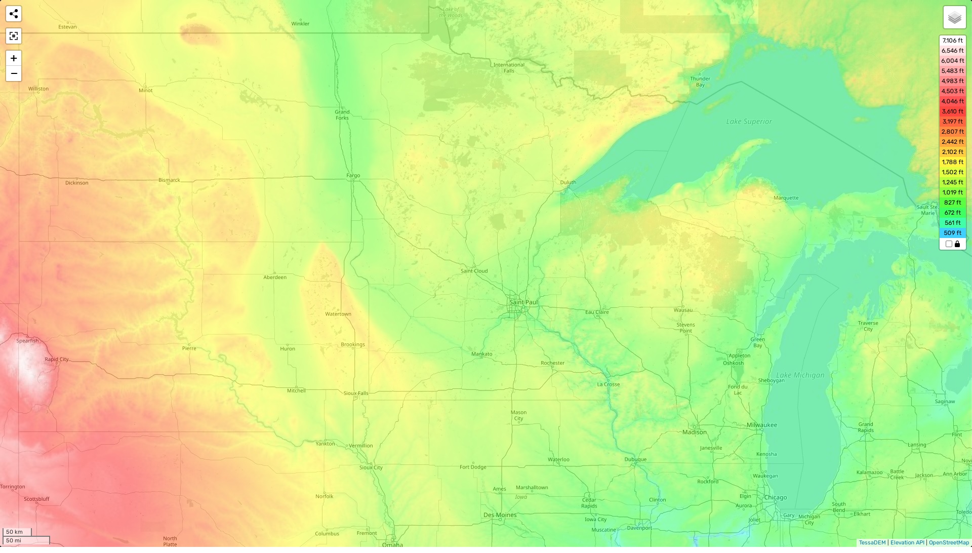
Minnesota topographic map
Minnesota is an interesting and diverse state in terms of its topography. The highest elevation of the state can be found at Eagle Mountain, which sits at 2,301 feet above sea level and is located in the north-central part of the region. The average elevation for Minnesota is approximately 1,100 feet with a minimum elevation of 602 feet. The area boasts several distinctive topographic features including rolling hills, picturesque lakes and rivers, along with vast prairies and forests.
At our website, you can find an online topographic map of Minnesota that shows designations of heights and other important attributes for free. On this map you will find detailed information about the highest points on each mountain range as well as which areas are more prone to flooding due to their lower elevations. You will also be able to see various landform features such as valleys, ridges and plains that contribute to the unique landscape of Minnesota. Additionally, if you are looking for recreational activities in the state, our map can help you find trails suitable for biking or hiking depending on your interests.
Overall, there is much to explore within Minnesota’s topography – from its diverse terrain that ranges from rugged mountains to rolling hills and peaceful flatlands – all adding up to make it a wonderful place to visit or live!