Montenegro topographic map
Elevation and landscape map of Montenegro
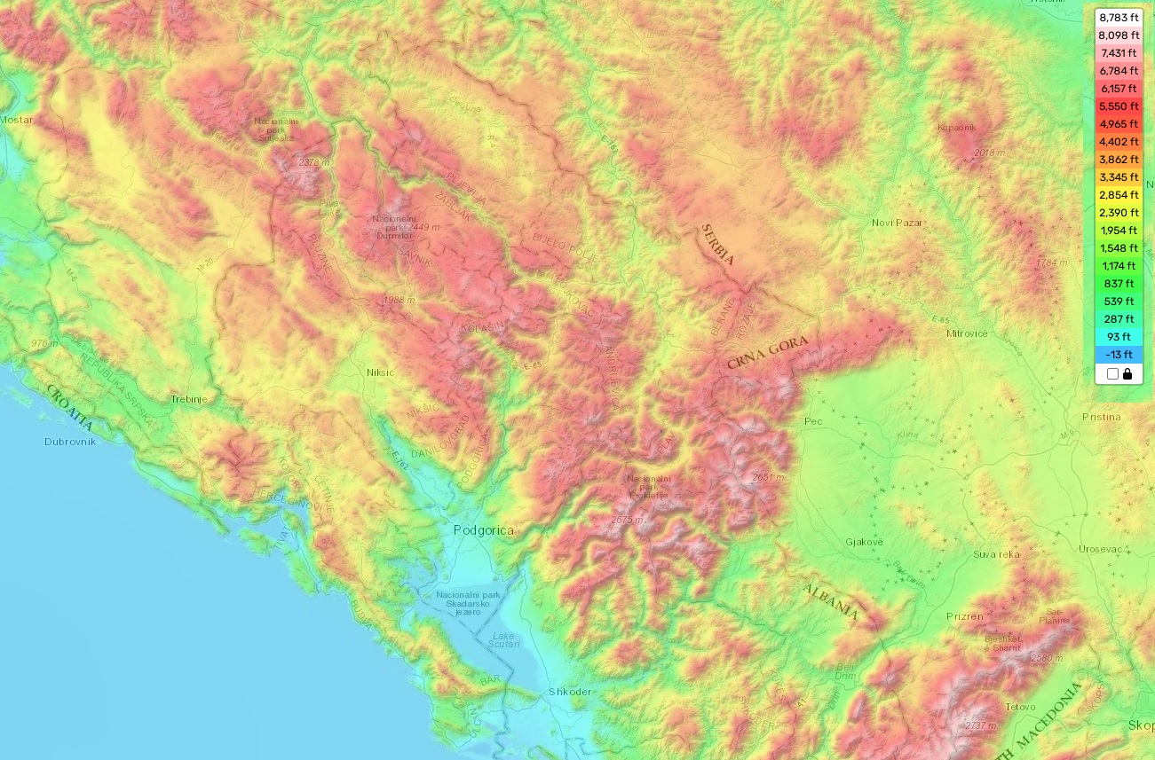
Montenegro topographic map
Montenegro is a small country nestled in the Balkan Peninsula with stunning topographical features. The topography of Montenegro according to its topographic map can be divided into three main elements: mountains, hills and plains. The highest elevation in Montenegro is at Bobotov Kuk (2523 m), located in Durmitor National Park—one of the most distinctive geographic features in the country. On average, Montenegro’s elevation stands at 732 meters above sea level, while the lowest elevation has been measured at 0 meters along its coastline.
In addition to its diverse elevations, Montenegro also boasts a variety of other natural features. These include deep canyons such as Tara Canyon and Plitvice Lakes National Park, along with numerous glacial lakes such as Lake Skadar and many more scattered around the mountainous terrain.
Here on our website you can find a free online topographic map of Montenegro that shows all these designations of heights and other important attributes. With this map you can explore the detailed topography of this beautiful Balkan nation with ease. So come explore Montenegro today!