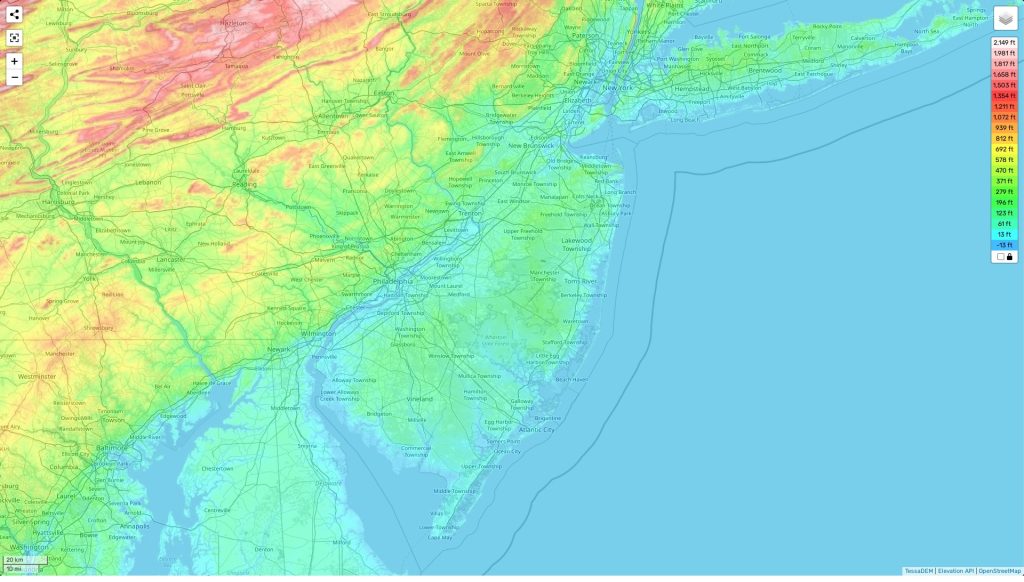
New Jersey topographic map
Terrain, elevation and landscape map
The topography of New Jersey is undulating, with rolling hills, rocky ridges and steep river valleys. The highest elevation in New Jersey is High Point at an elevation of 1,803 feet (550 m) above sea level. The average elevation of the state is 160 feet (50 m) above sea level, while the minimum elevation is 0 feet (0 m).
Distinctive features of New Jersey’s topography include its sandy beaches along the Atlantic coast and the heavily forested Appalachian Mountains in the northwest corner. Major rivers include the Delaware River, which forms a natural border between New Jersey and Pennsylvania, as well as the Hudson River and Raritan River which run through much of northern New Jersey.
For anyone looking to explore or learn more about New Jersey’s topography, our site provides a free online interactive topographic map that shows important designations such as heights, landforms (mountains, hills etc.), water bodies (rivers and lakes), vegetation cover and other relevant features across the entire state. It can be used for planning activities such as hiking, camping or navigating your way around different regions of New Jersey.
 The Guide Maps
