China topographic map
Elevation and landscape map of China (PRC)
China topographic map
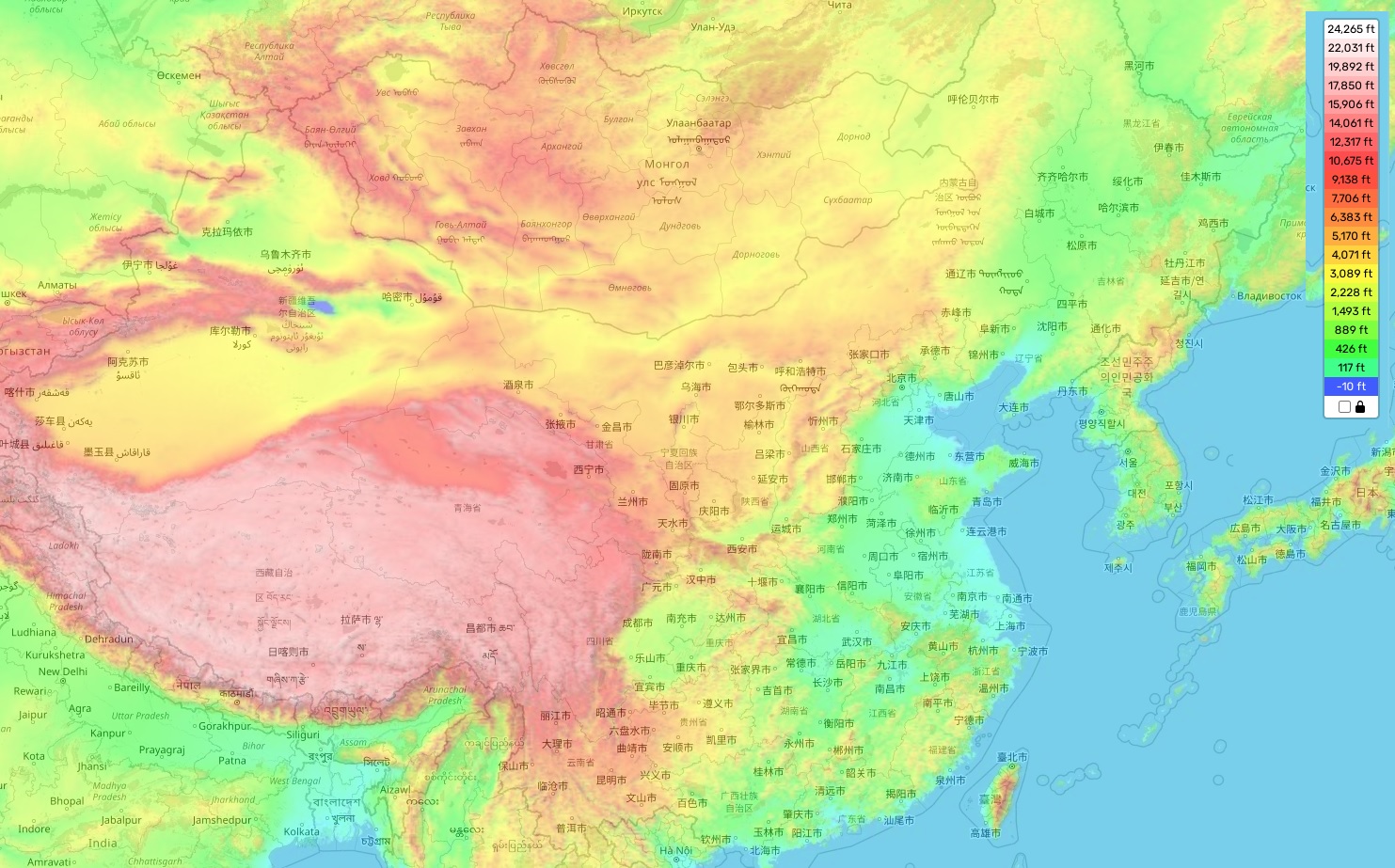
Spanning an extensive variety of terrains, China paints a dynamic picture of topographical diversity. Its topographic map reveals this geographical range in striking detail. The country’s elevation reaches its zenith at Mount Everest, an awe-inspiring giant that soars 29,032 feet, or roughly 8,848 meters, above sea level.
Conversely, the average elevation of China stands at around 4,900 feet, or approximately 1,500 meters. Its terrain plunges to its lowest at the Turpan Basin, a remarkable depression sinking to 505 feet, or about 154 meters, below sea level. This unique geological feature is one of the Earth’s lowest points, marking it as one of China’s most distinctive geographical highlights.
For those unaware, we proudly offer comprehensive online topographic maps free of charge on our site! Our map of China is complete with designations of heights and key attributes such as rivers and lakes, offering invaluable insights into this stunning country. Further, our resource lets you delve into details of various geographical features, enriching your understanding of China’s topography.
With this tool at your disposal, you are well-equipped to immerse yourself in the exploration of China’s breathtaking landscape. Whether you’re planning a trip, conducting research, or merely satisfying your curiosity, our map serves as a reliable guide to navigate the geographical wonders China has to offer.