Austria topographic map
Elevation and landscape map of Austria
-

- Physical map of Austria with relief elevation

Austria topographic map
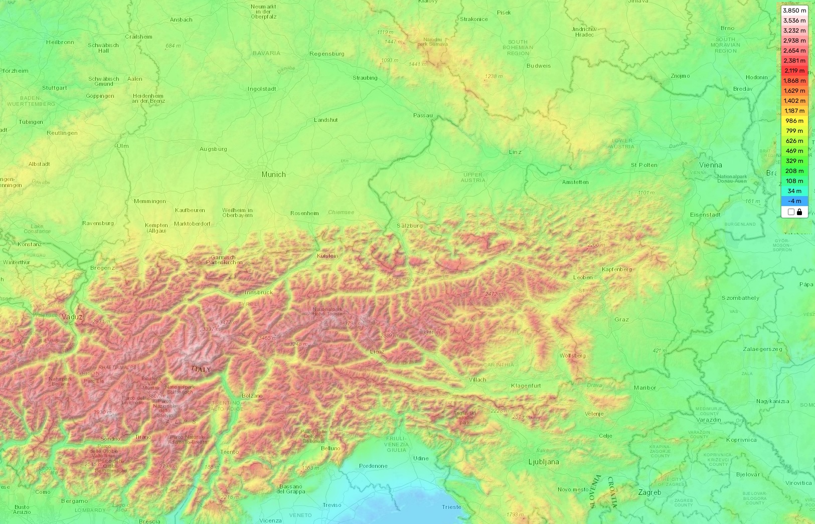
Austria is a small, landlocked country nestled within Central Europe. With a total area of only 83,871 km2, the spectacular terrain of Austria ranges from high mountain peaks and lush valleys to rolling hills and green pastures. The highest point in Austria is Grossglockner (3,798 m/ 12,461 ft), located in the Alps; this peak offers stunning views of the surrounding mountains as well as unique rock formations. The average elevation in Austria is about 690 m/ 2265 ft, with a minimum elevation of 120 m/ 394 ft (Lake Neusiedl).
Aside from its remarkable mountain ranges, Austria has several other distinctive features that make it stand out amongst its European neighbors. For example, it is home to the largest ice cave in the world – Eisriesenwelt – which consists of 41 km of winding passages and chambers filled with intricate ice sculptures created by natural forces. Additionally, one can find some of Europe’s most beautiful castles along the banks of the Danube River or tucked away in secluded glades throughout Austria’s countryside.
Our website provides an interactive topographic map online for free that allows you to explore these unique features more closely. On our map there are designations of heights and other important attributes such as rivers and lakes allowing users to get a better understanding of the topography without having to physically visit each location.