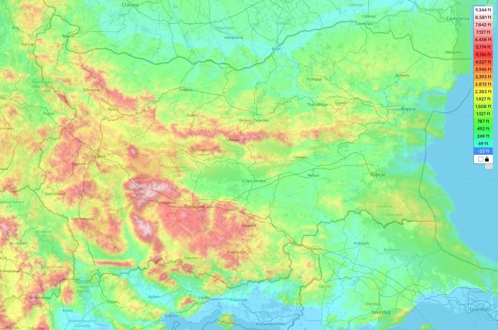
Bulgaria topographic map
Elevation and landscape map of Bulgaria
Bulgaria, with its splendid and diverse topography, promises a visual treat for all. Nestled in the Balkan Peninsula, it is home to the region’s highest elevation, the majestic Musala peak, towering at 9,596 feet, or about 2,925 meters.
The country, on average, perches at an elevation of 1,541 feet, or roughly 470 meters, with certain areas dipping to sea level. Bulgaria’s terrain is typically robust, characterized by an undulating expanse of mountains and hills that blanket a majority of the country.
The Balkan Mountains, coursing through the nation’s heartland, are a sight to behold. These towering structures bless the country with stunning landscapes and a unique biodiversity, contributing to Bulgaria’s distinctive geographical tapestry.
Enriching the country’s topographical wonders are more than 400 lakes, rivers, and mountain streams. This significant water network makes Bulgaria one of the most geographically diverse nations in Europe. On the eastern fringe, the Black Sea coastline unfolds, mesmerizing visitors with its incredible beaches and scenic coastal areas.
We take immense pleasure in offering a comprehensive online topographic map of Bulgaria on our site, free of charge. Our map offers a detailed representation of Bulgaria’s geographical features, marking elevations, rivers, lakes, roads, towns, and more. So, whether you are planning an adventure or are simply curious to learn more about this stunning country, our map serves as a reliable guide, making it a breeze to navigate Bulgaria’s beautiful terrains.
 The Guide Maps
