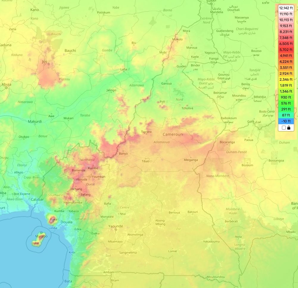
Cameroon topographic map
Elevation and landscape map of Cameroon
Cameroon is a country located in Central Africa with a diverse landscape, ranging from coastal regions to mountains and plains. Its topography is characterized by its highest elevation, Mt. Cameroon which stands at an impressive (13,255 feet) 4,040 meters above sea level. The average elevation of Cameroon is around (1,970 feet) 600 meters while the minimum elevation is barely above sea level. Other distinctive features of the country are Lake Chad and its numerous mountain ranges situated near the eastern border, such as Adamawa Mountains and Mandara Mountains.
At our site you can find a topographic map of Cameroon for free including designations of heights, land features and other important attributes. Moreover, many rivers cross through the region in all directions forming stunning natural attractions such as waterfalls and steep valleys. The atmosphere in this amazing country truly lives up to its zest as a melting pot of cultures from all over Africa.
 The Guide Maps
