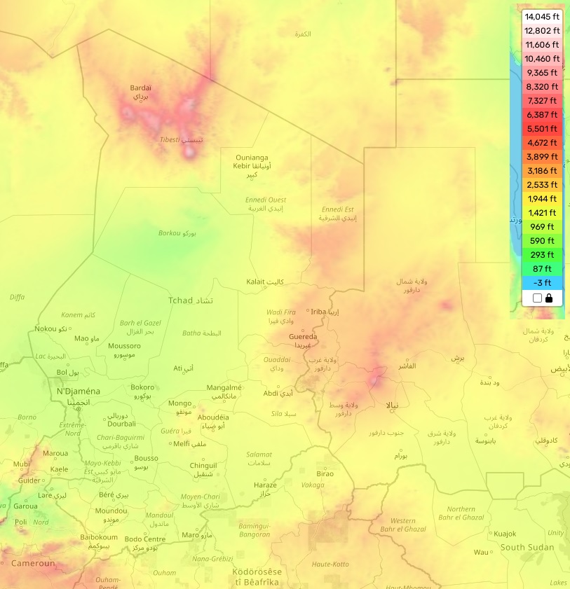
Chad topographic map
Elevation and landscape map of Chad
Nestled in the heart of the African continent, Chad is a landlocked country teeming with diverse terrains. Its landscape ebbs and flows between mountains, deserts, savannas, and grasslands, presenting a rich tapestry of geographical variety.
Crowning Chad’s terrain is Emi Koussi, a magnificent volcano standing at an impressive 11,204 feet, or around 3,415 meters. On average, Chad’s elevation hovers around 2,297 feet or approximately 700 meters above sea level. Contrarily, Lake Fitri marks the country’s lowest point, residing at a depth of 525 feet, or about 160 meters, below sea level.
Chad’s topography mirrors its unique geographical location, bridging Central Africa with the formidable Sahara Desert. Up north, expansive sandy deserts unfurl, notably the Borkou-Ennedi-Tibesti massif. Additionally, numerous mountain ranges punctuate the country’s scenery. Plains swath the southern and certain western regions of Chad, while low plateaus hold sway over much of the central and eastern parts.
A distinctive feature of Chad’s terrain is its plentiful wetlands, encompassing swamps, marshes, lagoons, lakes, and rivers — some of which maintain their flow throughout the year. These water bodies not only form crucial habitats for a wide array of birds, fish, and other wildlife, but they also support human life, serving as irrigation sources for projects such as rice farming and livestock grazing.
We are delighted to offer a comprehensive online topographic map of Chad on theguidemaps, free of charge. Our interactive map delineates heights and other significant geographic features like roads and rivers. You are invited to zoom in and discover the exquisite details of this splendid African nation, exploring the wonders of Chad’s topography right at your fingertips.
 The Guide Maps
