Colombia topographic map
Elevation and landscape map of Colombia
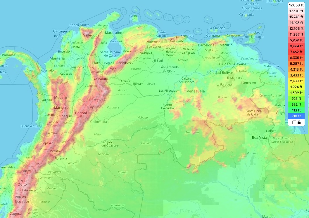
Colombia topographic map
Colombia is a country full of geographical diversity, with an incredibly varied landscape and topography. In total, the country has four mountain ranges: the Caribbean Coastal Range, the Andes Mountains, the Eastern Hills, and the Central Ranges. The highest peak in all of Colombia is Pico Cristobal Colon 18,947 feet (5,775m), located in the Sierra Nevada de Santa Marta in northern Colombia. Along with its oceanic coastline on both sides of the country, this makes for an incredibly diverse environment that has earned it many different nicknames as “the land of mountains,” “the Switzerland of Latin America,” and “the gateway to South America.”
The average elevation of Colombia is 3,940 feet(1,200 meters) above sea level; however, there are areas that reach up to 5,000 meters above sea level such as Las Tangaras Peak (5,366m) in Tolima region. The minimum elevation in Colombia is found at low elevations along its coastlines around 0-100m above sea level which allows for a very mild climate year-round.
Our site provides a topographic map online for free which includes designations of heights and other important attributes. With this map you can explore some of Colombia’s distinctive features such as its unique biodiversity or its stunning landscapes like CañoCristales river – also known as “the river from paradise” – which wows visitors with its colorful five-meter tall aquatic plants!