Costa Rica topographic map
Elevation and landscape map of Costa Rica
-

- Physical map of Costa Rica with relief height

-

- The height of the landscape of Costa Rica and the city on the map

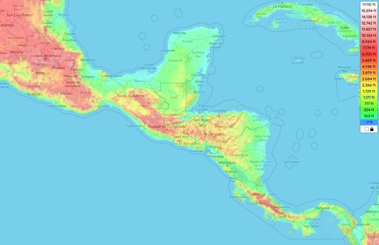
Costa Rica topographic map
Costa Rica is a Central American nation that is renowned for its lush rainforest and biodiversity. Its varied terrain ranges from the highest elevation point of Cerro Chirripó, located at 12,532 feet (3,820 meters) above sea level, to its average elevation of 860 meters (2,821 feet) and its minimum of 0 meters above sea level. The country’s coastlines are composed of mangrove swamps, sandy beaches, and rocky cliffs.
The country’s topography is divided into three main regions — the coastal plains in the Pacific and Caribbean, the central valley region which consists of highlands, volcanoes, and lakes, and the mountainous region in the north where active volcanoes still stand. From Sierra de Tilaran’s craggy peaks to Arenal Volcano’s stunning views, Costa Rica has something for everyone who wants to explore nature in a unique way.
Moreover, our site provides a topographic map online for free with designations of heights and other important attributes that could help you discover some of Costa Rica’s hidden wonders. On this map you will find information like river depths and ocean current directions as well as characteristics such as land elevations ranging from mountains over 3 km tall to green valleys sloping down towards both coasts. It also features national parks like Corcovado National Park – renowned for its primary forest ecosystems – or La Amistad International Park – home to rare species like Puma yaguarundi or Tayra solutrans – which can be visited through guided tours in some areas. If you want to explore Costa Rica even more deeply we offer an interactive version with more detailed topographic features that include land cover features such as terrain slopes or soil types.
Overall, Costa Rica is not only famous for its rich biodiversity but also for its dramatic landscapes and exciting adventures available in each corner of this beautiful country!