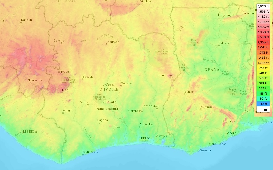
Ivory Coast topographic map
Elevation and landscape map of Ivory Coast
Côte d’Ivoire topographic map
The Republic of Ivory Coast, nestled in West Africa, is famed for its verdant jungles, picturesque beaches, and abundant natural resources. Despite its compact size, the country’s topography is impressively varied and diverse. The loftiest elevation in Ivory Coast is Mount Nimba, reaching an impressive 5,750 feet, or around 1,752 meters above sea level. The country’s average elevation varies from 328 to 984 feet, or roughly 100-300 meters above sea level, while the minimum elevation drops to sea level.
Ivory Coast is adorned with unique geographical features, especially along its coast. This region is graced with magnificent beaches, serene lagoons, and expansive mangrove swamps. Moving inland, vast plains and savannas spread across the landscape, seamlessly transitioning into rolling hills situated near various mountain ranges, such as the Simandou and Man Mountains.
Our website proudly offers a comprehensive, free topographic map of Ivory Coast. Here, users can find designations of heights, alongside other crucial attributes such as rivers and roads, enriching their understanding of this eclectic terrain. Whether you’re planning a trip or conducting research, our map serves as an excellent resource for exploring the diverse topography of the Republic of Ivory Coast.