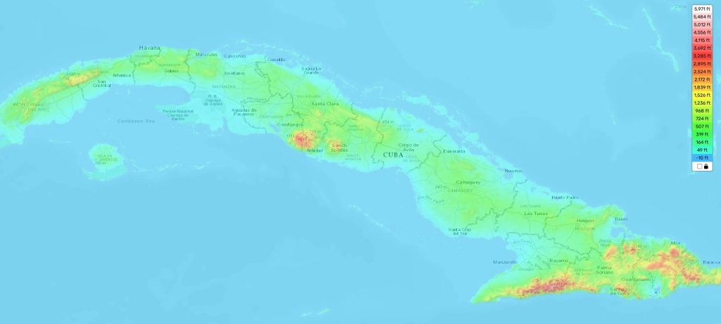
Cuba topographic map
Elevation and landscape map of Cuba - online
- Physical map of Cuba with relief heights
Cuba is a diverse country with many distinctive features when it comes to its topography. The highest point in Cuba is Pico Turquino, standing at 6,476 feet (1,974 metres) above sea level and located in Sierra Maestra, Granma Province. This mountain range runs through the south-central part of the island, and also has El Toldo Peak (650 m) as another major elevation. The average elevation of Cuba is approximately 150 m (492 feet), while the minimum elevation also lies in Granma Province at 0 m. On our site there is a free online topographic map for Cuba that allows users to explore the designations of heights, bodies of water and other important attributes. It provides an insight into the various landscapes of Cuba from its lush green valleys to its mountainous areas and humid coastal plains. Along with this, one unique feature that makes up much of Cuban geography is its extensive network of caves; the most famous being Cueva de los Portales which was used during the Cuban Revolution against Fulgencio Batista’s army in 1958. With our topographic map you can get a complete overview of this fascinating country!
 The Guide Maps

