Cyprus topographic map
Elevation and landscape map of Cyprus
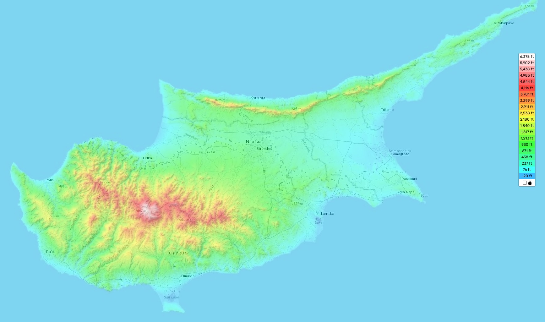
Cyprus topographic map
The topography of Cyprus is incredibly diverse and visually stunning. The highest elevation in the country is Mt Olympus, at 1,952 meters (6,404 feet) above sea level. The average elevation is 345m (1,131ft). Meanwhile, the minimum elevation of 0m (0ft) can be found in the Mediterranean Sea.
One distinctive feature of Cyprus’s topography is its two mountain ranges: the Kyrenia Mountains to the north and the Troodos Mountains to the south. Both mountain ranges are heavily forested and provide amazing views from their peaks. In addition, both ranges have a number of impressive gorges and valleys for hikers to explore.
On our topographic map online, users can find a wealth of information about Cyprus’s terrain. Designations for heights as well as other important attributes such as rivers and roads are included on the map. With our free topographic map you can zoom in and out to check out different parts of this diverse region or simply admire its beauty from afar!