Ecuador topographic map
Elevation and landscape map of Ecuador
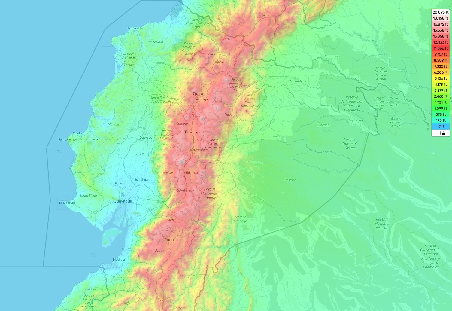
Ecuador topographic map
Ecuador, a country in South America, is home to a mesmerizing array of geographical features. Dominated by mountainous terrain, it’s cradled between two major mountain ranges: the Andes and the Coastal Range. Ecuador’s highest elevation, Mount Chimborazo, reaches a formidable 20,564 feet or approximately 6,268 meters. Located in the Andes Mountains, this peak is considered the point closest to the sun due to its position near the equator and the Earth’s equatorial bulge. Ecuador’s average elevation is around 4,900 feet or roughly 1,500 meters, while its minimum elevation drops to sea level.
One of the distinctive aspects of Ecuador’s topography is its four diverse regions: The Costa, or coastal region; La Sierra, the highlands; El Oriente, the eastern lowlands; and El Amazonia, the rainforest region. Each of these areas boasts its unique features and environments, ranging from majestic volcanoes and tranquil lagoons to sprawling rivers and diverse wildlife species.
We are proud to offer a comprehensive, interactive topographic map of Ecuador for free on our website. This user-friendly map displays accurate elevations and important geographical attributes of various areas, including cities, towns, parks, and monuments. With our online tools at your disposal, you can navigate through Ecuador with ease and explore the nation’s intriguing topographical features to your heart’s content.
Popular Reference Pages