Estonia topographic map
Elevation and landscape map of Estonia
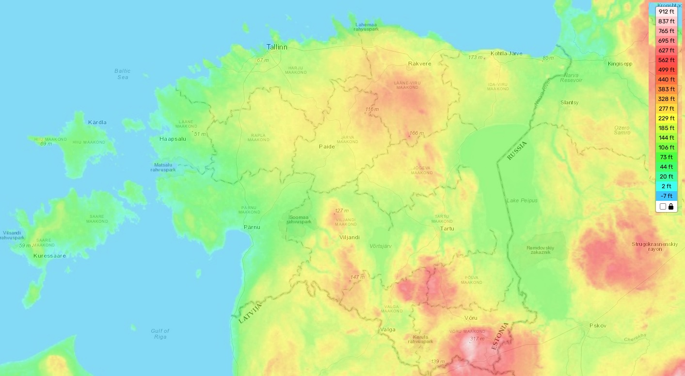
Estonia topographic map
The topography of Estonia is mostly low-lying and flat. The highest elevation in the country is Suur Munamägi (318 m), located in Haanja, Võru County. On average, the elevation in the country is about 50 metres above sea level. The minimum elevation is 0 metres. With over 2000 islands and countless lakes, Estonia is known for its abundance of bodies of water which add to its zestful atmosphere and diverse landscape.
Our site provides a topographic map online for free, offering designations of heights and other important attributes that help people to understand more about this picturesque region. The map also displays information on several rivers, forests, swamps and wetlands that can be found across the country. Additionally, it contains geological data such as rock types or natural hazards like sinkholes or landslides that are part of this area’s unique terrain.