Finland topographic map
Elevation and landscape map of Finland
Finland topographic map
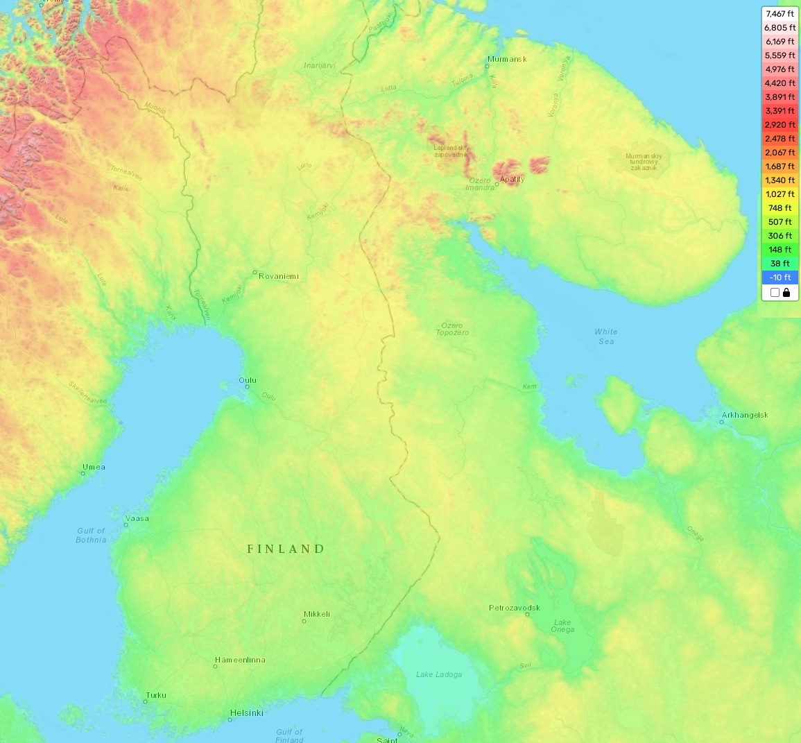
The topography of Finland can be divided into three parts – the coastal lowlands, the lake district in the center and the highlands in Northern Finland. The highest elevation is Halti, located at 1,324 meters above sea level, while the average elevation across Finland is 160 meters. The minimum elevation is located near Lake Saimaa, which is only 59 meters above sea level.
Finland’s landscape features a mix of forests, lakes, and rugged fells that offer stunning scenery throughout the country. A distinctive feature of Finland’s topography is its extensive network of thousands of interconnected lakes, including Europe’s largest lake Saimaa. In addition to its natural beauty, this intricate system provides numerous environmental benefits and has undeniable recreational appeal.
Our site provides a detailed topographic map online for free. On our map there are designated heights and other important attributes which help with planning trips and activities as well as getting to know more about Finland’s beautiful terrain. With this resource you will have all you need to explore every nook and cranny of this magnificent country!