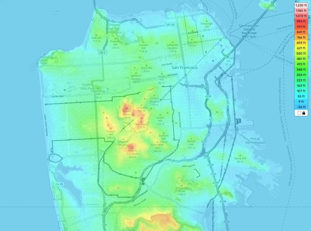
San Francisco topographic map
Terrain, elevation and landscape map
Perched on the western edge of the United States, San Francisco is celebrated for its diverse topography. With our free online topographic map, you can traverse the varied elevations of this vibrant city.
The city reaches its highest elevation near Twin Peaks on its southeastern fringes, standing at an imposing 922 feet, or about 281 meters. Conversely, the average elevation of San Francisco gently undulates around 52 feet or roughly 16 meters. The cityscape dips to its lowest at sea level, resulting in a fascinating amalgamation of flat expanses and rolling hills, imbuing San Francisco with its signature charm.
Our topographic map reveals more than just heights; it unfolds a wide array of features such as notable landmarks, rivers, lakes, and parks that dot San Francisco’s landscape. It also offers insights into ocean depths along the city’s shoreline and provides terrain indices and contour lines to illustrate the steepness of slopes in specific locales.
With such a wealth of information available at your fingertips, our online map equips you to delve into the captivating topography of San Francisco. So, whether you’re charting your next adventure or satiating your geographical curiosity, this map is your comprehensive guide to exploring the City by the Bay.
 The Guide Maps
