Scotland topographic map
Terrain, elevation and landscape map
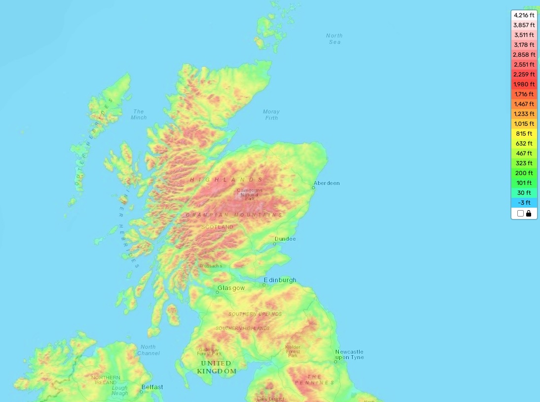
Scotland topographic map
Scotland, renowned for its varied topography, offers an enticing mix of mountains and moorlands that cater to outdoor enthusiasts like hikers, bikers, and skiers. The country’s highest elevation point is at Ben Nevis, standing tall at 4,413 feet, or about 1,345 meters. On average, Scotland’s elevation hovers around 656 feet, or roughly 200 meters, while the minimum elevation touches down at sea level.
Our website proudly offers a detailed topographic map of Scotland for free. This map includes intricate designations of heights and other significant geographical attributes, unveiling the hidden beauty of this stunning country. With a glimpse, it’s clear why Scotland’s enchanting landscapes and picture-perfect views are world-famous.
Scotland’s topography is marked by a wealth of lochs dispersed throughout the country, creating a unique geographical feature. Take Loch Lomond, for example, it holds the title as the largest lake in Great Britain by surface area and cradles several islands within its waters. Additionally, an array of rivers meander through the lowland regions, connecting via small canals or cascading waterfalls.
In essence, Scotland offers a wealth of exploration opportunities. From towering mountain peaks to verdant valleys, it’s an idyllic haven for nature enthusiasts. With our online topographic map, you’re well equipped to chart your next adventure through Scotland’s awe-inspiring scenery.