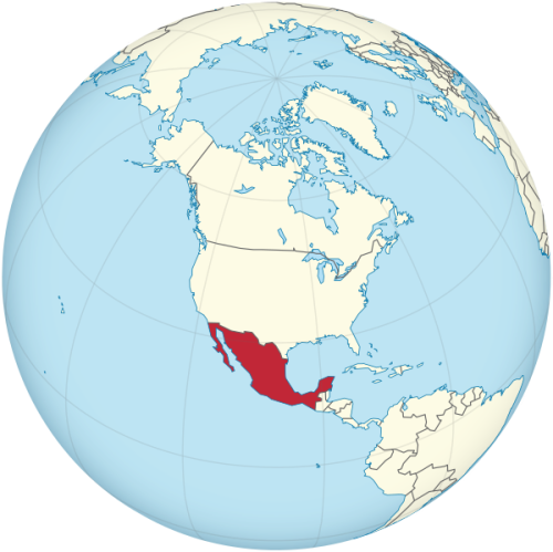
Map of Mexico
United Mexican States map online
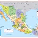
- Large detailed political and administrative map of Mexico with roads
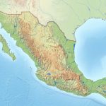
- Physical map of Mexico with relief and bodies of water
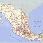
- Large detailed highways map of Mexico
General description of the United Mexican States
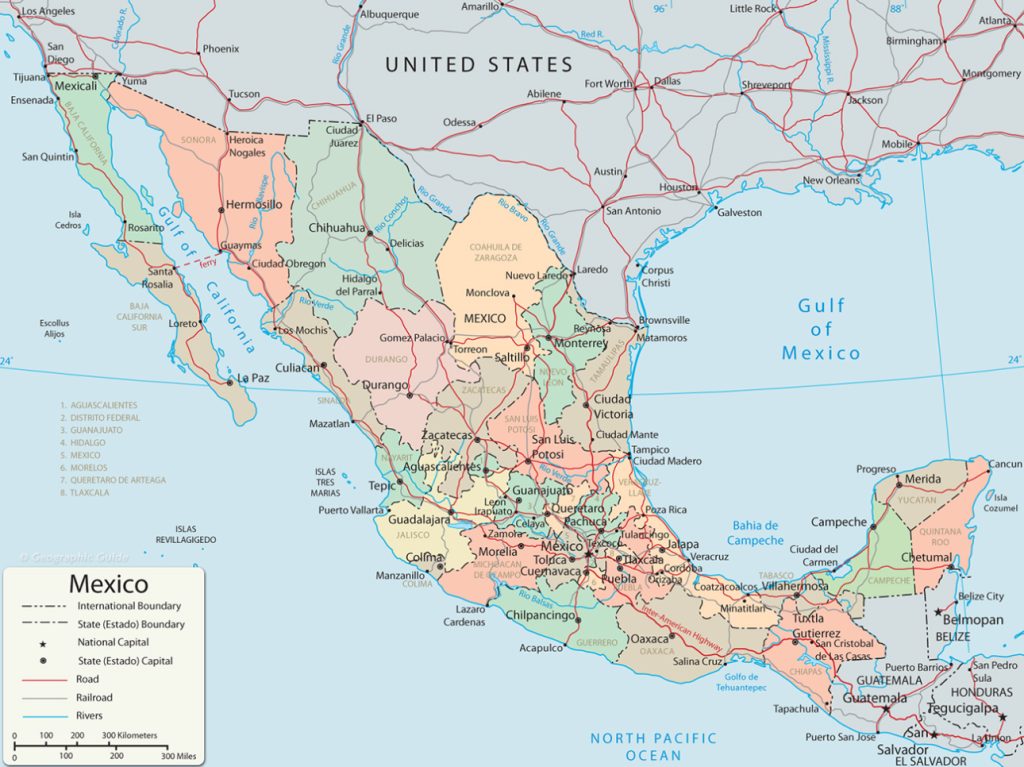 Mexico is considered one of the largest countries in Latin America, attracting tourists from all over the world. This is a territory of contrasts, both in relief and in climate, the standard of living of the population, and the development of infrastructure.
Mexico (United Mexican States) is the largest Spanish -speaking country in the world. It is located in Central America, but according to geopolitical features, it belongs to North America.
The state ranks 13th in the world in terms of area. If you look at the map of Mexico, you will notice that in addition to the mainland, the country includes the California Peninsula, a number of islands in the Pacific Ocean and the Caribbean Sea.
Mexico on the map looks like a bridge connecting the US and Canada with the countries of South America. Due to the location on three lithospheric plates at once, the whole country is in the zone of the highest seismic activity – earthquakes of various strengths and volcanic eruptions often occur here.
Location of Mexico on the world map
The territory of the country is elongated, washed by the waters of the Pacific Ocean from the west, the Caribbean Sea and the Gulf of Mexico from the east. To the north, closer to the border with the United States, the territory is the widest, and the narrowest point is located in the Isthmus of Tehuantepec – only 192 km. At the same time, Mexico looks impressive on the world map, being the largest state in Central America.
In the north, the state borders only on the United States, the length of the border reaches 3141 km, a significant part of which is located in the Rio Grande river valley. Neighbors to the southeast are Belize and Guatemala.
The country’s relief is predominantly mountainous, with plains stretching along the coast of the Pacific Ocean, the Caribbean Sea and the Gulf of Mexico. Between the Western and Eastern Sierra Madre ranges lies the vast Mexican Highlands. It stretches from the US border to the center of the country.
Most of the rivers flow into the Pacific Ocean, only ⅓ of them flow into the Caribbean Sea.
The map of Mexico is not rich in lakes, there are 12 of them, the largest of which are Chapala and Cuitzeo. The area of Cuitzeo changes, depending on the time of year.
Relief features
Mexico is divided from north to south by two mountain ranges – the Eastern and Western Sierra Madre . In the center of the country is the famous Trans-Mexican volcanic belt, with the three highest peaks of the country – the volcanoes Orizaba (5700 m), Popocatepetl (5462 m) and Iztaccihuatl (5286 m).
The Mexican Highlands is divided by a relatively low mountain range into two parts – Northern and Central Mesa . In Central Mesa are the largest cities in the country – the capital of Mexico City and Guadalajara.
The California Peninsula, comparable in area to the Apennine Peninsula, is intersected from north to south by mountains ranging in height from 200 to 2000m. Its western part is washed by the cold current of the Pacific Ocean, the eastern part by the warm waters of the Gulf of California.
In the southern and southeastern parts of Mexico, two ridges rise – Sierra Madre South and Sierra Madre de Chiapas . The highest point of the second is Takuma volcano (4000 m),
Water resources: seas, rivers and lakes
There are about 150 rivers in Mexico, the most full-flowing and swift flow in the southeast of the country. In the northwest, the rivers are long, but shallow and rare. In places on the Yucatan Peninsula and the Mexican Highlands, there are no rivers.
The largest rivers are shown in the table.
| Name | Length (km) | Basin area ( km2 ) |
| Usumacinta | 560 | 106 000 |
| Papaloapan | 122 | 46 560 |
| Grijalva | 480 | 134 440 |
| Coatzacoalcos | 325 | no data |
| Panuko | 510 | 84 596 |
40 km from Guadalajara is the largest lake in Mexico – Chapala, which is 60 km long and 18 km wide. The large Falcon Reservoir was built on the Rio Grande .
The natural world of Mexico
Mexico ranks 4th in the world in terms of plant diversity, with about 26,000 flowering species alone. The flora is predominantly tropical and subtropical:
- Ahuuete – coniferous tree, national symbol;
- blue agave;
- flower of the dead;
- Okote blanco (a type of pine);
- Manzanita is a fruit tree and many others.
In the desert regions grows Saguaro – a cactus that reaches a height of 18 m. In the valleys you can find oak groves, and on the coast – mangroves.
The largest cities on the map of Mexico
There are 20 cities in Mexico with more than 700,000 inhabitants. On the map of the country, you can easily find the largest and most famous cities among tourists.
Mexico city
Mexico City – 9 million people, in the agglomeration 21 million inhabitants. The largest Spanish-speaking city in the world. It is located in the depression of the Mexican Highlands, in the subtropical climate zone. Mexico City is the cultural and economic center of the country, the financial center of North America.
Ecatepec de Morelos
Ecatepec de Morelos – 1.6 million inhabitants. In fact, this is a suburb of Mexico City, which is part of the agglomeration of the capital. One of the popular tourist centers, not far from it is Teotihuacan , one of the oldest settlements in the Western Hemisphere.
Tijuana
Tijuana – 1.9 million people. Considered the westernmost city in Latin America. The city is especially popular among American youth – they sell alcohol here from the age of 18, in the USA only from 21 years old. Tijuana has a reputation for being the most crime-prone city in Mexico.
Puebla
Puebla – 1.5 million inhabitants. The city is surrounded by high hills and four volcanoes, one of which is active. This is the only city in the world with such a location that attracts tourists to it. In addition to tourism, the metallurgical industry is well developed here.
Guadalajara
Guadalajara – 1.4 million inhabitants. Capital of the state of Jalisco . The unofficial name of the city is “Pearl of the West”, because of the abundance of flowering gardens, groves and flower beds. Located in the south-west of the country, it is a major economic and tourist center, with the second largest agglomeration.
Ciudad Juarez
Ciudad Juarez – 1.3 million people. The city is considered a transit point on the border with the United States. This is a large industrial center, the production of which is focused on American exports.
Leon
Leon – 1.5 million people, the fourth largest in the country. A large industrial center, most of the inhabitants work in factories for the production of shoes and leather accessories. At the same time it is a tourist center.
Main directions of tourism
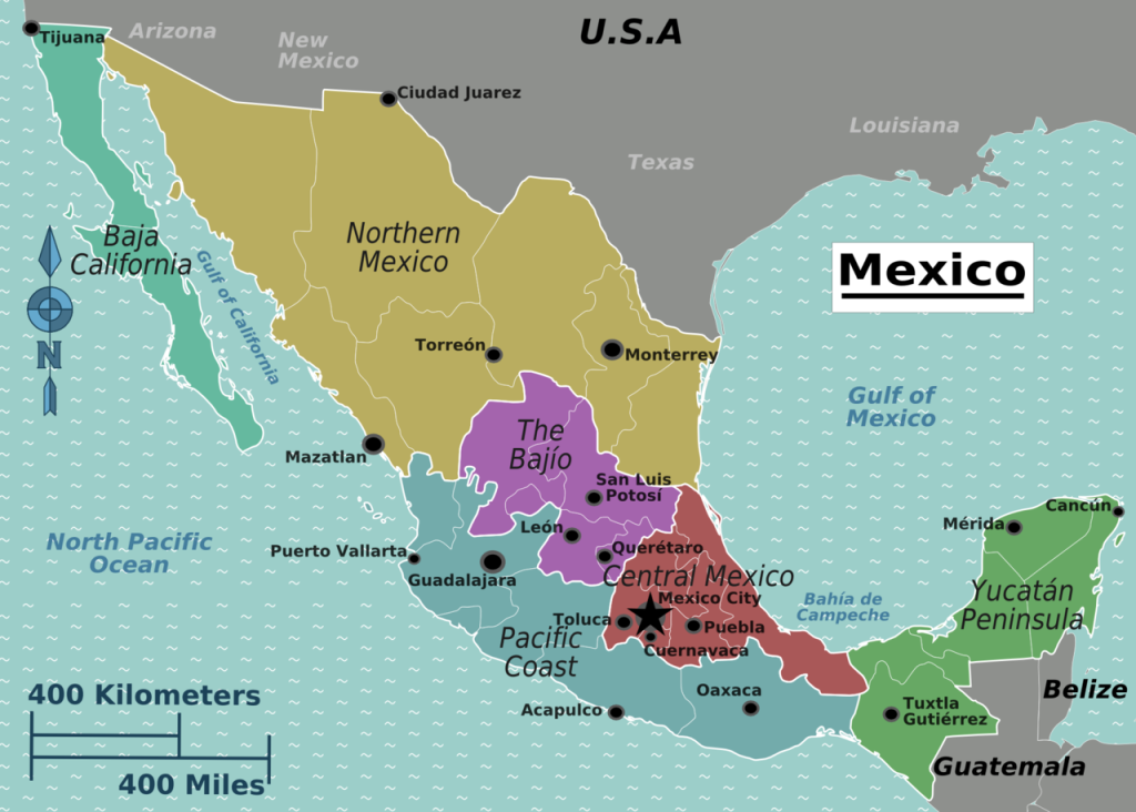 Traditionally, Mexico is divided into 6 regions, each of which is attractive for tourists in its own way.
- Baja California is a state on the California Peninsula with a variety of natural areas – deserts, mountains, subtropical coast. This is a recognized region for beach holidays, as well as gastronomic tourism.
- Northern Mexico is not the most popular tourist area in the country, with the exception of the Copper Canyon. It is notable for its high mountain railway and the opportunity to observe the life of the Tarahumara Indians . The large industrial city of Monterrey is also interesting .
- Baio is a region with an abundance of ancient and old cities. Attractive is the center of ceramics Dolores Hidalgo, the ghost town of Real de Catorce . There is also Leon, famous for leather goods.
- Central Mexico is the economic and political center of the country. For tourists, in addition to Mexico City and Pueblo, the city of Veracruz is interesting , famous for nightclubs and Cuban culture. It is worth seeing the city of Cuernavaca , immersed in gardens.
- The Pacific coast is a region with an abundance of tourist areas. These are gorgeous tropical beaches in the southern part, and the picturesque highlands of Oaxaca , and the large tourist city of Guadalajara. It is here, in Jalisco , that the birthplace of tequila is located .
- The last, sixth region is the jungles of Yucatan and the South – attractive for fans of history and archeology. Here are well-preserved Mayan settlements, and in the city of Merida you can admire the architecture in the colonial style. There are resorts on the shores of the Caribbean Sea, including the Riviera Maya, which is famous among tourists.
 The Guide Maps
