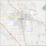
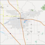
Bakersfield map, California USA
Bakersfield, California is a beautiful city located in the southern part of the state. It is known for its agricultural industry and is home to some of the most stunning sites in the state. It is also home to a great diversity of cultures, with many people from different backgrounds and origins living here. In this article, we will take a look at the physical and political map of Bakersfield and explore what makes it such a special place.
Interactive Map of Bakersfield
Bakersfield map collection
- Road map of Bakersfield
- Reference map of Bakersfield
- Location of Bakersfield
Introduction to Bakersfield
 Bakersfield is located in Kern County and is the ninth most populous city in California, with a population of over 380,000 people. It is located near the foothills of the Sierra Nevada mountains and is a hub for agricultural and oil production. The city is also known for its museums and cultural attractions, such as the Kern County Museum and the Fox Theater. Bakersfield is also a major transportation hub, with several highways and railways running through the city.
Physical Map of Bakersfield
The physical map of Bakersfield can help provide a more detailed understanding of the city’s geography. The physical map of Bakersfield shows the major roads and highways that run through the city, as well as the surrounding area. It also shows the major rivers and lakes in the area, as well as parks and other attractions. This map can be used to get an overall picture of the area or to plan a route for a road trip.
The physical map of Bakersfield can also provide information about the elevation and terrain of the area. This can be especially useful for hikers and outdoor enthusiasts who are looking for a challenging hike or a scenic view. The map can also provide information about the climate of the area, as well as the vegetation and wildlife that can be found in the area.
Political Map of Bakersfield
The political map of Bakersfield can provide a more detailed understanding of the city’s government and political structure. It can show the boundaries of the city and the county, as well as the political districts that make up the city. The political map of Bakersfield can also show the major political parties and the elected officials in the city. It can also show the major cities and towns in the area and the relationships between them. This map can be used to understand the local political landscape and how it affects the city as a whole.
Zip Code Map of Bakersfield
The zip code map of Bakersfield can be used to find specific addresses and locations in the city. This map can show the boundaries of the postal codes in the city and the neighborhoods and streets that make up each zip code. It can also provide information about the local businesses and other attractions in each area. This map can be used to find specific addresses and locations in the city or to plan a route for a road trip.
Directions to Bakersfield
Bakersfield is easily accessible from most major cities in California. It is located about two hours north of Los Angeles and two hours south of San Francisco. It is also accessible by several highways, such as the I-5, the I-99, and the I-40.
The easiest way to reach Bakersfield is by car. There are several highways that lead directly into the city, such as the I-5, the I-99, and the I-40. There are also several other roads that lead into the city, such as California State Route 99 and California State Route 58.
How Far is Bakersfield from Surrounding Cities
Bakersfield is located about two hours north of Los Angeles and two hours south of San Francisco. It is also located about one hour west of Fresno and about four hours east of San Diego. It is also about three hours northwest of Las Vegas.
Conclusion
Bakersfield is a beautiful city located in the southern part of California. It is known for its agricultural industry and is home to some of the most stunning sites in the state. It is also home to a great diversity of cultures, with many people from different backgrounds and origins living here. By exploring the physical and political map of Bakersfield, you can get a better understanding of the city and its surroundings. So, if you are ever in the area, make sure to take a look at the amazing physical and political map of Bakersfield!
 The Guide Maps


